One of my followers put it best: “I didn’t know Let It Snow was an Easter tune.” Some locations north of I-70 notched just over an inch Monday morning. About a quarter-inch of liquid precipitation fell. Our next bigger round of rain will be later Wednesday into Thursday morning, as a warm front re-introduces us to Spring.
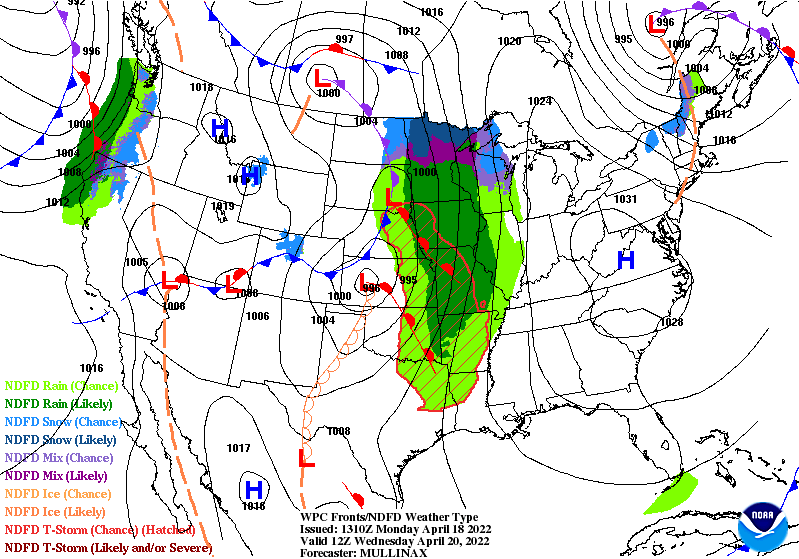
The front will stall in the area before moving north Friday afternoon in response to a big time ridge in the upper atmosphere. That should keep us dry and very warm this weekend.
Bands of snow moved through Indiana this morning with 1 to 1.5+ inches of accumulation in some spots! This photo was sent into us from Frankfort, IN where the ground was completely covered. Show us your view this morning! #inwx pic.twitter.com/qjo4DCHP1s
— NWS Indianapolis (@NWSIndianapolis) April 18, 2022
Never miss me! Subscribe for free. My Huge Radar has real-time weather tracking, current temperatures, and severe weather watches and warnings. Get detailed Indiana conditions by clicking here. Click here to see my central Indiana 7-Day Forecast. Follow these links to get my forecasts for Lafayette, Muncie, Hendricks County, and Hamilton County. Need a second opinion? Click here for central Indiana National Weather Service forecasts. (Some charts via WeatherBELL.)
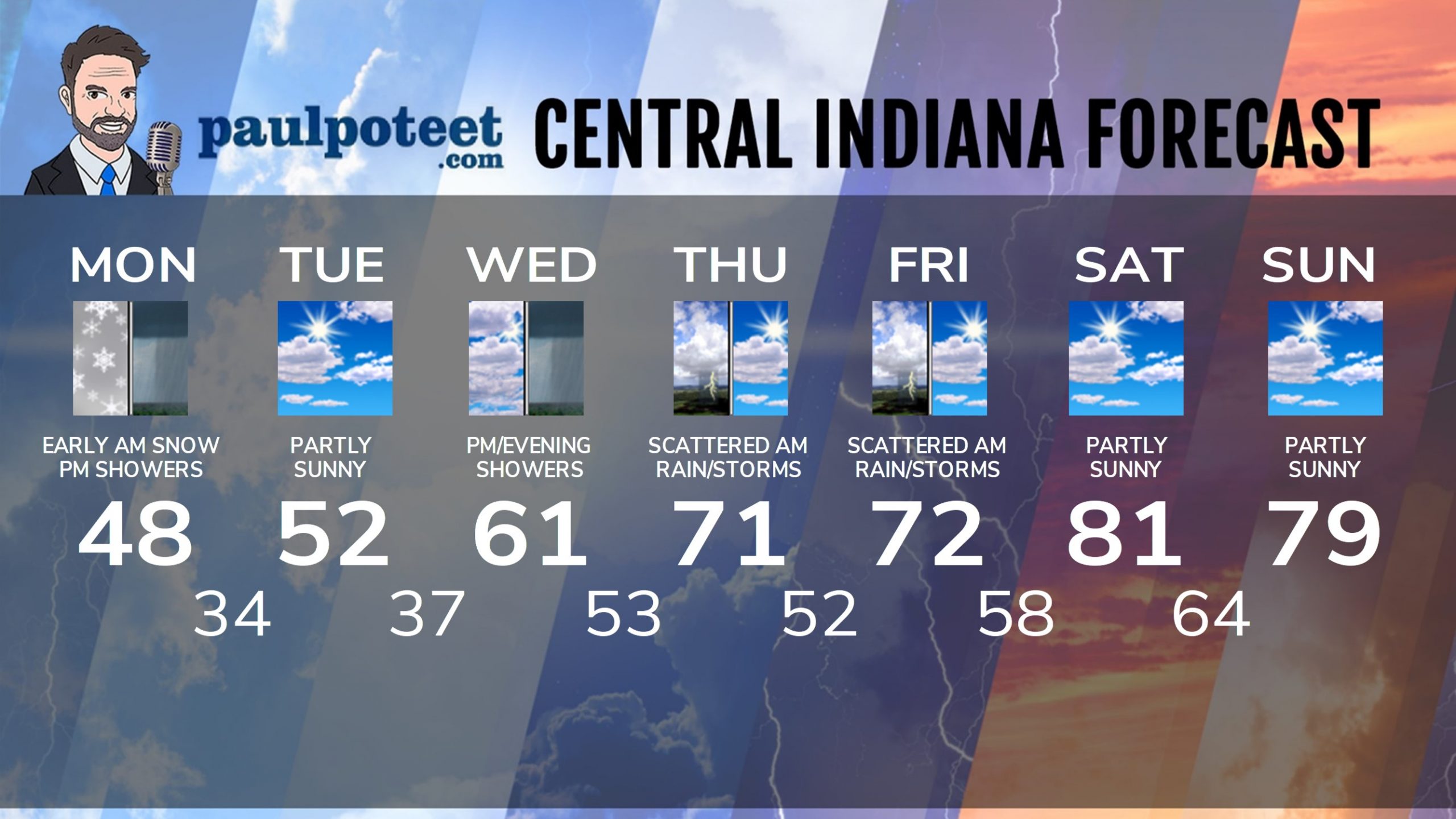
INDY SEVEN DAY FORECAST
Monday Afternoon: Scattered showers. Wind gusts to 30 mph. High 48.
Monday Night: Rain and snow showers in the evening. Partly cloudy overnight. Wind gusts to 30 mph. Low 34.
Tuesday. Partly sunny. Wind gusting to 25 mph. High 52.
Tuesday Night: Clouds increase. Low 37.
Wednesday: Mostly cloudy. Scattered afternoon showers. High 61.
Wednesday Night: Rain. Low 53.
Thursday: Morning shower chances. Partly sunny and warmer. High 71.
Thursday Night: Partly cloudy. Low 52.
Friday: Morning shower and storms, then partly sunny. High 72.
Friday Night: Partly cloudy. Low 58.
Saturday: Partly sunny. High 81.
Saturday Night: Partly cloudy. Low 64.
Sunday: Partly sunny. High 79.
Never miss me! Subscribe for free. My Huge Radar has real-time weather tracking, current temperatures, and severe weather watches and warnings. Get detailed Indiana conditions by clicking here. Click here to see my central Indiana 7-Day Forecast. Follow these links to get my forecasts for Lafayette, Muncie, Hendricks County, and Hamilton County. Need a second opinion? Click here for central Indiana National Weather Service forecasts. (Some charts via WeatherBELL.)


