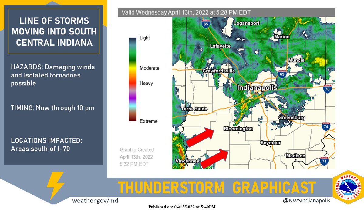
(Via @NWSIndianapolis.) A line of storms has developed to our southwest and is now moving into south central Indiana. Primary threat is damaging winds, but an isolated tornado threat remains. The storms will move northeastward, affecting areas primarily south of I-70. #INwx https://t.co/MTNneLqnoa
My Huge Radar has real-time weather tracking, current temperatures, and severe weather watches and warnings. Get detailed Indiana conditions by clicking here. Follow these links to get my forecasts for Lafayette, Muncie, Hendricks County, and Hamilton County. Need a second opinion? Click here for central Indiana National Weather Service forecasts.
Never miss me! Subscribe for free. My Huge Radar has real-time weather tracking, current temperatures, and severe weather watches and warnings. Get detailed Indiana conditions by clicking here. Click here to see my central Indiana 7-Day Forecast. Follow these links to get my forecasts for Lafayette, Muncie, Hendricks County, and Hamilton County. Need a second opinion? Click here for central Indiana National Weather Service forecasts. (Some charts via WeatherBELL.)


@NWSIndianapolis Radar indicates that the heaviest rain will fall south of Marion County. Fine by me. T… https://t.co/4LBnwUUTG1