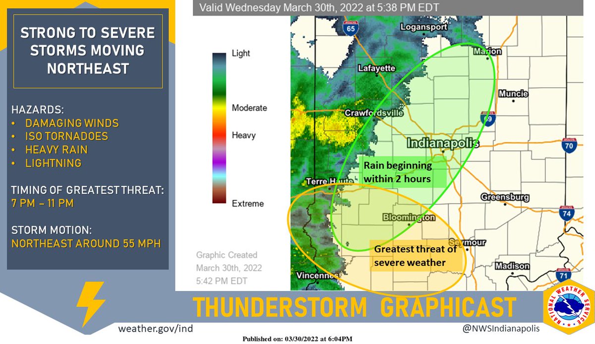
(Via @NWSIndianapolis.) Heavy rain and thunderstorms approaching the IN/IL border this evening. Expect rain to push northeastward through Central Indiana over the next few hours. Greatest threat for severe storms is along and southwest of a line from Terre Haute to Bloomington to Seymour. #inwx https://t.co/t7KpEgyuaN
My Huge Radar has real-time weather tracking, current temperatures, and severe weather watches and warnings. Get detailed Indiana conditions by clicking here. Follow these links to get my forecasts for Lafayette, Muncie, Hendricks County, and Hamilton County. Need a second opinion? Click here for central Indiana National Weather Service forecasts.
Never miss me! Subscribe for free. My Huge Radar has real-time weather tracking, current temperatures, and severe weather watches and warnings. Get detailed Indiana conditions by clicking here. Click here to see my central Indiana 7-Day Forecast. Follow these links to get my forecasts for Lafayette, Muncie, Hendricks County, and Hamilton County. Need a second opinion? Click here for central Indiana National Weather Service forecasts. (Some charts via WeatherBELL.)


