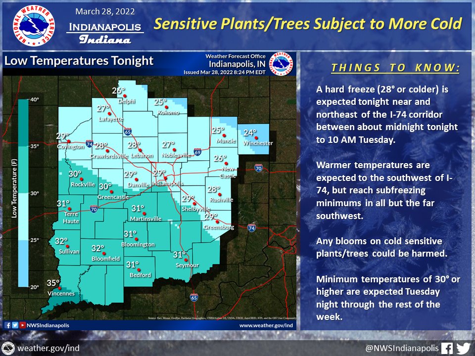
(Via @NWSIndianapolis.) Hard freeze (≤28°) expected tonight from I-74 corridor NE ~midnight tonight to 10 AM Tue. Warmer but subfreezing minimums most of rest of area to the SW. Blooms on cold sensitive plants could be harmed. Mins ≥30° Tue night thru rest of the week.
#INwx #nwsind https://t.co/QpQ1tQbn7a
My Huge Radar has real-time weather tracking, current temperatures, and severe weather watches and warnings. Get detailed Indiana conditions by clicking here. Follow these links to get my forecasts for Lafayette, Muncie, Hendricks County, and Hamilton County. Need a second opinion? Click here for central Indiana National Weather Service forecasts.
Never miss me! Subscribe for free. My Huge Radar has real-time weather tracking, current temperatures, and severe weather watches and warnings. Get detailed Indiana conditions by clicking here. Click here to see my central Indiana 7-Day Forecast. Follow these links to get my forecasts for Lafayette, Muncie, Hendricks County, and Hamilton County. Need a second opinion? Click here for central Indiana National Weather Service forecasts. (Some charts via WeatherBELL.)


