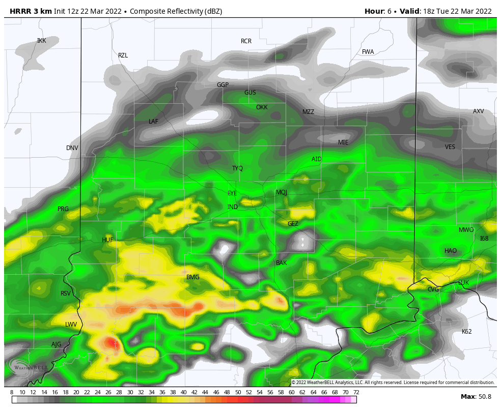
Some places – especially north of Indy – will get a brief break from showers today, but rain will return through the afternoon and evening. Rain won’t be as steady tomorrow, but there will be periods of scattered showers and storms.
Never miss me! Subscribe for free. My Huge Radar has real-time weather tracking, current temperatures, and severe weather watches and warnings. Get detailed Indiana conditions by clicking here. Click here to see my central Indiana 7-Day Forecast. Follow these links to get my forecasts for Lafayette, Muncie, Hendricks County, and Hamilton County. Need a second opinion? Click here for central Indiana National Weather Service forecasts. (Some charts via WeatherBELL.)
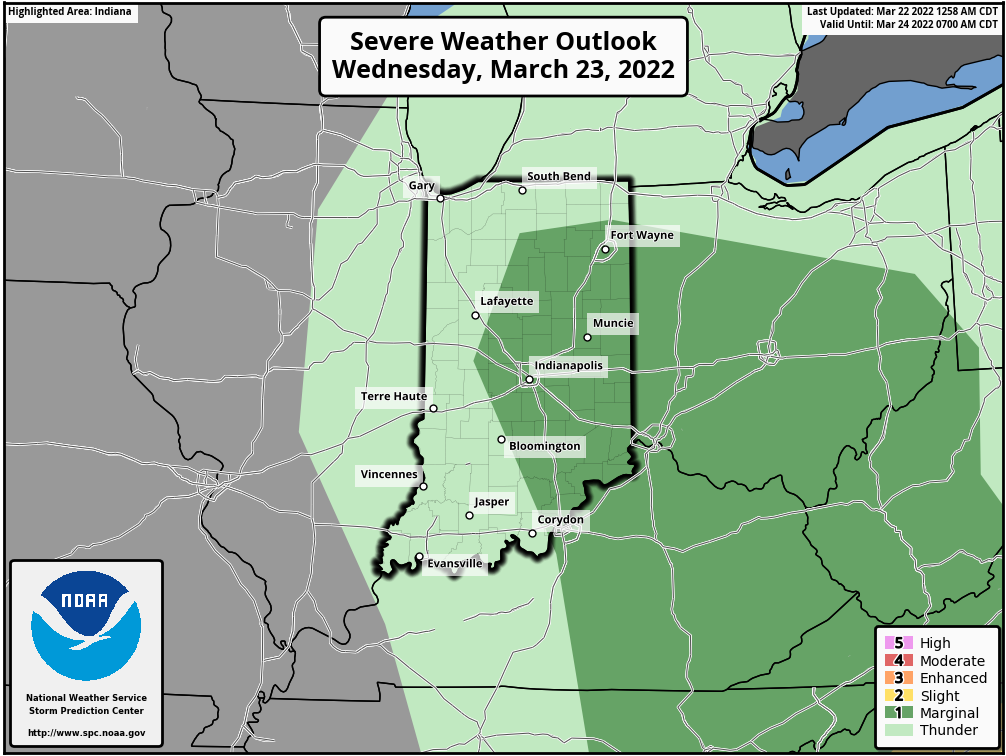
Any of the storms tomorrow have a “level one out of five” chance of becoming severe.
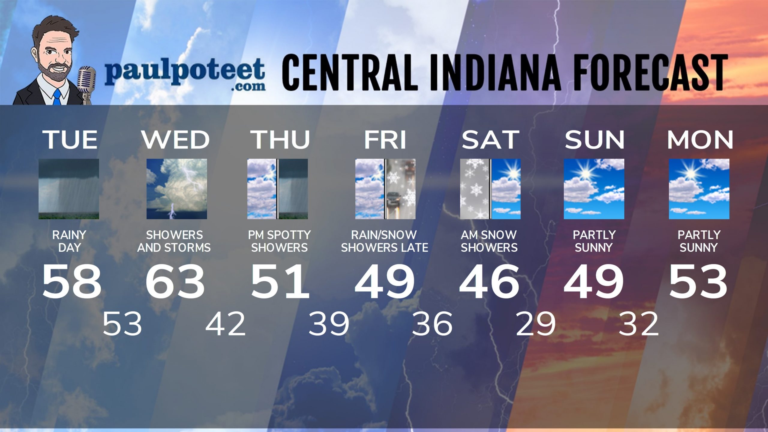
INDY SEVEN DAY FORECAST
Today: Rainy. Wind gusting to 30 mph. High 58.
Tonight: Rainy. Wind gusting to 30 mph. Low 53.
Wednesday: Scattered showers and storms. High 63.
Wednesday Night: Scattered showers and storms in the evening. Mostly cloudy overnight. Low 42.
Thursday: Mostly cloudy, with a few spotty showers, mainly in the afternoon. High 51.
Thursday Night: Mostly cloudy. Low 39.
Friday: Mostly cloudy. High 49.
Friday Night: Spotty rain and/or snow showers. Low 36.
Saturday: A few morning snow showers, then mostly to partly cloudy. High 46.
Saturday Night: Partly cloudy. Low 29.
Sunday: Partly sunny. High 49.
Sunday Night: Partly cloudy. Low 32.
Monday: Partly sunny. High 53.
Never miss me! Subscribe for free. My Huge Radar has real-time weather tracking, current temperatures, and severe weather watches and warnings. Get detailed Indiana conditions by clicking here. Click here to see my central Indiana 7-Day Forecast. Follow these links to get my forecasts for Lafayette, Muncie, Hendricks County, and Hamilton County. Need a second opinion? Click here for central Indiana National Weather Service forecasts. (Some charts via WeatherBELL.)


