Happy St. Patrick’s Day! And talk about lucky–some sunshine, and the low to mid 70s! Having walked a few St. Pat’s Day parades in Indy…I can tell you it could be a lot worse.
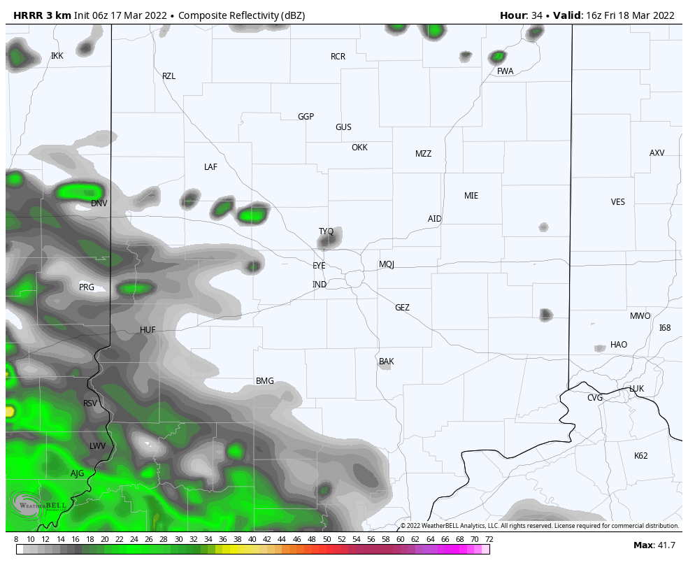
Our weather bracket gets busted tomorrow, with mainly afternoon rain and maybe some thunderstorms. Rain could pause around early evening before cranking up again overnight into Saturday morning.
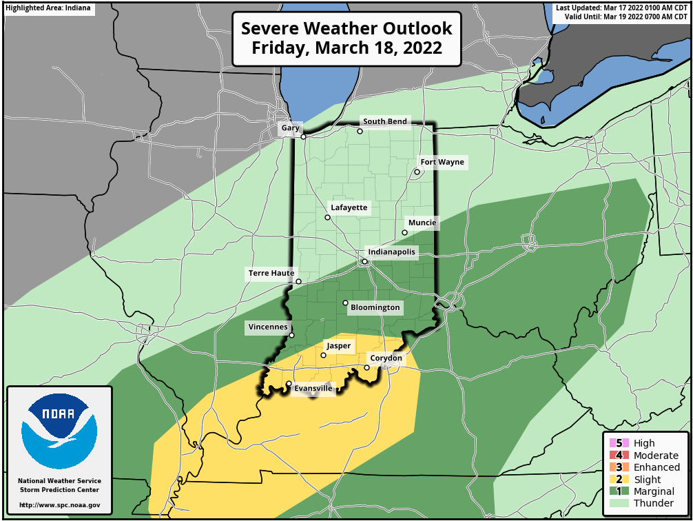
There is a marginal (level one of five) risk of severe weather in the southeastern half of the state.
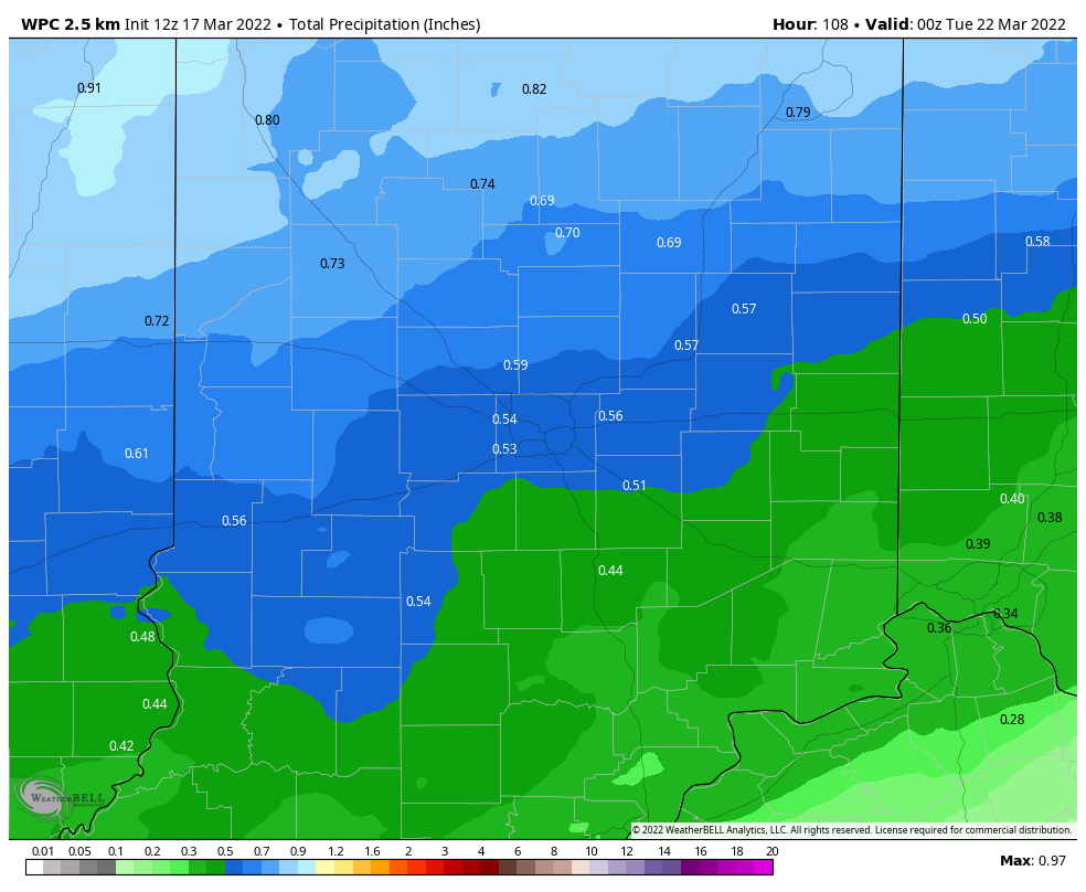
Rainfall should range from around a half-inch to three quarters of an inch through Saturday evening.
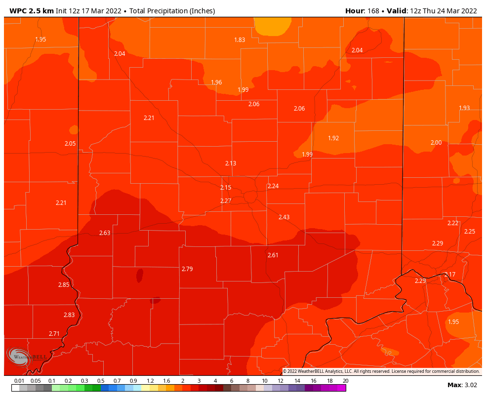
Bigger rain amounts are coming next Tuesday and Wednesday. This could be the running total through the entire period.
Never miss me! Subscribe for free. My Huge Radar has real-time weather tracking, current temperatures, and severe weather watches and warnings. Get detailed Indiana conditions by clicking here. Click here to see my central Indiana 7-Day Forecast. Follow these links to get my forecasts for Lafayette, Muncie, Hendricks County, and Hamilton County. Need a second opinion? Click here for central Indiana National Weather Service forecasts. (Some charts via WeatherBELL.)
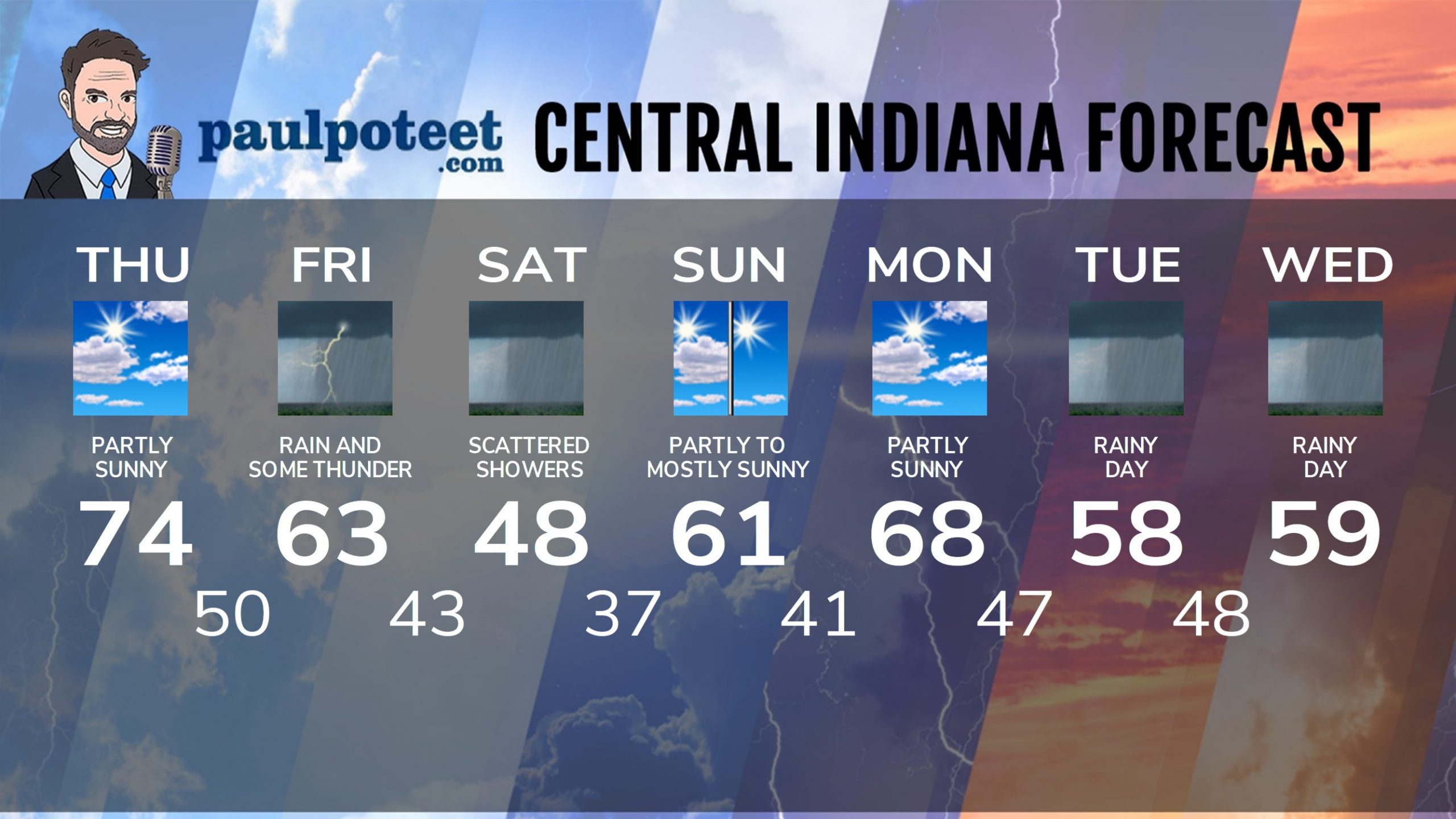
INDY SEVEN DAY FORECAST
Today: Partly sunny. High 74.
Tonight: Partly cloudy. Low 50.
Friday: Periods of rain. Thunder also possible in the later afternoon. High 63.
Friday Night: More rain. Thunder possible. Low 43.
Saturday: Mostly cloudy. Scattered showers. High 48.
Saturday Night: Mostly cloudy evening. Partly cloudy overnight. Low 37.
Sunday: Partly to mostly sunny. High 61.
Sunday Night: Partly cloudy. Low 41.
Monday: Partly sunny. High 68.
Monday Night: Showers after midnight. Low 47.
Tuesday: Rainy. High 58.
Tuesday Night: Rainy. Low 48.
Wednesday: More rain. High 59.
Never miss me! Subscribe for free. My Huge Radar has real-time weather tracking, current temperatures, and severe weather watches and warnings. Get detailed Indiana conditions by clicking here. Click here to see my central Indiana 7-Day Forecast. Follow these links to get my forecasts for Lafayette, Muncie, Hendricks County, and Hamilton County. Need a second opinion? Click here for central Indiana National Weather Service forecasts. (Some charts via WeatherBELL.)


