In the same 7 day stretch: record heat, an EF-0 tornado, and a possible coating of snow. Spring is Back Home Again in Indiana!
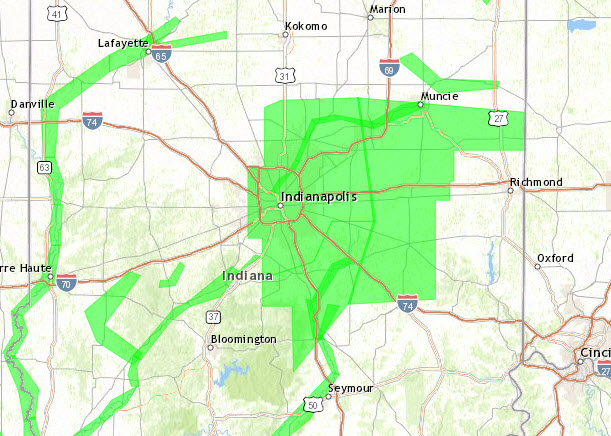
Here are the details on the brief, weak tornado in Cass County early Sunday morning. No storms any time soon, but the after-effects of Monday have left behind a Flood Warning for much of central Indiana until 5pm today. Almost two inches of rain fell at Indy from Sunday into Monday.
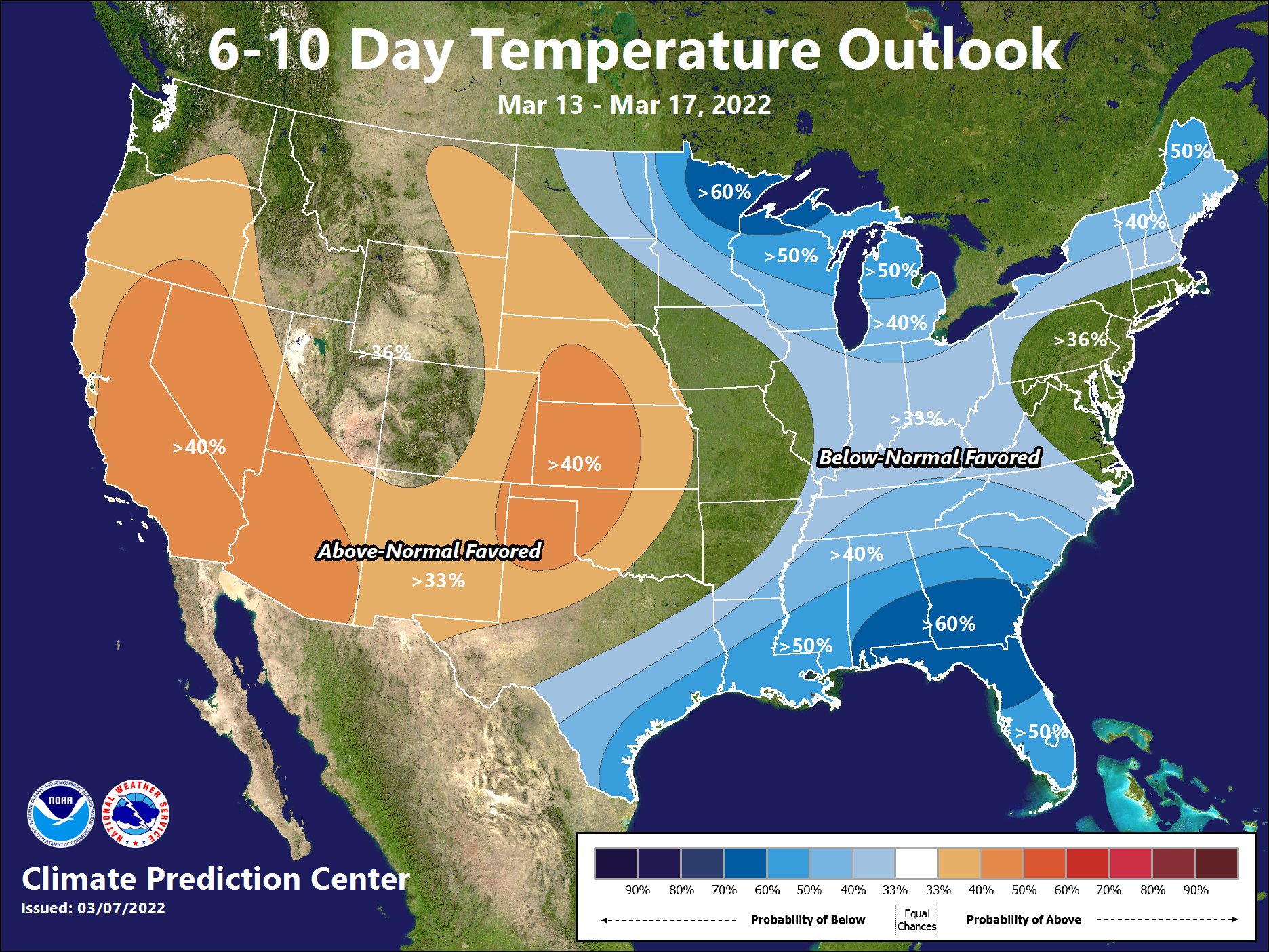
Snow showers are on the table later Friday, with generally below-average temperatures through St. Patty’s Day.
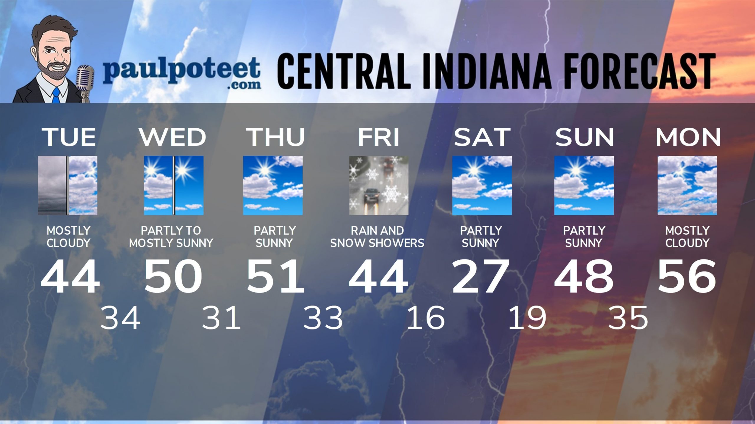
INDY SEVEN DAY FORECAST
Today: Mostly to partly cloudy. High 44.
Tonight: Mostly cloudy. Low 34.
Wednesday: Partly to mostly sunny. High 50.
Wednesday Night: Partly cloudy. Low 31.
Thursday: Partly sunny. High 51.
Thursday Night: Mostly cloudy. Low 33.
Friday: Scattered rain and snow showers. High 44.
Friday Night: Snow showers. Less than an inch accumulation. Low 16.
Saturday: Partly sunny. High 27.
Saturday Night: Partly cloudy. Low 19.
Sunday: Partly sunny. High 48.
Sunday Night: Partly cloudy. Low 35.
Never miss me! Subscribe for free. My Huge Radar has real-time weather tracking, current temperatures, and severe weather watches and warnings. Get detailed Indiana conditions by clicking here. Click here to see my central Indiana 7-Day Forecast. Follow these links to get my forecasts for Lafayette, Muncie, Hendricks County, and Hamilton County. Need a second opinion? Click here for central Indiana National Weather Service forecasts. (Some charts via WeatherBELL.)


