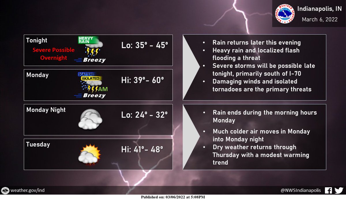
(Via @NWSIndianapolis.) Another round of showers and thunderstorms are expected tonight, with heavy rain and localized flash flooding possible, in addition to a few severe storms, primarily south of I-70. Damaging winds and isolated tornadoes will be threats. Turning cooler briefly mid week. #INwx https://t.co/ycNEHUrSlq
My Huge Radar has real-time weather tracking, current temperatures, and severe weather watches and warnings. Get detailed Indiana conditions by clicking here. Follow these links to get my forecasts for Lafayette, Muncie, Hendricks County, and Hamilton County. Need a second opinion? Click here for central Indiana National Weather Service forecasts.
Never miss me! Subscribe for free. My Huge Radar has real-time weather tracking, current temperatures, and severe weather watches and warnings. Get detailed Indiana conditions by clicking here. Click here to see my central Indiana 7-Day Forecast. Follow these links to get my forecasts for Lafayette, Muncie, Hendricks County, and Hamilton County. Need a second opinion? Click here for central Indiana National Weather Service forecasts. (Some charts via WeatherBELL.)


