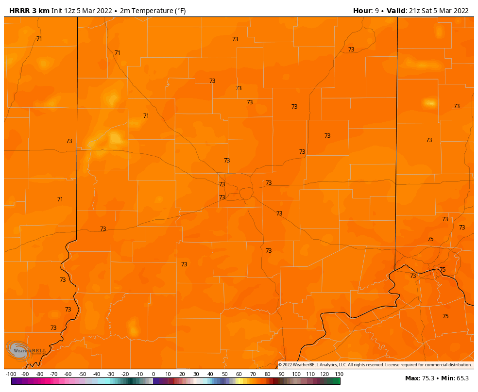
Going for a record Saturday afternoon! Current record is 75, set in 1983. Forecast is within a degree or two.
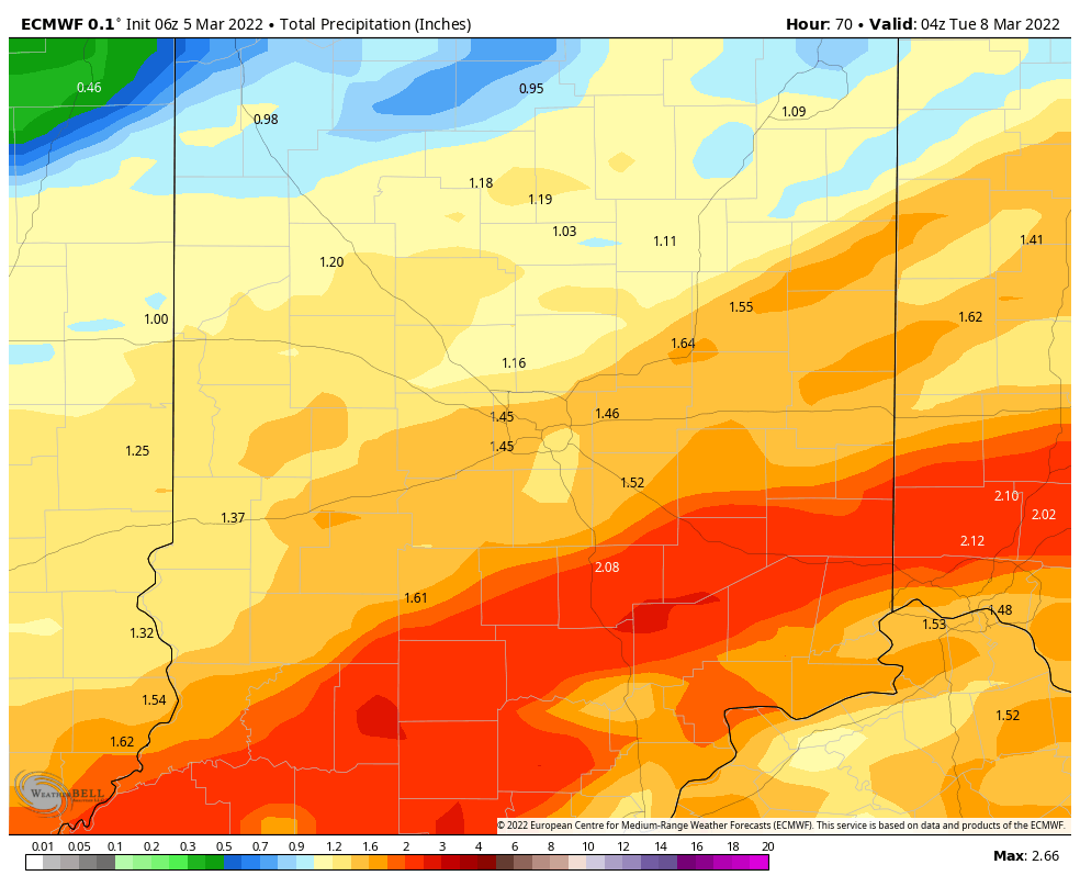
Unfortunately, the *next* big thing is big rainfall…from later Sunday night into Monday, when over an inch of rainfall is likely, especially south/southeast of Indianapolis.
Never miss me! Subscribe for free. My Huge Radar has real-time weather tracking, current temperatures, and severe weather watches and warnings. Get detailed Indiana conditions by clicking here. Click here to see my central Indiana 7-Day Forecast. Follow these links to get my forecasts for Lafayette, Muncie, Hendricks County, and Hamilton County. Need a second opinion? Click here for central Indiana National Weather Service forecasts. (Some charts via WeatherBELL.)
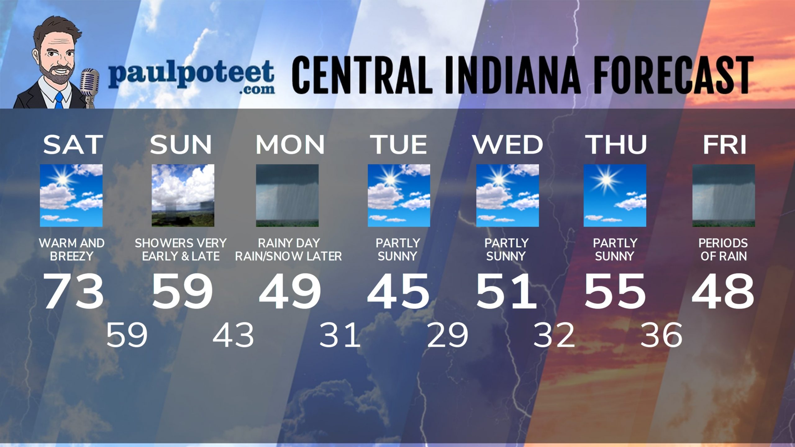
Saturday: Partly sunny. Warm winds gusting to 35 mph. High 73.
Saturday Night: Showers mainly after midnight. Thunder possible. Wind gusting to 40 mph. Low 59.
Sunday: Showers end early morning. Partly sunny. Wind gusting to 30 mph. High 59.
Sunday Night: Showers and storms return, mainly late. Low 43.
Monday: Rainy. High 49.
Monday Night: Rain (and snow showers to the north) in the evening. Clouds decrease overnight. Low 31.
Tuesday: Partly sunny. High 45.
Tuesday Night: Mostly clear. Low 29.
Wednesday: Partly sunny. High 51.
Wednesday Night: Partly cloudy. Low 32.
Thursday: Partly sunny. High 55.
Thursday Night: Mostly cloudy. Low 36.
Friday: Periods of rain. High 48.
Never miss me! Subscribe for free. My Huge Radar has real-time weather tracking, current temperatures, and severe weather watches and warnings. Get detailed Indiana conditions by clicking here. Click here to see my central Indiana 7-Day Forecast. Follow these links to get my forecasts for Lafayette, Muncie, Hendricks County, and Hamilton County. Need a second opinion? Click here for central Indiana National Weather Service forecasts. (Some charts via WeatherBELL.)


