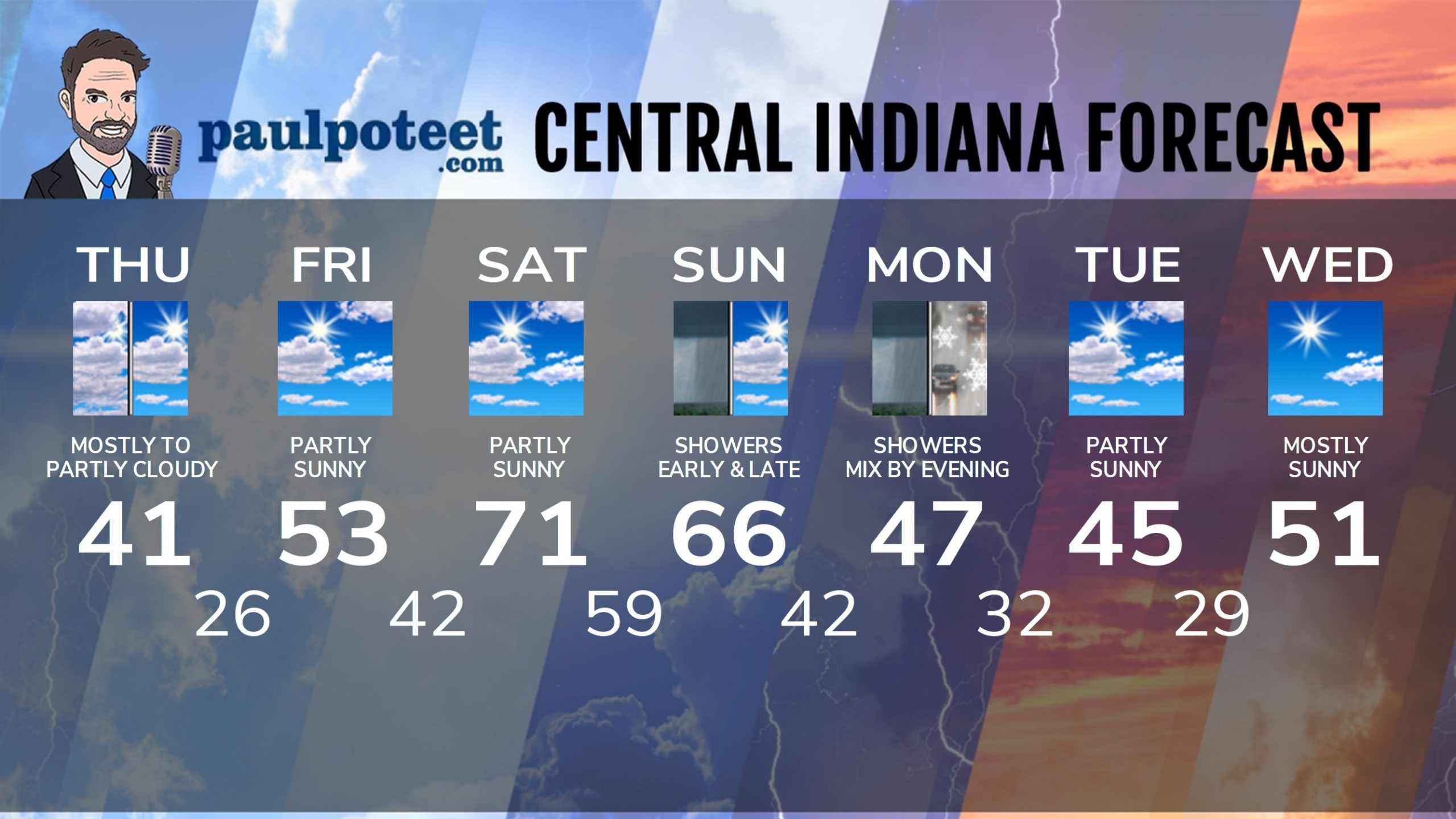
It’s the lottery numbers weather pattern. 68…41…53…71. That covers yesterday through Saturday!
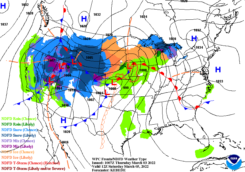
Here’s Saturday morning’s map. The red line moving up over Indiana is a sweet little warm front. The “L” in northwest Iowa is the storm system’s surface center. It will be moving northeast, eventually pulling the cold front through the state by later Sunday.
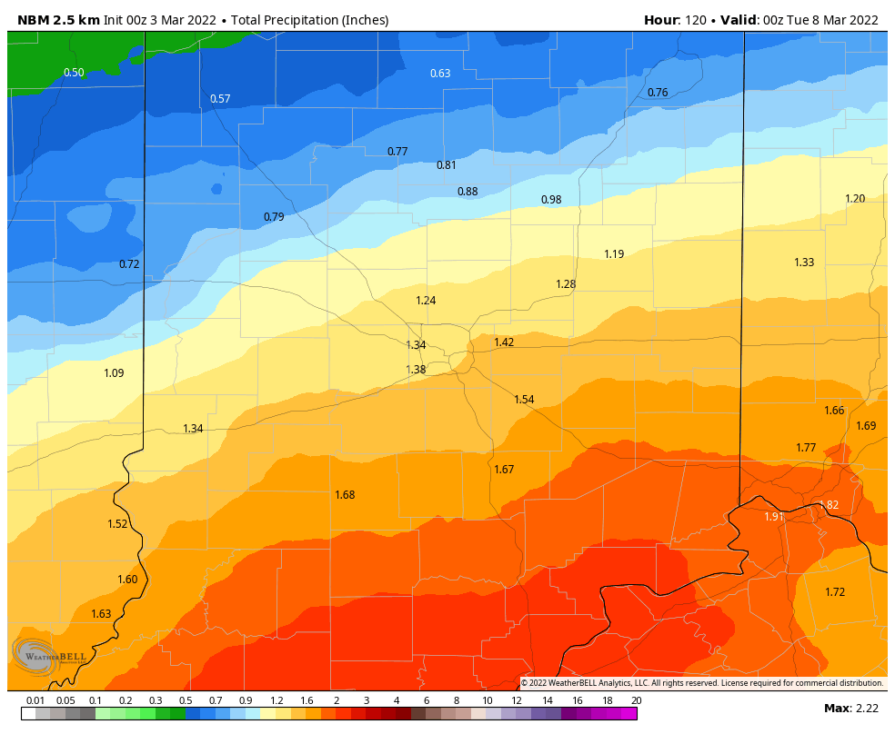
A round of showers (maybe some storms) overnight into Sunday morning could put down about a quarter-inch of precipitation. The bigger batch arrives Sunday night into Monday, with final totals possibly over an inch for some.
Never miss me! Subscribe for free. My Huge Radar has real-time weather tracking, current temperatures, and severe weather watches and warnings. Get detailed Indiana conditions by clicking here. Click here to see my central Indiana 7-Day Forecast. Follow these links to get my forecasts for Lafayette, Muncie, Hendricks County, and Hamilton County. Need a second opinion? Click here for central Indiana National Weather Service forecasts. (Some charts via WeatherBELL.)
INDY SEVEN DAY FORECAST
Today: Mostly to partly cloudy. High 41.
Tonight: Partly cloudy. Low 26.
Friday: Partly sunny. High 53.
Friday Night: Mostly cloudy. Low 42.
Saturday: Partly sunny. Warm! High 71.
Saturday Night: Showers after midnight. Thunder possible. Low 59.
Sunday: Mainly morning showers. Mostly to partly cloudy. High 66.
Sunday Night: Showers return, mainly late. Low 42.
Monday: Scattered showers. High 47.
Monday: Rain and snow showers. Low 32.
Tuesday: Partly sunny. High 45.
Tuesday Night: Mostly clear. Low 29.
Wednesday: Mostly sunny. High 51.
Never miss me! Subscribe for free. My Huge Radar has real-time weather tracking, current temperatures, and severe weather watches and warnings. Get detailed Indiana conditions by clicking here. Click here to see my central Indiana 7-Day Forecast. Follow these links to get my forecasts for Lafayette, Muncie, Hendricks County, and Hamilton County. Need a second opinion? Click here for central Indiana National Weather Service forecasts. (Some charts via WeatherBELL.)


