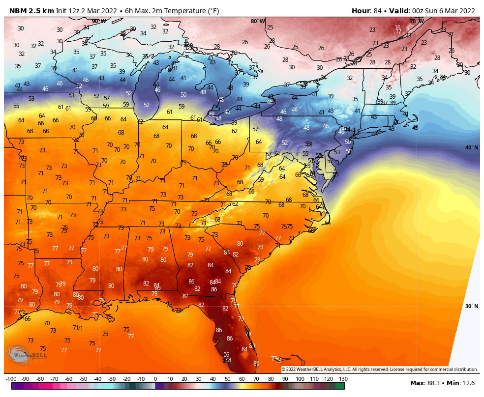
Big temps…and big rains over the next few days. The peak temps comes Saturday, over much of the Eastern U.S, before a big cold front arrives with rain Saturday night into early Sunday morning.
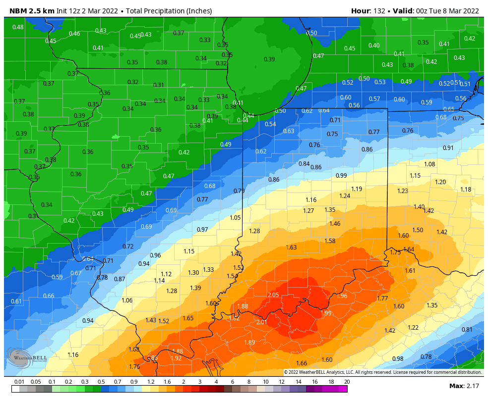
That round of rain should be limited to a quarter-inch or less, but heavier rain will fall Sunday night into Monday. This is a look at expected totals from now through Monday.
Never miss me! Subscribe for free. My Huge Radar has real-time weather tracking, current temperatures, and severe weather watches and warnings. Get detailed Indiana conditions by clicking here. Click here to see my central Indiana 7-Day Forecast. Follow these links to get my forecasts for Lafayette, Muncie, Hendricks County, and Hamilton County. Need a second opinion? Click here for central Indiana National Weather Service forecasts. (Some charts via WeatherBELL.)
INDY SEVEN DAY FORECAST
Today: Mostly to partly sunny. High 64.
Tonight: Mostly cloudy. A few sprinkles possible. Low 32.
Thursday: Mostly to partly cloudy. High 40.
Thursday Night: Partly cloudy. Low 27.
Friday: Partly sunny. High 53.
Friday Night: Mostly cloudy. Low 44.
Saturday: Partly sunny. Warm! High 71.
Saturday Night: Showers likely. Thunder possible. Low 59.
Sunday: Mainly morning showers. Mostly cloudy. High 59.
Sunday Night: Mostly cloudy. Showers return. Low 42.
Monday: Mostly cloudy. Scattered showers. High 45.
Monday: Rain and snow showers. Low 33.
Tuesday: Partly sunny. High 43.

Never miss me! Subscribe for free. My Huge Radar has real-time weather tracking, current temperatures, and severe weather watches and warnings. Get detailed Indiana conditions by clicking here. Click here to see my central Indiana 7-Day Forecast. Follow these links to get my forecasts for Lafayette, Muncie, Hendricks County, and Hamilton County. Need a second opinion? Click here for central Indiana National Weather Service forecasts. (Some charts via WeatherBELL.)


