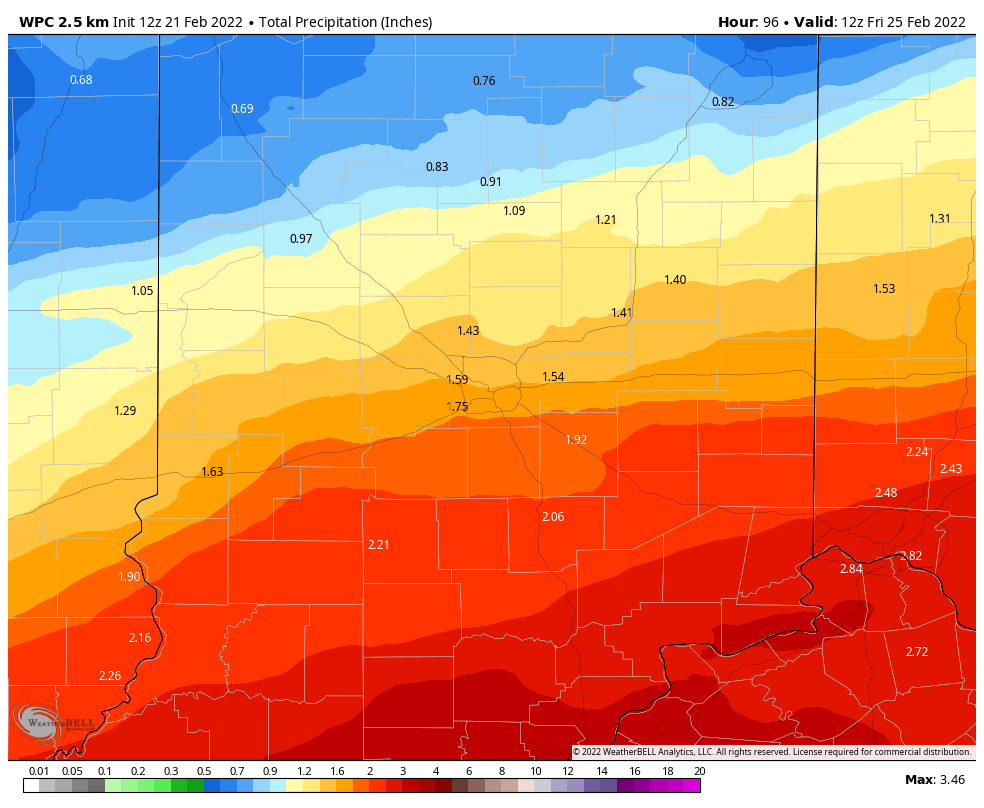
Enjoy today, because rain is coming late tonight and tomorrow. We’re already saturated. Over an inch may fall south of Indy
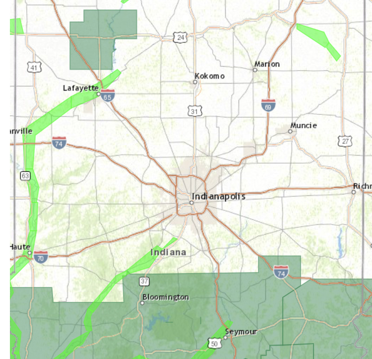
There’s a Flood Watch in place south of Indy. River Flood Warnings continue around Lafayette.
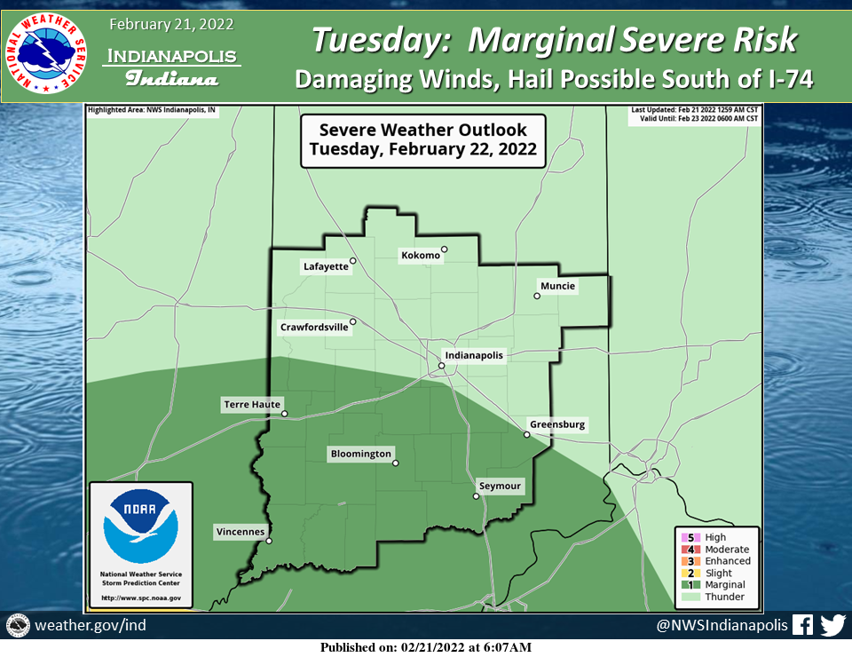
There’s also a marginal (level one of five) risk of severe weather Tuesday in the southern half of the state. Damaging wind and large hail are the biggest threats.
The second storm of the week will bring back winter, with the potential of accumulating snow Thursday.

Never miss me! Subscribe for free. My Huge Radar has real-time weather tracking, current temperatures, and severe weather watches and warnings. Get detailed Indiana conditions by clicking here. Click here to see my central Indiana 7-Day Forecast. Follow these links to get my forecasts for Lafayette, Muncie, Hendricks County, and Hamilton County. Need a second opinion? Click here for central Indiana National Weather Service forecasts. (Some charts via WeatherBELL.)
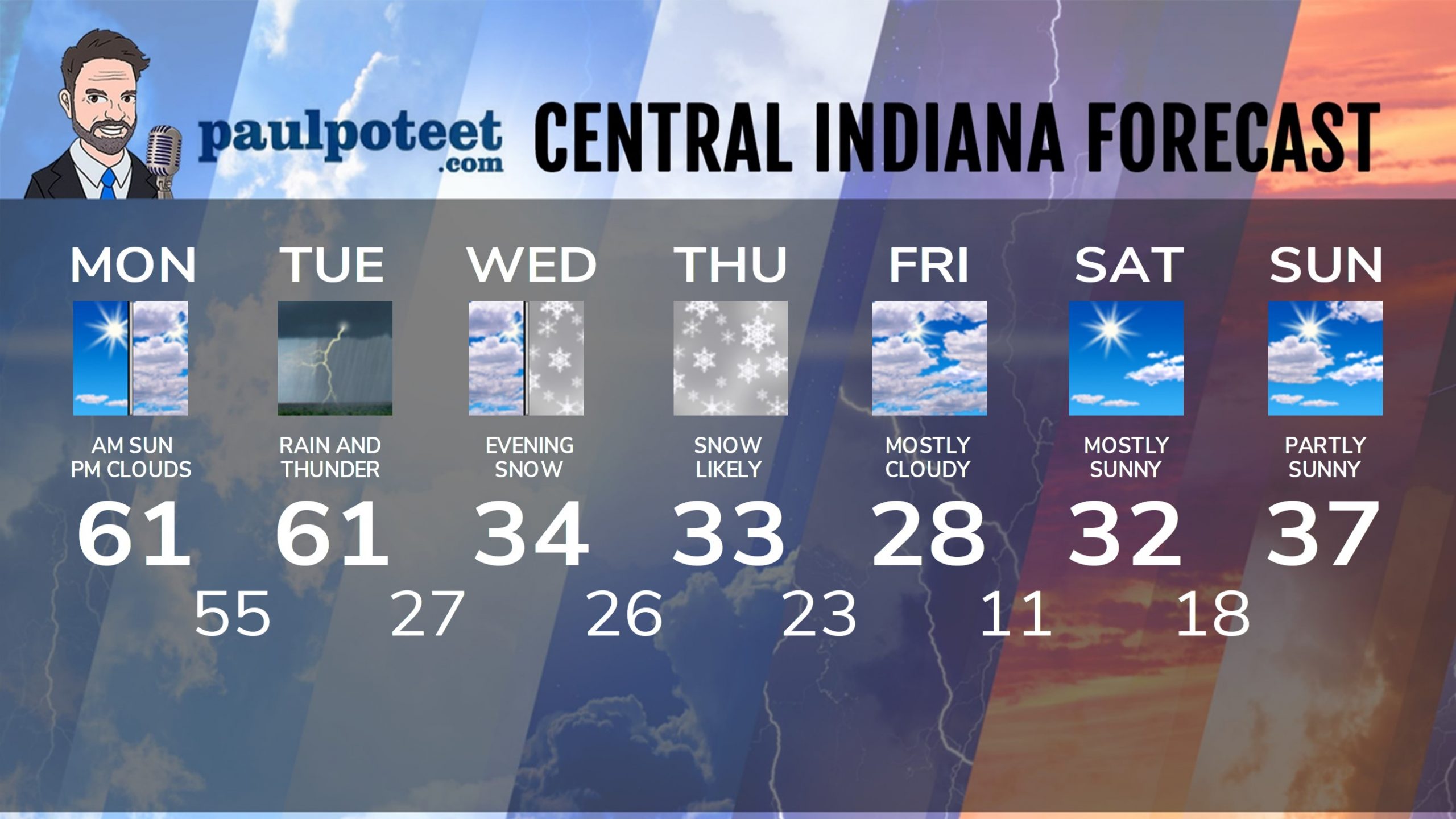
INDY SEVEN DAY FORECAST
Today: Afternoon clouds increase. High 61.
Tonight: Evening shower chance. Low 55.
Tuesday: Rain and some thunder. High 61.
Tuesday Night: Scattered showers early. Mostly cloudy overnight. Low 27.
Wednesday: Mostly cloudy. High 34.
Wednesday Night: Snow likely. Low 26.
Thursday: Snow likely. Snow could be heavy. High 33.
Thursday Night: Snow likely. Low 23.
Friday: Mostly cloudy. High 28.
Friday Night: Partly cloudy. Low 11.
Saturday: Mostly sunny. High 32.
Saturday Night: Mostly clear. Low 18.
Sunday: Partly sunny. High 37.
Never miss me! Subscribe for free. My Huge Radar has real-time weather tracking, current temperatures, and severe weather watches and warnings. Get detailed Indiana conditions by clicking here. Click here to see my central Indiana 7-Day Forecast. Follow these links to get my forecasts for Lafayette, Muncie, Hendricks County, and Hamilton County. Need a second opinion? Click here for central Indiana National Weather Service forecasts. (Some charts via WeatherBELL.)


