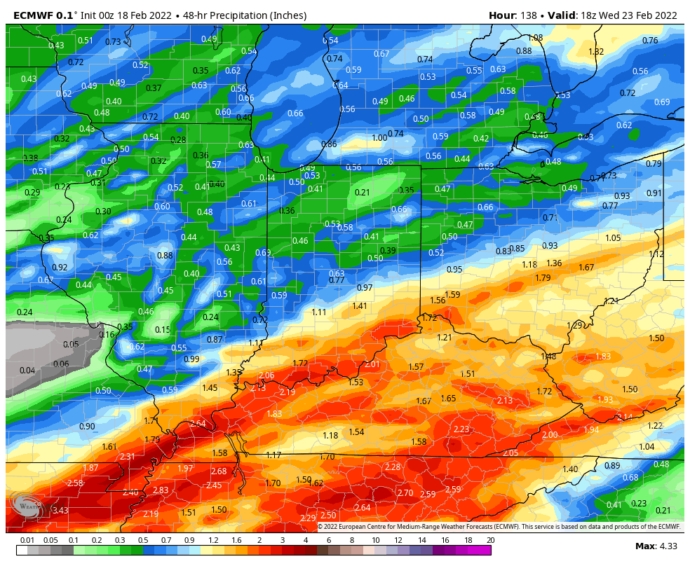
So much water! Warm temperatures helped to melt a snowpack and dislodge river ice. Add a rain rinse of some two inches…and you have river flooding to start the weekend in Indiana. Conditions will improve slowly into Sunday, when the high temperature will suddenly double. The *next* rain threat is Monday night into Tuesday, and the next snow threat is next Thursday. Rainfall Tuesday could exceed an inch in southern Indiana, at least according to early round of computer modeling.
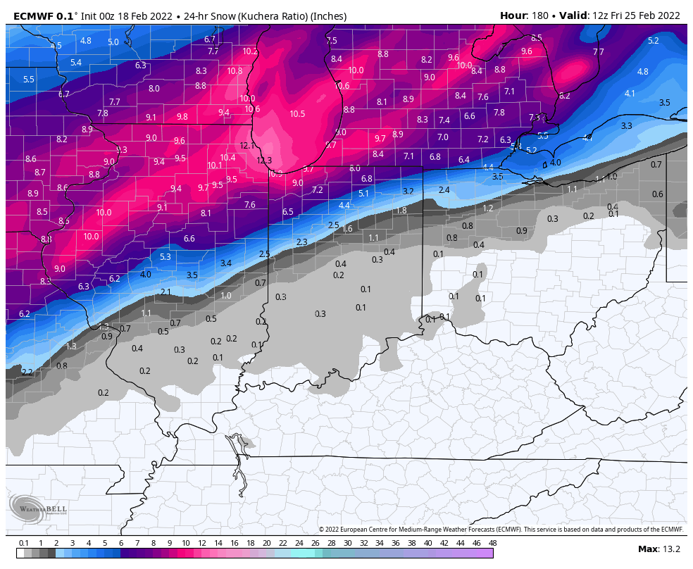
Light snow is likely Thursday. Again: one round of *early* computer modeling.
Never miss me! Subscribe for free. My Huge Radar has real-time weather tracking, current temperatures, and severe weather watches and warnings. Get detailed Indiana conditions by clicking here. Click here to see my central Indiana 7-Day Forecast. Follow these links to get my forecasts for Lafayette, Muncie, Hendricks County, and Hamilton County. Need a second opinion? Click here for central Indiana National Weather Service forecasts. (Some charts via WeatherBELL.)
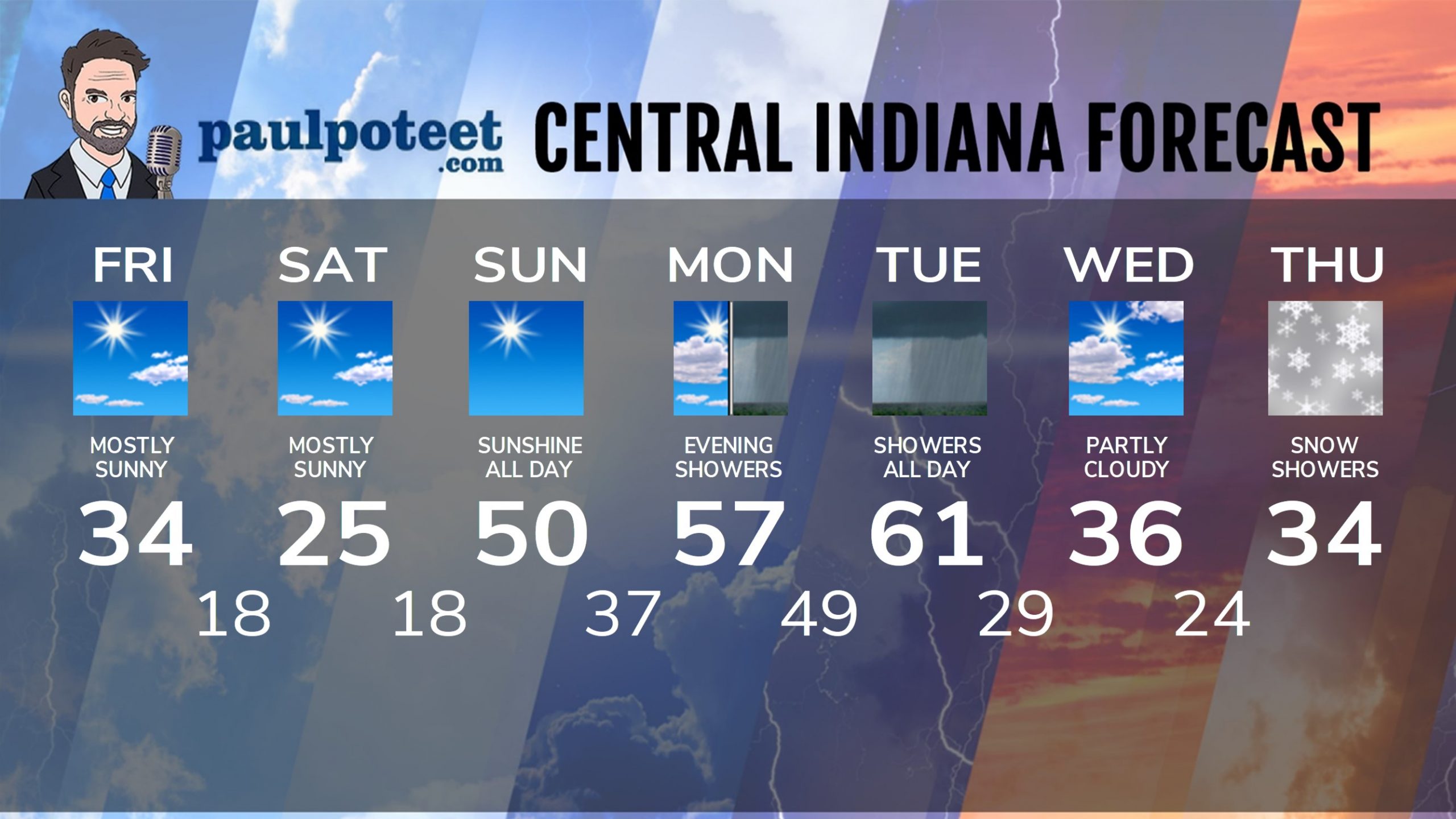
INDY SEVEN DAY FORECAST
Friday: Mostly sunny. High 34.
Friday Night: Partly cloudy evening. Clouds and a few flurries overnight. Low 18.
Saturday: Mostly sunny. High 25.
Saturday Night: Mostly clear. Low 18.
Sunday: Sunshine! Breezy. High 50.
Sunday Night: Mostly clear. Low 37.
Washington’s Birthday: Clouds increase. High 57.
Monday Night: Showers. Low 49.
Tuesday: Showers. High 61.
Tuesday Night: Scattered showers. Low 29.
Wednesday: Mostly cloudy. High 36.
Wednesday Night: Snow showers, especially late. Low 24.
Thursday: Snow showers. High 34.
Never miss me! Subscribe for free. My Huge Radar has real-time weather tracking, current temperatures, and severe weather watches and warnings. Get detailed Indiana conditions by clicking here. Click here to see my central Indiana 7-Day Forecast. Follow these links to get my forecasts for Lafayette, Muncie, Hendricks County, and Hamilton County. Need a second opinion? Click here for central Indiana National Weather Service forecasts. (Some charts via WeatherBELL.)


