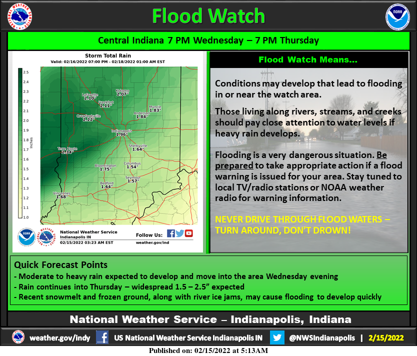
A combo platter of heavy rainfall, recent snow melt, frozen ground, and river ice jams, may cause flooding to develop quickly. The worst of it will come late Wednesday night through Thursday when the cold front passes. Snow could follow, and there could even by light accumulation by Thursday evening in the northern half of the state.
Never miss me! Subscribe for free. My Huge Radar has real-time weather tracking, current temperatures, and severe weather watches and warnings. Get detailed Indiana conditions by clicking here. Click here to see my central Indiana 7-Day Forecast. Follow these links to get my forecasts for Lafayette, Muncie, Hendricks County, and Hamilton County. Need a second opinion? Click here for central Indiana National Weather Service forecasts. (Some charts via WeatherBELL.)
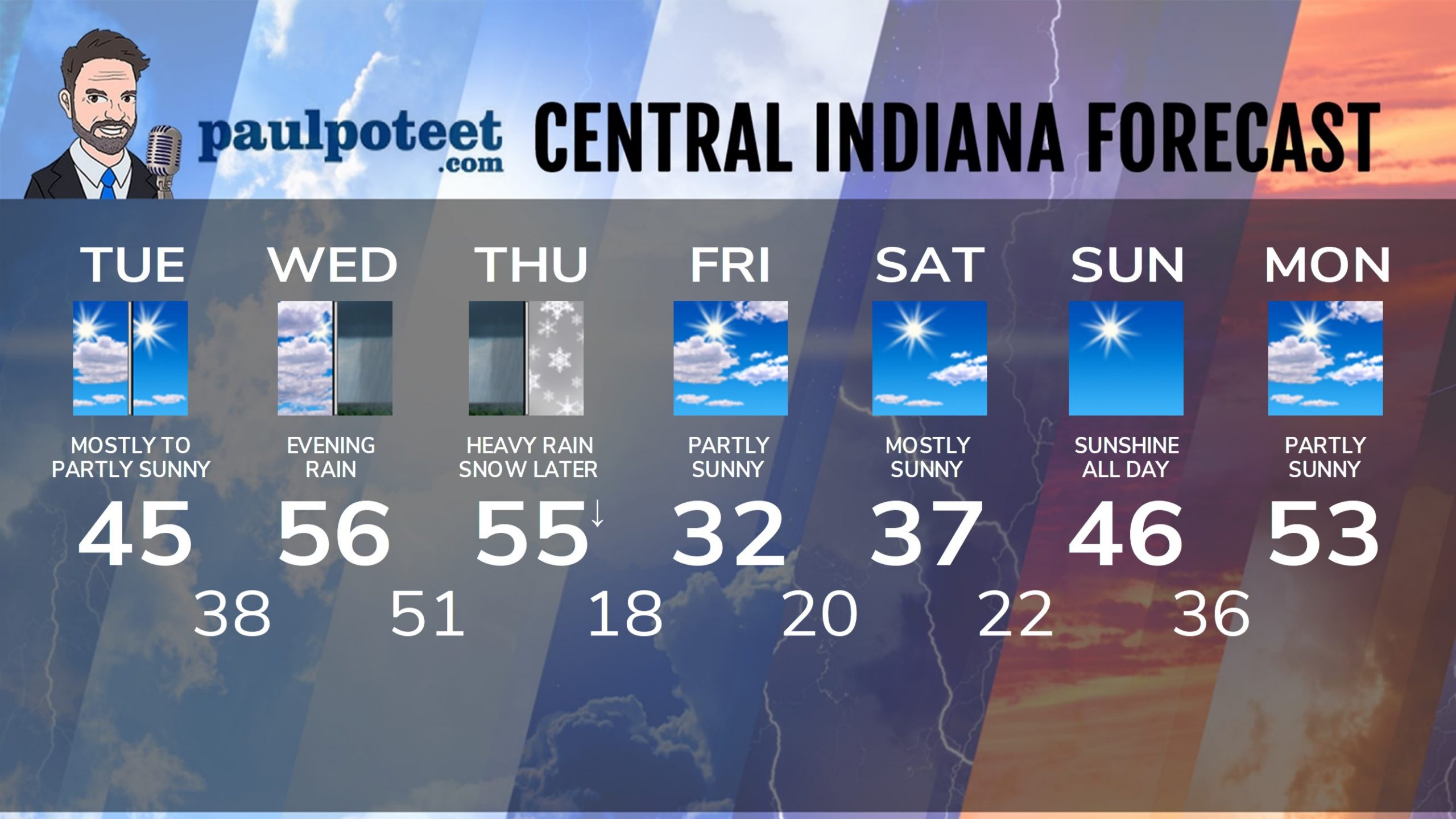
INDY SEVEN DAY FORECAST
Today: Mostly to partly sunny. High 45.
Tonight: Partly cloudy. Low 38.
Wednesday: Mostly cloudy. High 56.
Wednesday Night: FLOOD WATCH from rain that could be heavy. Low 51.
Thursday: FLOOD WATCH from morning and midday rain. Temps falling, with rain changing to snow by late afternoon. High 55.
Thursday Night: Snow early, then partly cloudy. Low 18.
Friday: Partly sunny. High 32.
Friday Night: Mostly clear. Low 20.
Saturday: Mostly sunny. High 37.
Saturday Night: Mostly clear. Low 22.
Sunday: Sunshine! High 46.
Sunday Night: Mostly clear. Low 36.
Washington’s Birthday: Partly sunny. High 53.
Never miss me! Subscribe for free. My Huge Radar has real-time weather tracking, current temperatures, and severe weather watches and warnings. Get detailed Indiana conditions by clicking here. Click here to see my central Indiana 7-Day Forecast. Follow these links to get my forecasts for Lafayette, Muncie, Hendricks County, and Hamilton County. Need a second opinion? Click here for central Indiana National Weather Service forecasts. (Some charts via WeatherBELL.)


Yuck. It’s going to be a soppy mess.