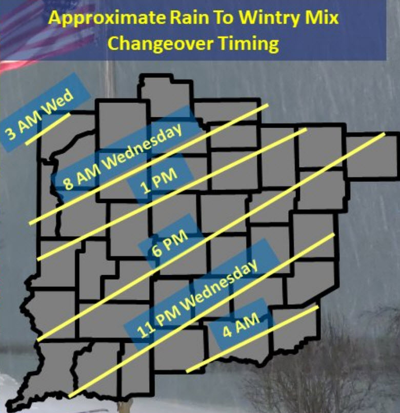
So far, so good! WELL…at least in terms of the ongoing forecast. As expected we’ve already flipped to snow in Lafayette, where the 10am temp is down to 31, and the visibility is down to a half-mile. Rain continues over much of the rest of central Indiana. My Huge Radar is color-coded for your weather convenience.
Never miss me! Subscribe for free. My Huge Radar has real-time weather tracking, current temperatures, and severe weather watches and warnings. Get detailed Indiana conditions by clicking here. Click here to see my central Indiana 7-Day Forecast. Follow these links to get my forecasts for Lafayette, Muncie, Hendricks County, and Hamilton County. Need a second opinion? Click here for central Indiana National Weather Service forecasts. (Some charts via WeatherBELL.)
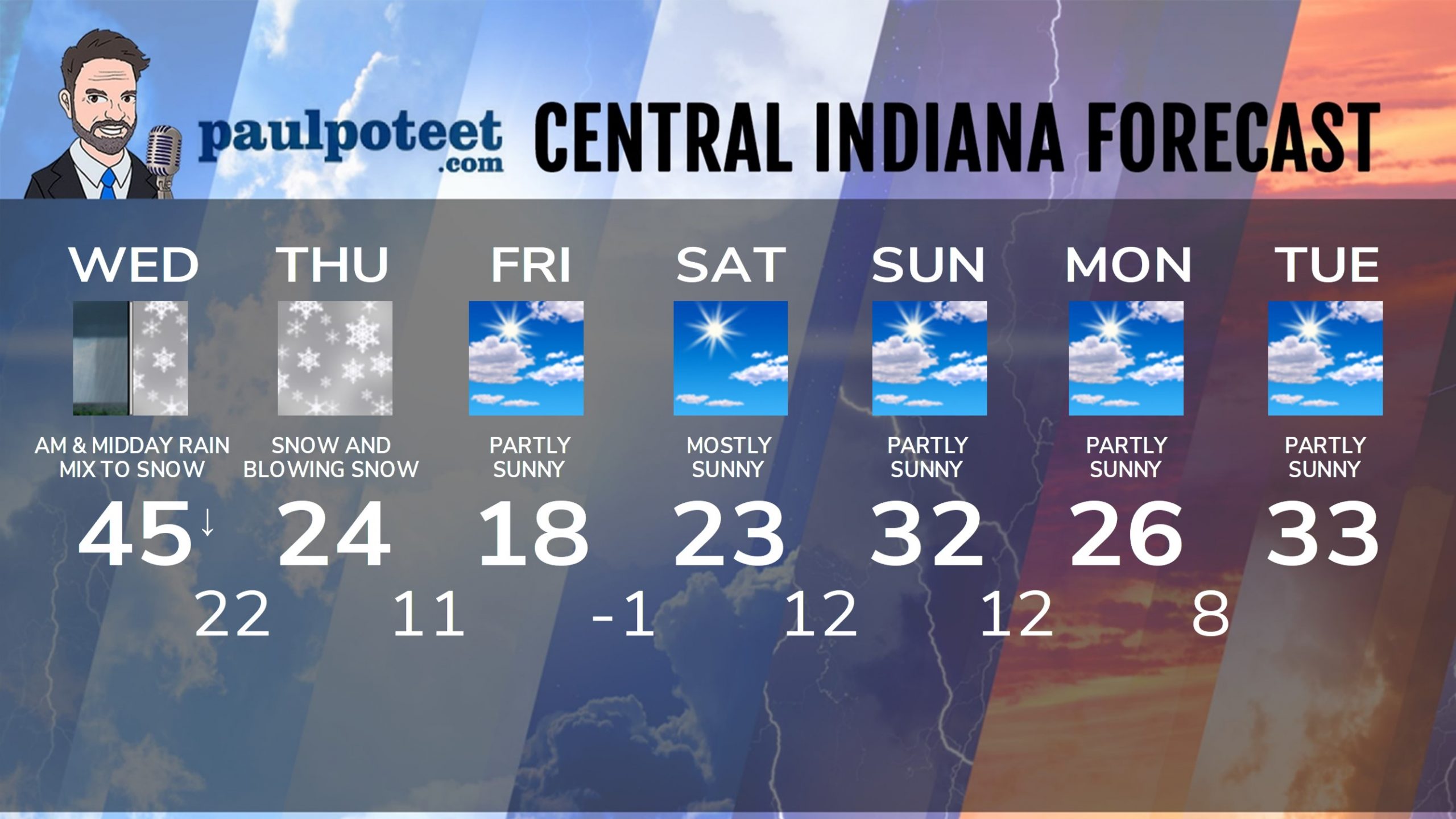
INDY SEVEN DAY FORECAST
Today: Morning rain. Rain will mix with freezing rain and sleet during afternoon rush hours, as temps fall from the mid 40s to below freezing. High 45.
Tonight: Snow, mixed at times with sleet and freezing rain in the evening. Wind gusting to 30 mph. Low 22.
Thursday: Snow, and blowing snow. Snow will be heavy at times. Wind gusting to 35 mph. High 24.
Thursday Night: Snow diminishes FINAL SNOW TOTALS of 8-12 inches, including some sleet. Minor ice accumulations. Low 11.
Friday: Partly to mostly sunny. High 18.
Friday Night: Clear and cold. Low -1.
Saturday: Mostly sunny. High 23.
Saturday Night: Mostly clear. Low 12.
Sunday: Partly sunny. High 32.
Sunday Night: Partly cloudy. Low 12.
Monday: Partly sunny. High 26.
Monday Night: Partly cloudy. Low 8.
Tuesday: Partly sunny. High 33.
Never miss me! Subscribe for free. My Huge Radar has real-time weather tracking, current temperatures, and severe weather watches and warnings. Get detailed Indiana conditions by clicking here. Click here to see my central Indiana 7-Day Forecast. Follow these links to get my forecasts for Lafayette, Muncie, Hendricks County, and Hamilton County. Need a second opinion? Click here for central Indiana National Weather Service forecasts. (Some charts via WeatherBELL.)


