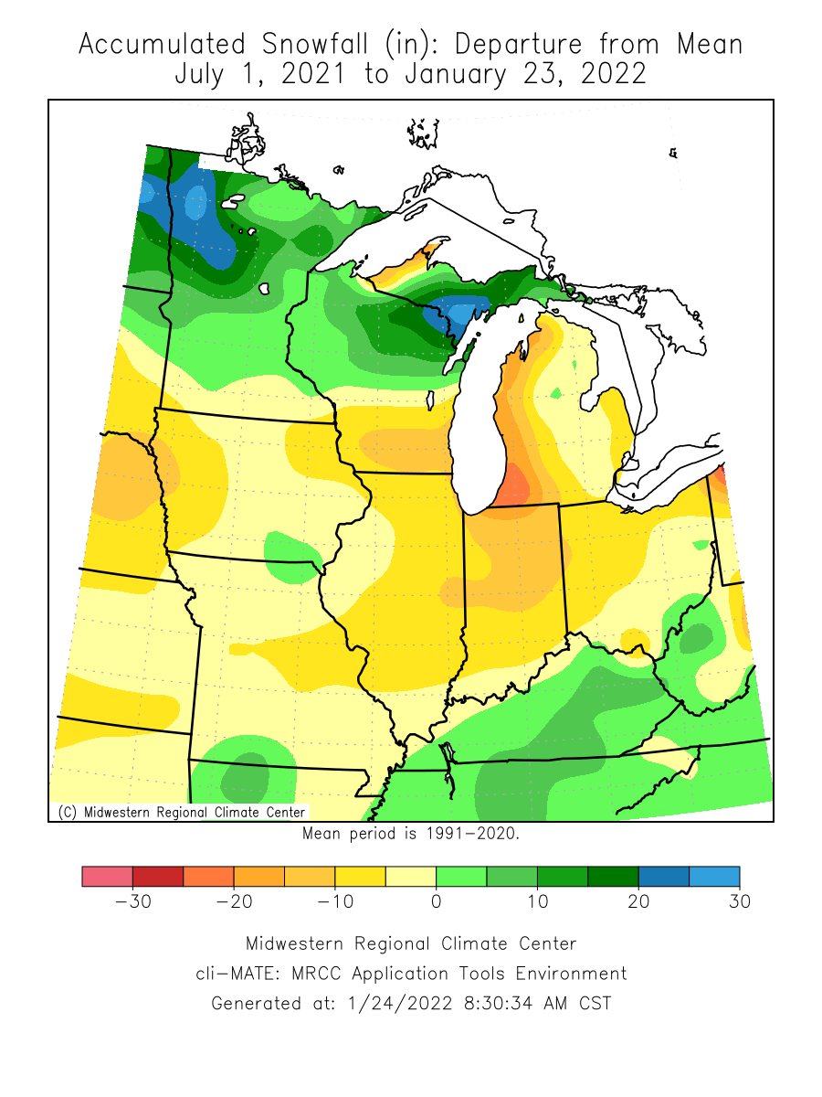
A little snow to start another winter week in Central Indiana. Seasonal snow totals are still slim. The third of an inch Indy measured Sunday finally gets us over an inch…barely. The number is 1.1 inches. This chart shows the difference between what we’ve had and what we should have. Anything in orange, yellow, and red is below average.
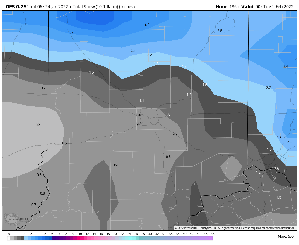
Little additional snow is expected over the next week.

Never miss me! Subscribe for free. My Huge Radar has real-time weather tracking, current temperatures, and severe weather watches and warnings. Get detailed Indiana conditions by clicking here. Click here to see my central Indiana 7-Day Forecast. Follow these links to get my forecasts for Lafayette, Muncie, Hendricks County, and Hamilton County. Need a second opinion? Click here for central Indiana National Weather Service forecasts. (Some charts via WeatherBELL.)
INDY SEVEN DAY FORECAST
Today: Morning snow. Less than an inch by noon. Snow and/or rain showers possible this afternoon. High 37.
Tonight: Cloudy with a few snow showers in the evening. Some clearing late. Low 14.
Tuesday: Partly sunny. Single digit chills. High 23.
Tuesday Night: Clearing and cold. Chills below zero. Low 3.
Wednesday: Sunny. High 20.
Wednesday Night: Clear evening. Partly cloudy overnight. Low 12.
Thursday: Partly to mostly cloudy. High 35.
Thursday Night: Flurries or snow showers possible. Low 20.
Friday: Mostly cloudy. High 26.
Friday Night: Partly cloudy. Low 12.
Saturday: Mostly sunny. High 29.
Saturday Night: Partly cloudy. Low 20.
Sunday: Mostly cloudy. High 40.

Never miss me! Subscribe for free. My Huge Radar has real-time weather tracking, current temperatures, and severe weather watches and warnings. Get detailed Indiana conditions by clicking here. Click here to see my central Indiana 7-Day Forecast. Follow these links to get my forecasts for Lafayette, Muncie, Hendricks County, and Hamilton County. Need a second opinion? Click here for central Indiana National Weather Service forecasts. (Some charts via WeatherBELL.)


