An Arctic Front is coming to town, and temperatures are going down!
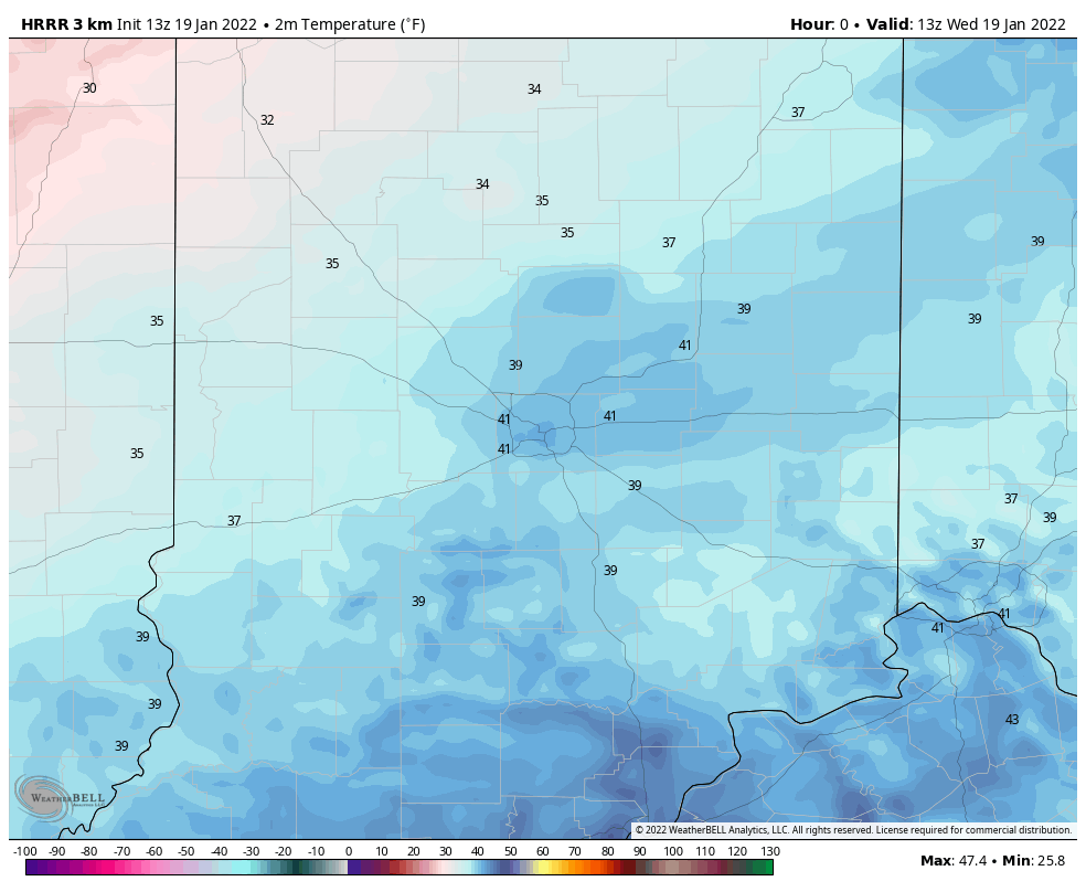
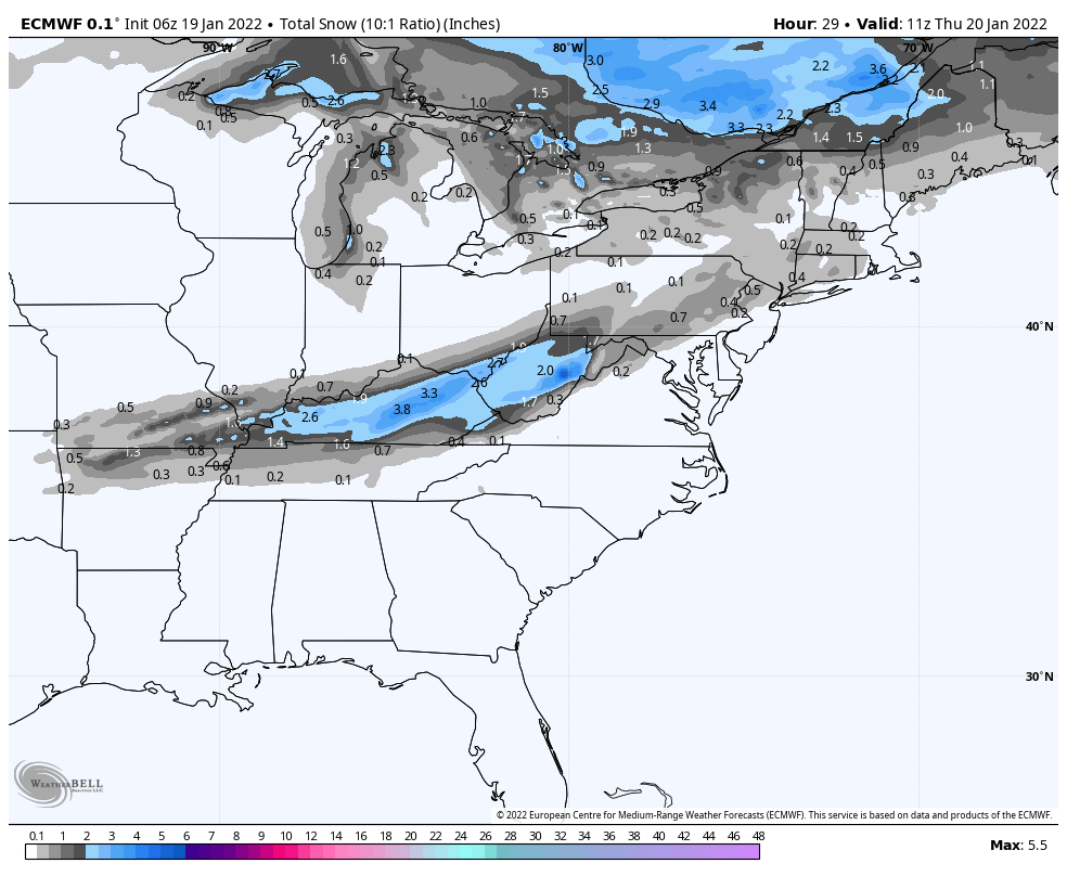
The high since midnight was 44 in Indy…no place to go but down now. Chills will be in the 20s by afternoon. The front passes precipitation-free around here…but guess who’s getting more snow tonight? The south totals will rise again.
Never miss me! Subscribe for free. My Huge Radar has real-time weather tracking, current temperatures, and severe weather watches and warnings. Get detailed Indiana conditions by clicking here. Click here to see my central Indiana 7-Day Forecast. Follow these links to get my forecasts for Lafayette, Muncie, Hendricks County, and Hamilton County. Need a second opinion? Click here for central Indiana National Weather Service forecasts. (Some charts via WeatherBELL.)
INDY SEVEN DAY FORECAST
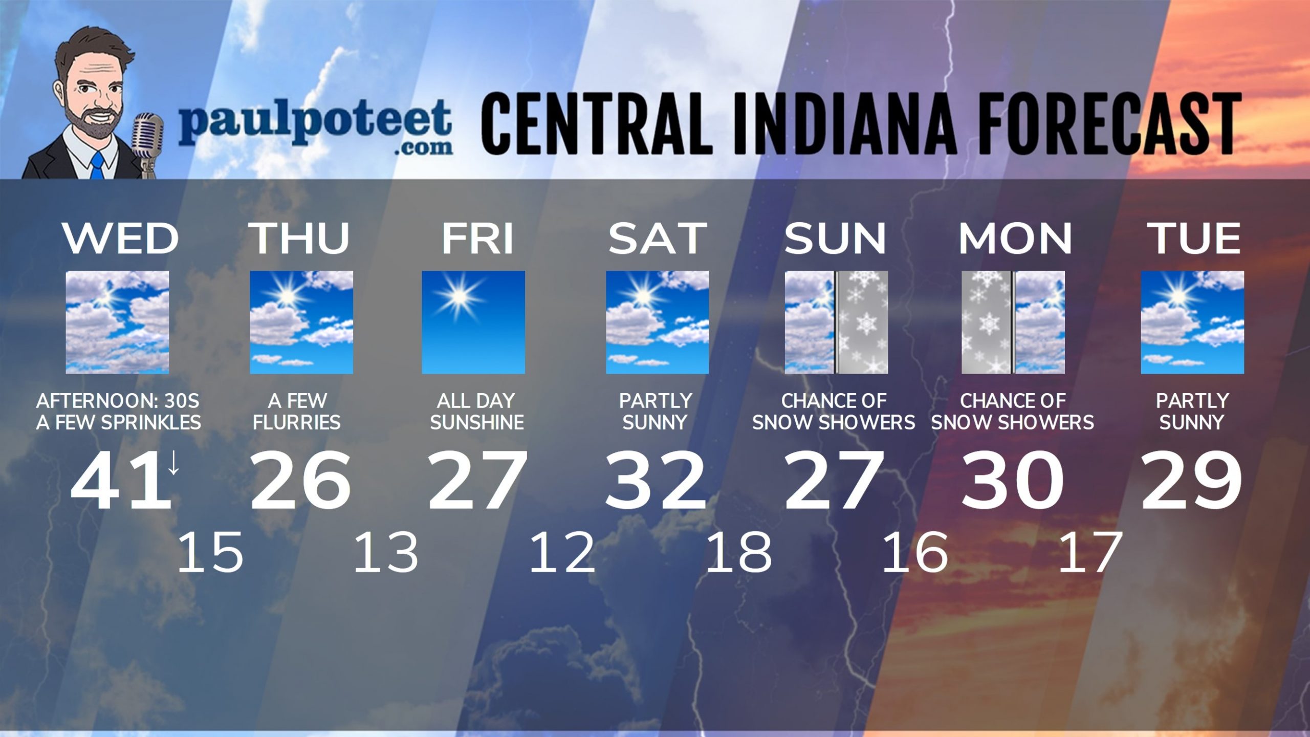
Today: Mostly cloudy, with a few sprinkles possible. Breezy. Temps fall from the lower 40s early morning to around freezing by late afternoon.
Tonight: Mostly cloudy evening. Partly cloudy overnight. Breezy, with chills around zero. Low 15.
Thursday: Partly sunny. Breezy, with a few flurries. Chills in single digits. High 26.
Thursday Night: Mostly clear. Low 13.
Friday: Sunny. High 27.
Friday Night: Mostly clear. Low 12.
Saturday: Partly sunny. High 32.
Saturday Night: Mostly cloudy. Low 18.
Sunday: Mostly cloudy. A few snow showers possible. High 27.
Sunday Night: Snow showers possible. Low 16.
Monday: Mostly cloudy. Snow showers possible. High 30.
Monday Night; Partly cloudy. Low 17.
Tuesday: Partly sunny. High 29.
Never miss me! Subscribe for free. My Huge Radar has real-time weather tracking, current temperatures, and severe weather watches and warnings. Get detailed Indiana conditions by clicking here. Click here to see my central Indiana 7-Day Forecast. Follow these links to get my forecasts for Lafayette, Muncie, Hendricks County, and Hamilton County. Need a second opinion? Click here for central Indiana National Weather Service forecasts. (Some charts via WeatherBELL.)


