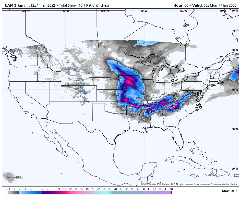
A dreary start to what eventually will be a brighter weekend in central Indiana. This chart is modeling total snowfall through Sunday night. Look at all that action to the West! And South! And Southeast!
Never miss me! Subscribe for free. My Huge Radar has real-time weather tracking, current temperatures, and severe weather watches and warnings. Get detailed Indiana conditions by clicking here. Click here to see my central Indiana 7-Day Forecast. Follow these links to get my forecasts for Lafayette, Muncie, Hendricks County, and Hamilton County. Need a second opinion? Click here for central Indiana National Weather Service forecasts. (Some charts via WeatherBELL.)
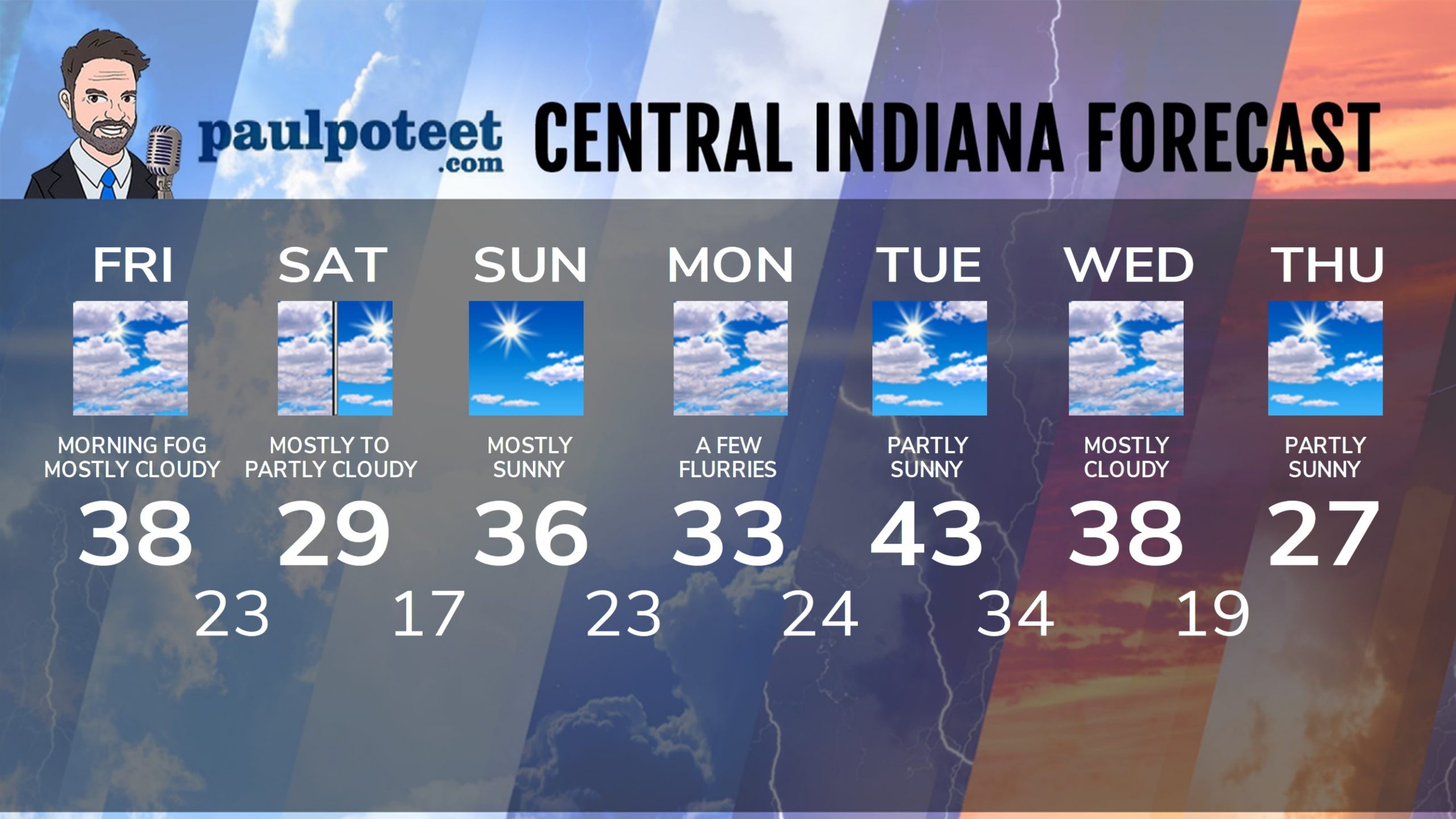
INDIANAPOLIS SEVEN DAY FORECAST
Friday: Morning fog. Mostly cloudy, and colder. High 38.
Friday Night: Flurries or snow showers after midnight. Little or no accumulation. Low 23.
Saturday: Mostly, then partly cloudy. High 29.
Saturday Night: Mostly clear. Low 17.
Sunday: Mostly sunny. High 36.
Sunday Night: Partly cloudy evening. Mostly cloudy overnight. Low 23.
Monday: Mostly cloudy, with a few flurries. High 33.
Monday Night: Mostly cloudy. Low 24.
Tuesday: Partly sunny. High 43.
Tuesday Night: Mostly cloudy. Low 34.
Wednesday: Mostly cloudy. High 38.
Wednesday Night: Mostly cloudy. Low 19.
Thursday: Partly sunny. High 27.
Never miss me! Subscribe for free. My Huge Radar has real-time weather tracking, current temperatures, and severe weather watches and warnings. Get detailed Indiana conditions by clicking here. Click here to see my central Indiana 7-Day Forecast. Follow these links to get my forecasts for Lafayette, Muncie, Hendricks County, and Hamilton County. Need a second opinion? Click here for central Indiana National Weather Service forecasts. (Some charts via WeatherBELL.)


Oh darn, We don’t get 6-10 inches ? https://t.co/V3mfGB00oQ