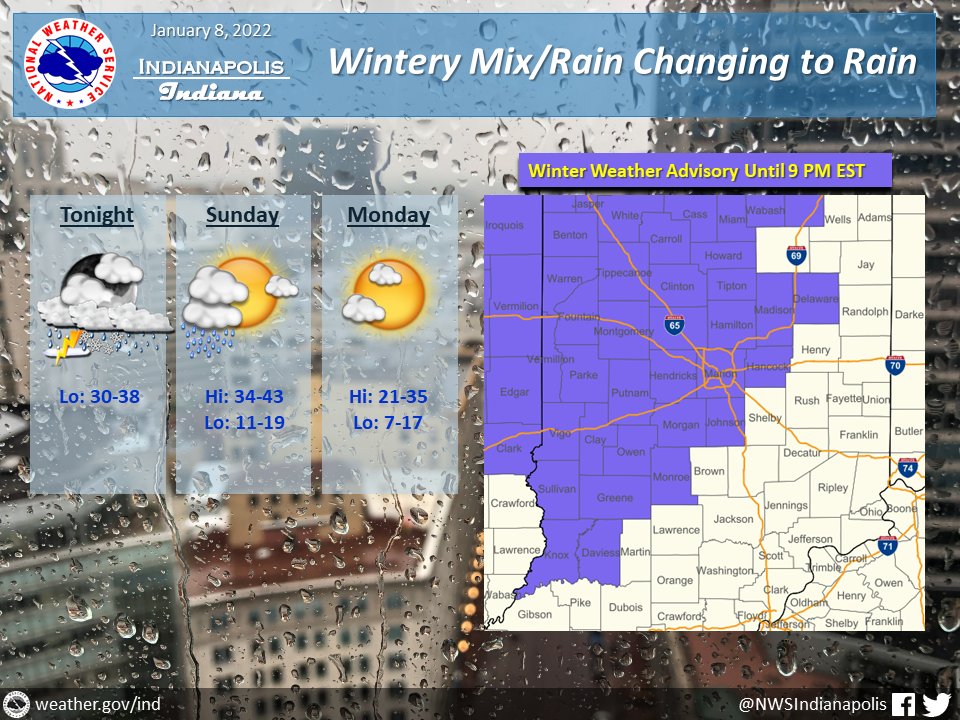
(Via @NWSIndianapolis.) Wintry mix late afternoon/early eve will transition to rain as the eve wears on. Beware of slick areas. A rumble of thunder before 4 AM EST possible near/S of I-70 west of a Martinsville/Medora line. Rain ends Sun morn, w/ clearing skies Sun afternoon. #INwx #nwsind https://t.co/9cTl5ttZ80
My Huge Radar has real-time weather tracking, current temperatures, and severe weather watches and warnings. Get detailed Indiana conditions by clicking here. Follow these links to get my forecasts for Lafayette, Muncie, Hendricks County, and Hamilton County. Need a second opinion? Click here for central Indiana National Weather Service forecasts.
Never miss me! Subscribe for free. My Huge Radar has real-time weather tracking, current temperatures, and severe weather watches and warnings. Get detailed Indiana conditions by clicking here. Click here to see my central Indiana 7-Day Forecast. Follow these links to get my forecasts for Lafayette, Muncie, Hendricks County, and Hamilton County. Need a second opinion? Click here for central Indiana National Weather Service forecasts. (Some charts via WeatherBELL.)


