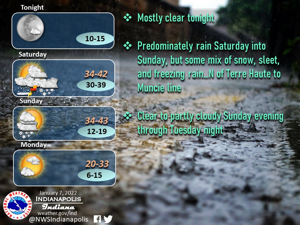
(Via @NWSIndianapolis.) Predominately rain Sat PM-Sun AM, but some mix of snow, sleet, freezing rain N of Terre Haute/Muncie line. Chance of t-storm SW Sat night. Rain/snow most areas Sun AM. Very little or no snow/ice accum. Clear to partly cloudy Sun eve thru Tue night. #INwx #nwsind https://t.co/ka0UtXBqoW
My Huge Radar has real-time weather tracking, current temperatures, and severe weather watches and warnings. Get detailed Indiana conditions by clicking here. Follow these links to get my forecasts for Lafayette, Muncie, Hendricks County, and Hamilton County. Need a second opinion? Click here for central Indiana National Weather Service forecasts.
Never miss me! Subscribe for free. My Huge Radar has real-time weather tracking, current temperatures, and severe weather watches and warnings. Get detailed Indiana conditions by clicking here. Click here to see my central Indiana 7-Day Forecast. Follow these links to get my forecasts for Lafayette, Muncie, Hendricks County, and Hamilton County. Need a second opinion? Click here for central Indiana National Weather Service forecasts. (Some charts via WeatherBELL.)


