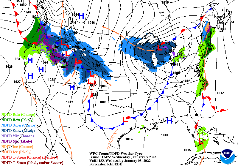
The blue triangles on this map represent an Arctic cold front that will be east of Indiana by this afternoon.
Temps tumble into the 20s and teens this afternoon!

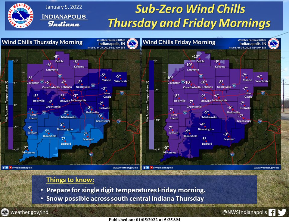
There will be some sub-zero chills Thursday and Friday morning.
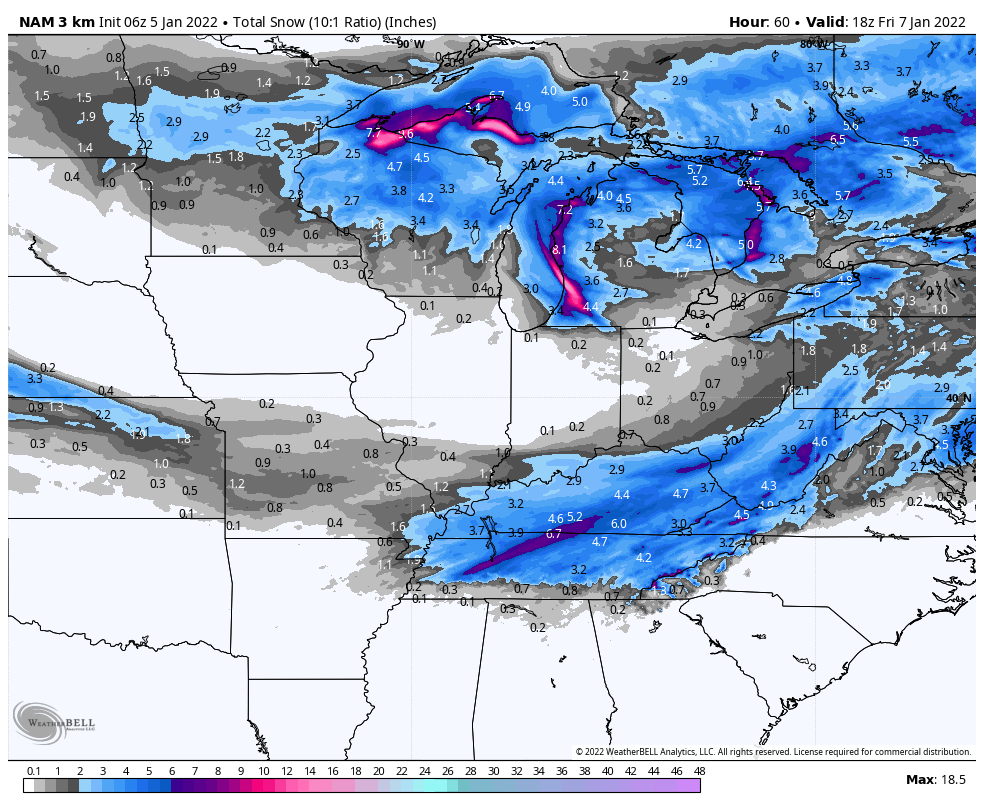
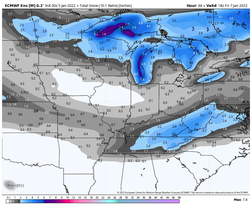
The snow-making wave stays south and southeast of central Indiana. There could be some snow showers around south of Indy Thursday afternoon and evening.

Never miss me! Subscribe for free. My Huge Radar has real-time weather tracking, current temperatures, and severe weather watches and warnings. Get detailed Indiana conditions by clicking here. Click here to see my central Indiana 7-Day Forecast. Follow these links to get my forecasts for Lafayette, Muncie, Hendricks County, and Hamilton County. Need a second opinion? Click here for central Indiana National Weather Service forecasts. (Some charts via WeatherBELL.)
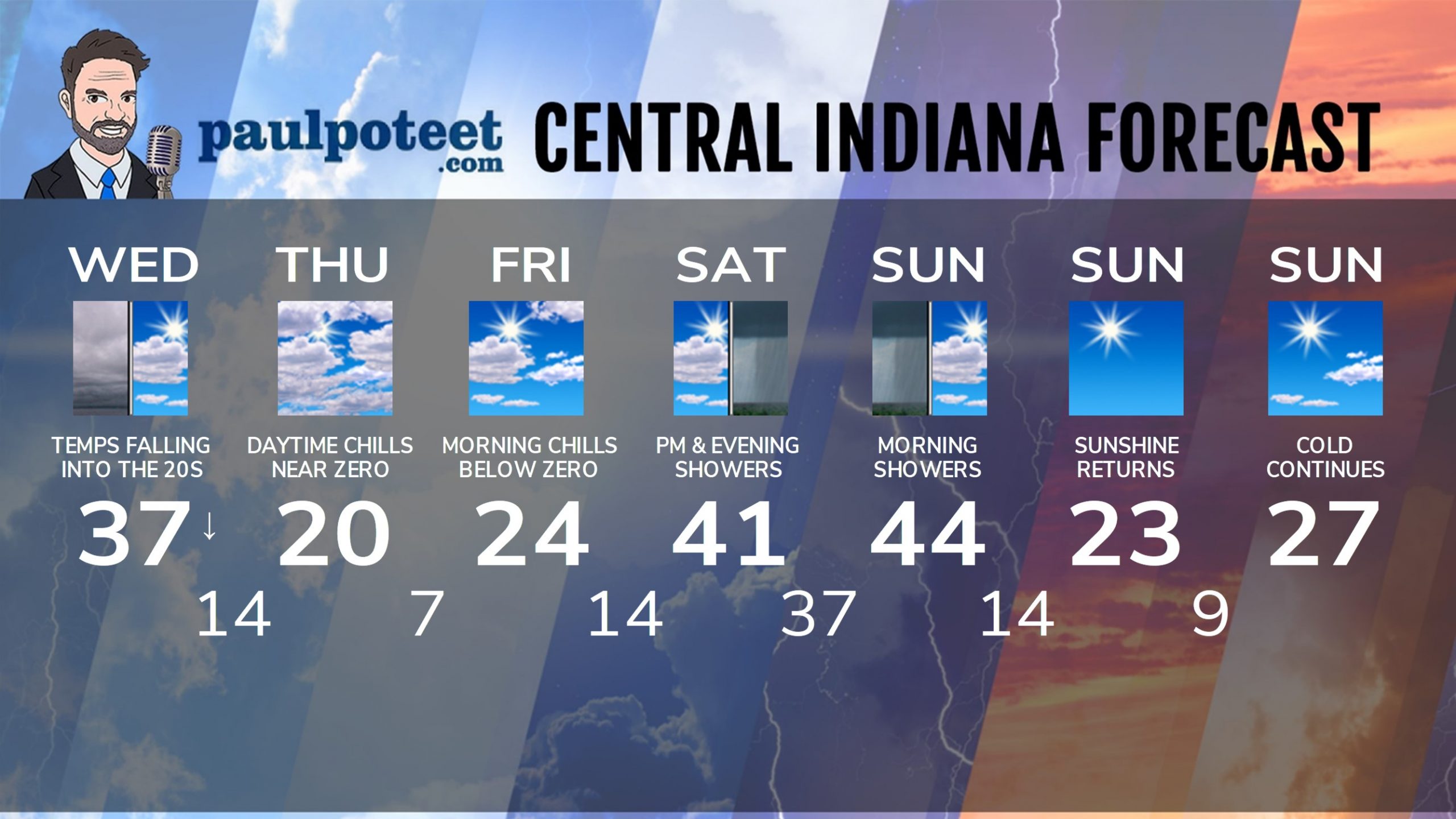
INDY SEVEN DAY FORECAST
Today: WIND ADVISORY until 6pm. Gusts to 45 mph. Chills fall into the teens and single digits. Mostly to partly cloudy, with temps falling into the mid 20s by afternoon.
Tonight: Mostly cloudy. Chills around zero. Low 14.
Thursday: Mostly cloudy. Single digit chills. A few snow showers in the afternoon, mainly south/southeast of Indy. High 20.
Thursday Night: Mostly cloudy. Chills below zero. A few snow showers, mainly south/southeast of Indy. Low 7.
Friday: Partly sunny. Wind chills “warm” to the teens. High 24.
Friday Night: Partly cloudy. Low 14.
Saturday: Partly to mostly cloudy. Spotty afternoon showers. High 41.
Saturday Night: Scattered showers. Low 37.
Sunday: Scattered morning showers. Partly High 44.
Sunday Night: Mostly clear and much colder again. Chills near zero. Low 14.
Monday: Sunny. Chills in single digits and teens. High 23.
Monday Night: Mostly clear. Chills near zero. Low 9.
Tuesday: Mostly sunny, and cold again. High 27.
Never miss me! Subscribe for free. My Huge Radar has real-time weather tracking, current temperatures, and severe weather watches and warnings. Get detailed Indiana conditions by clicking here. Click here to see my central Indiana 7-Day Forecast. Follow these links to get my forecasts for Lafayette, Muncie, Hendricks County, and Hamilton County. Need a second opinion? Click here for central Indiana National Weather Service forecasts. (Some charts via WeatherBELL.)


I’m a little worried that we’re heading for three Sundays….