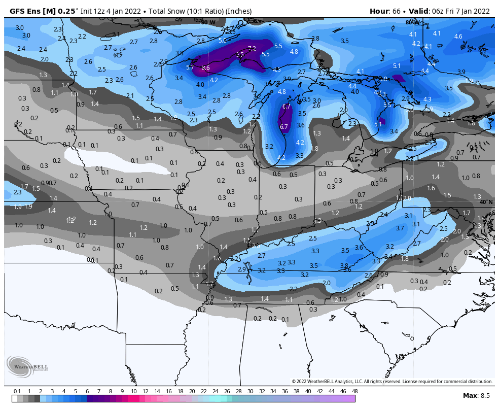
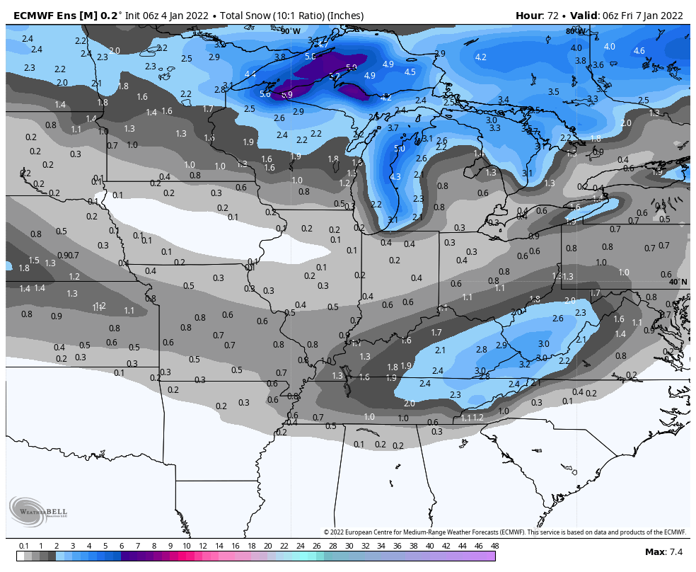
Snow amounts Thursday are expected to be less than an inch north of I-70, and up to an inch to the south. The highest amounts will be in Kentucky, northeastern Tennessee, West Virginia, and a few parts of Virginia. Here are two computer-modeled projections.
Never miss me! Subscribe for free. My Huge Radar has real-time weather tracking, current temperatures, and severe weather watches and warnings. Get detailed Indiana conditions by clicking here. Click here to see my central Indiana 7-Day Forecast. Follow these links to get my forecasts for Lafayette, Muncie, Hendricks County, and Hamilton County. Need a second opinion? Click here for central Indiana National Weather Service forecasts. (Some charts via WeatherBELL.)
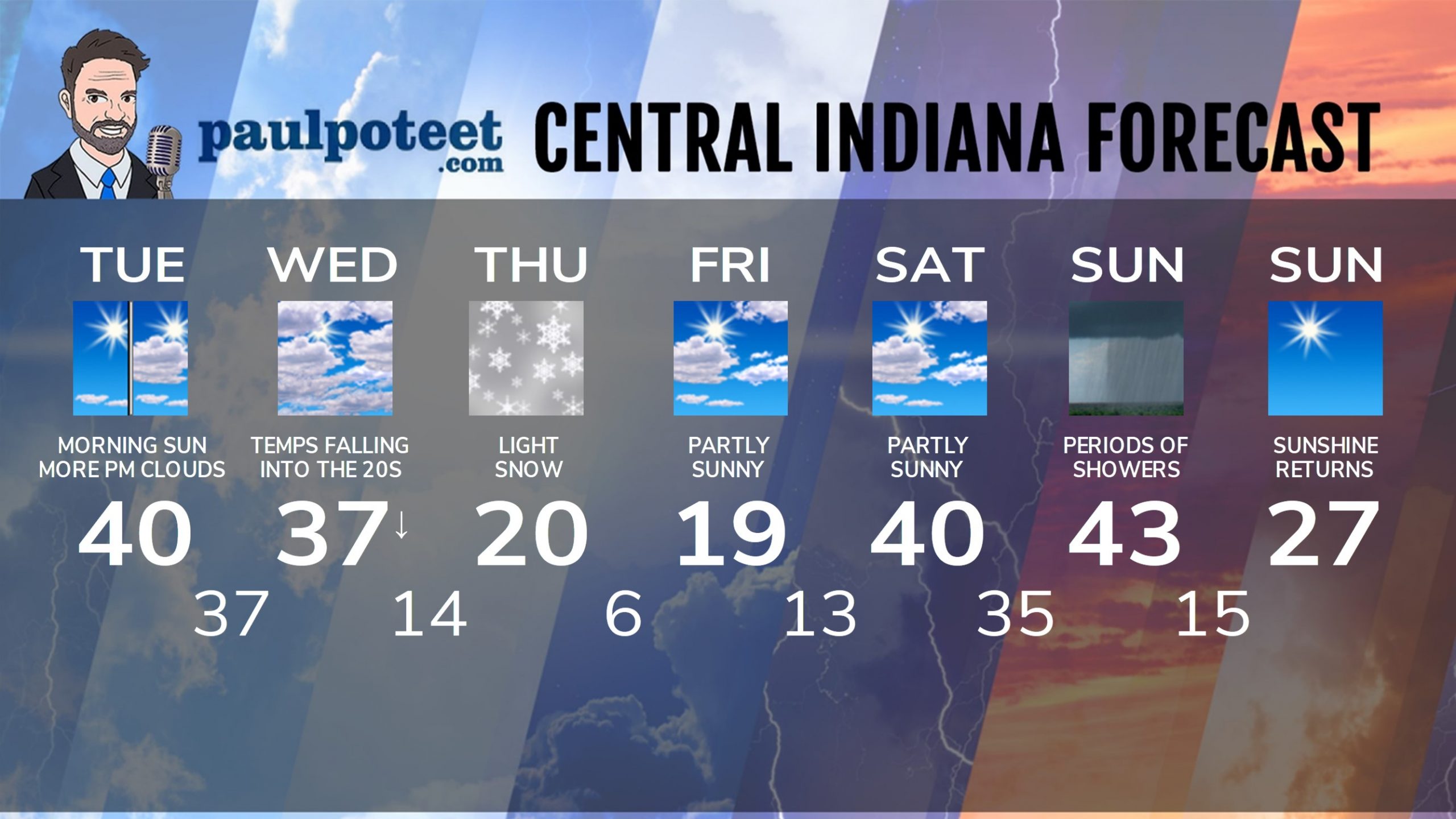
INDY SEVEN DAY FORECAST
Today: Becoming mostly sunny. High 32.
Tonight: Mostly clear. Low 23.
Tuesday: Partly sunny. High 42.
Tuesday Night: Mostly cloudy. Low 36.
Wednesday: Mostly cloudy, with temps falling into the 20s by afternoon.
Wind gusting to 30 mph. High 40.
Wednesday Night: Mostly cloudy. Low 17.
Thursday: Cloudy, with snow showers, and light accumulations. High 21.
Thursday Night: Mostly cloudy. Low 9.
Friday: Partly sunny. High 20.
Friday Night: Partly cloudy. Low 15.
Saturday: Partly sunny. High 38.
Saturday Night: Mostly cloudy. Low 35.
Sunday: Mostly cloudy. High 40.
Never miss me! Subscribe for free. My Huge Radar has real-time weather tracking, current temperatures, and severe weather watches and warnings. Get detailed Indiana conditions by clicking here. Click here to see my central Indiana 7-Day Forecast. Follow these links to get my forecasts for Lafayette, Muncie, Hendricks County, and Hamilton County. Need a second opinion? Click here for central Indiana National Weather Service forecasts. (Some charts via WeatherBELL.)


