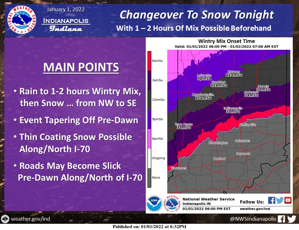
(Via @NWSIndianapolis.) A period of wintry mix and/or snow is expected tonight for most … before precipitation tapers off from west to east pre-dawn. Road surfaces will fall below freezing by dawn along/north of I-70. Air temps will drop to 25-30F for most locations with wind chills 10-20F. #INwx https://t.co/8ll5kwrQ3v
My Huge Radar has real-time weather tracking, current temperatures, and severe weather watches and warnings. Get detailed Indiana conditions by clicking here. Follow these links to get my forecasts for Lafayette, Muncie, Hendricks County, and Hamilton County. Need a second opinion? Click here for central Indiana National Weather Service forecasts.
Never miss me! Subscribe for free. My Huge Radar has real-time weather tracking, current temperatures, and severe weather watches and warnings. Get detailed Indiana conditions by clicking here. Click here to see my central Indiana 7-Day Forecast. Follow these links to get my forecasts for Lafayette, Muncie, Hendricks County, and Hamilton County. Need a second opinion? Click here for central Indiana National Weather Service forecasts. (Some charts via WeatherBELL.)


