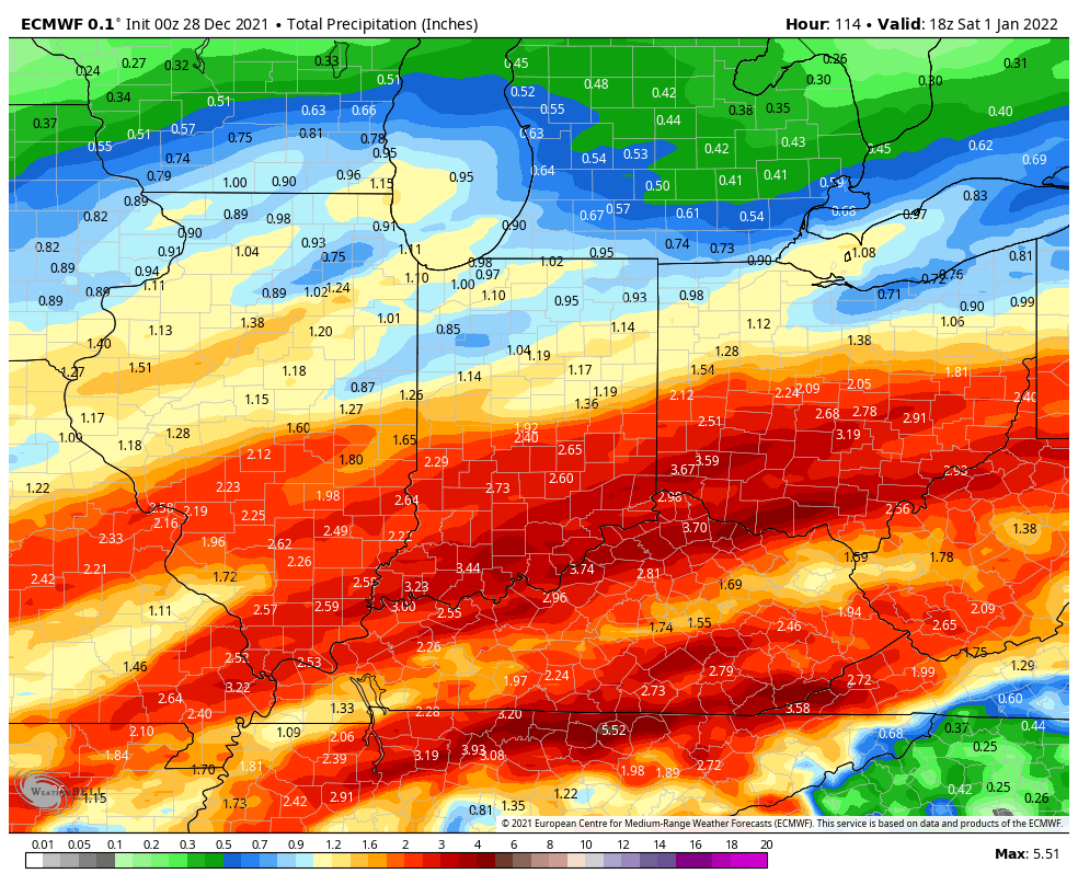
We’re done with the 60s, but temps stay above average through New Years Day. Rain is relentless, with an inch possible Tuesday afternoon, lesser amounts Wednesday afternoon, and a final rinse to welcome 2022 Friday night and Saturday. Totals through this stretch could exceed two inches, especially south of Indy.
Never miss me! Subscribe for free. My Huge Radar has real-time weather tracking, current temperatures, and severe weather watches and warnings. Get detailed Indiana conditions by clicking here. Click here to see my central Indiana 7-Day Forecast. Follow these links to get my forecasts for Lafayette, Muncie, Hendricks County, and Hamilton County. Need a second opinion? Click here for central Indiana National Weather Service forecasts. (Some charts via WeatherBELL.)
INDY SEVEN DAY FORECAST
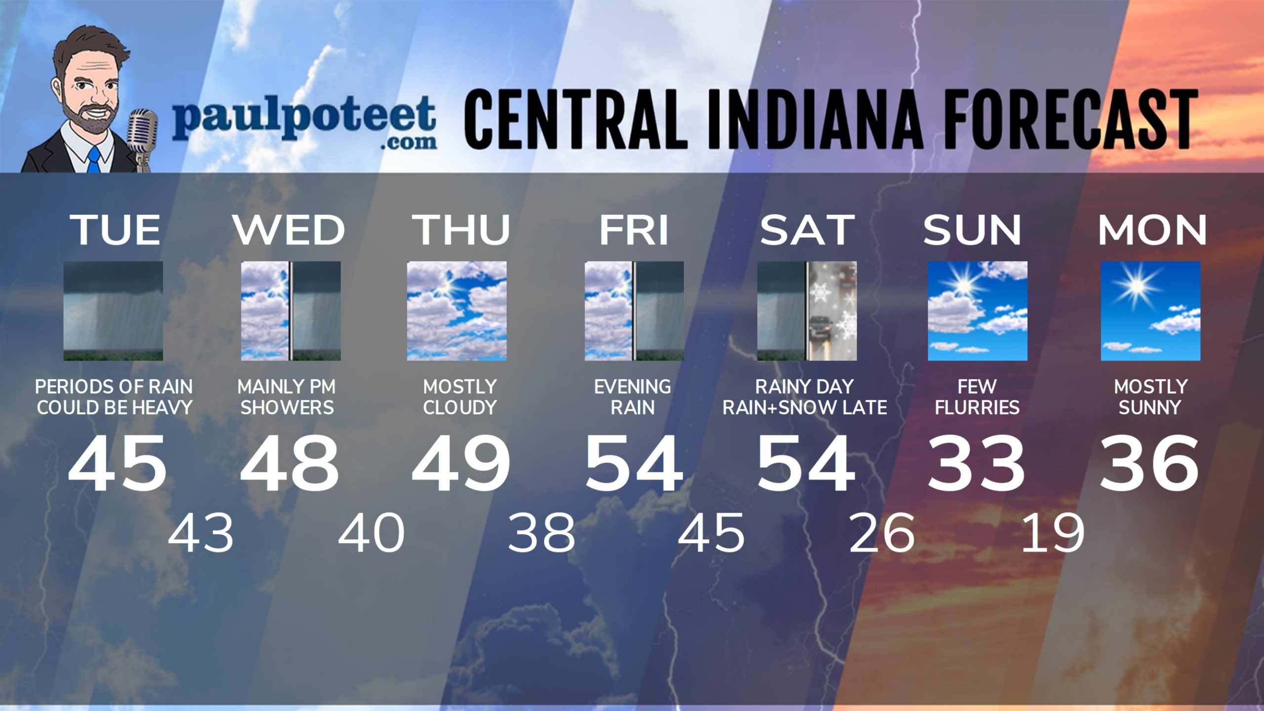
Today: Rainy. Rain could be heavy in the afternoon. Wind gusting to 25 mph. High 45.
Tonight: Showers end early in the evening. Low 43.
Wednesday: Mostly cloudy morning. Scattered afternoon showers. High 48.
Wednesday Night: Scattered showers. Low 40.
Thursday: Mostly cloudy. High 49.
Thursday Night: Partly cloudy. Low 38.
Friday: Partly sunny. Spotty afternoon showers. High 54.
New Years Eve: Rainy. Low 45.
New Years Day: Rainy. High 54.
Saturday Night: Rain and snow. Low 26.
Sunday: Partly to mostly cloudy, with a few flurries. Much colder. High 33.
Sunday Night: Partly cloudy. Low 19.
Monday: Mostly sunny. High 36.
Never miss me! Subscribe for free. My Huge Radar has real-time weather tracking, current temperatures, and severe weather watches and warnings. Get detailed Indiana conditions by clicking here. Click here to see my central Indiana 7-Day Forecast. Follow these links to get my forecasts for Lafayette, Muncie, Hendricks County, and Hamilton County. Need a second opinion? Click here for central Indiana National Weather Service forecasts. (Some charts via WeatherBELL.)


