December is on fire! Indy’s been running 7.5 degrees above average this month. We will tie a record today: 10 60-degree days in December, set in 1889. This come after the record Christmas Day high temp of 66 was tied Saturday. Earlier in the month on December 11th a record high was broken, ahead of the cold front that brought severe weather. Just for perspective: today’s normal high is 38. (Today’s record is 68.)
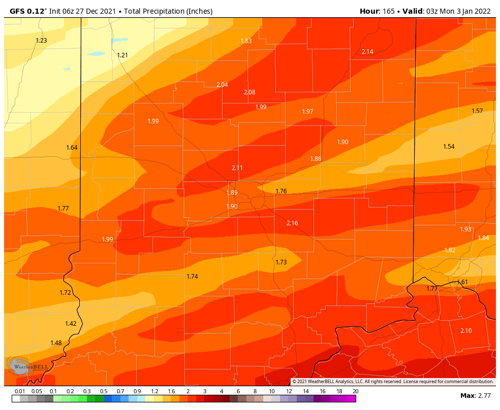
Two big rain events this week. The first is a big batch arriving Tuesday, with around an inch expected.
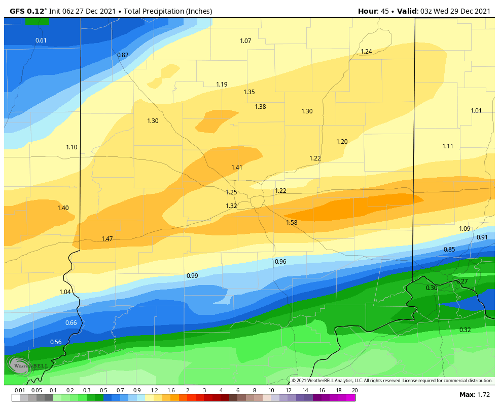
Spottier showers will return Wednesday afternoon and evening. Then: another big wave Friday night into the first day of the year. That should send the week’s running rain total up to around two inches.
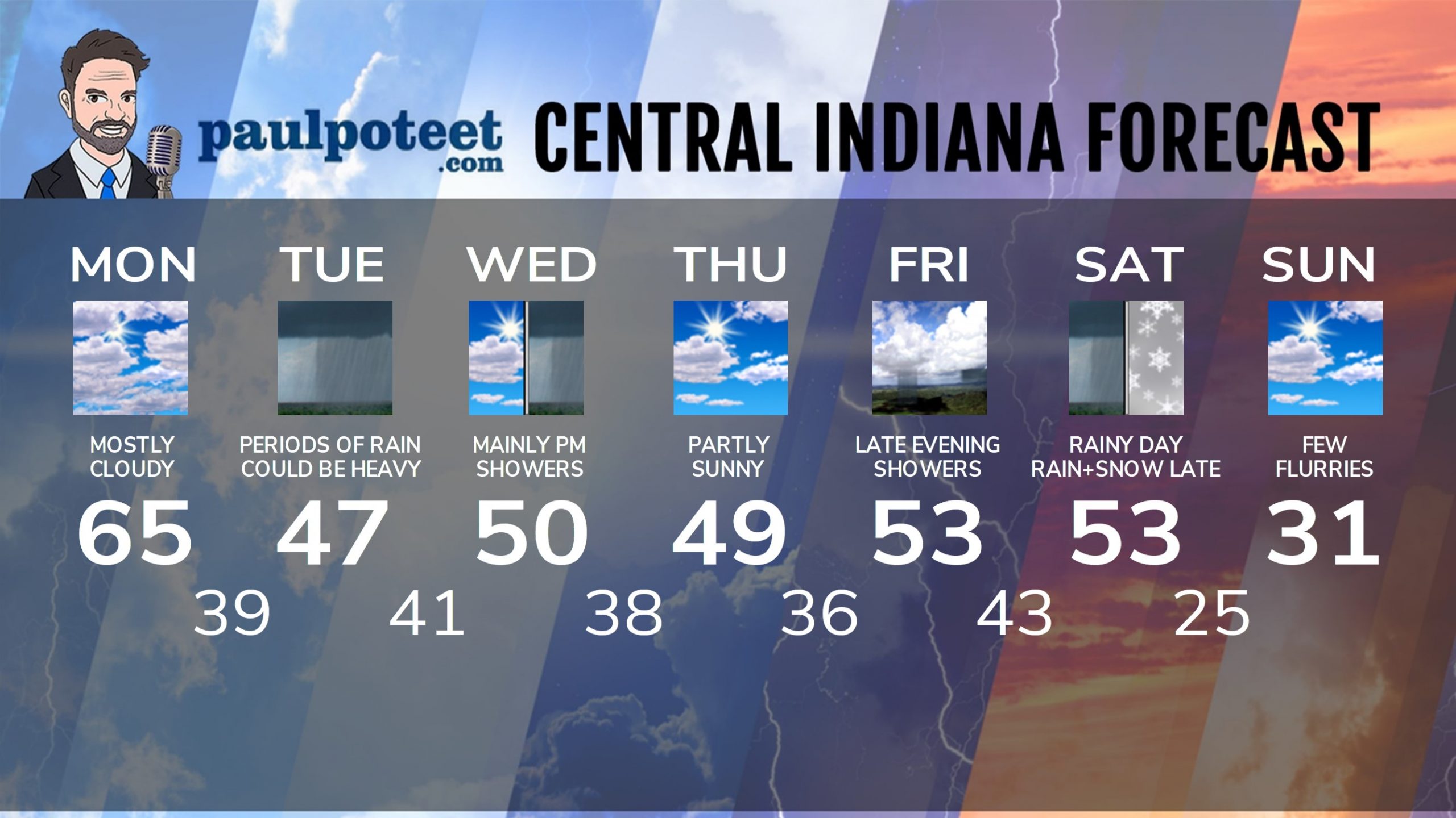
INDY SEVEN DAY FORECAST
Today: Patchy morning fog. Wind gusting to 25 mph by afternoon. A spotty shower is possible, otherwise mostly cloudy and mild again. High 65.
Tonight: Partly to mostly cloudy. Low 39.
Tuesday: Rainy. Wind gusting to 25 mph. High 47.
Tuesday Night: Scattered showers, mainly in the evening. Low 41.
Wednesday: Partly cloudy morning. Scattered afternoon showers. High 50.
Wednesday Night: Scattered showers. Low 38.
Thursday: Partly sunny. High 49.
Thursday Night: Partly cloudy. Low 36.
Friday: Partly sunny. High 53.
New Years Eve: Showers by late evening. Low 43.
New Years Day: Rainy. High 53.
Saturday Night: Rain and snow. Low 25.
Sunday: Partly to mostly cloudy, with a few flurries. Much colder. High 31.
Never miss me! Subscribe for free. My Huge Radar has real-time weather tracking, current temperatures, and severe weather watches and warnings. Get detailed Indiana conditions by clicking here. Click here to see my central Indiana 7-Day Forecast. Follow these links to get my forecasts for Lafayette, Muncie, Hendricks County, and Hamilton County. Need a second opinion? Click here for central Indiana National Weather Service forecasts. (Some charts via WeatherBELL.)


