More than an inch of rain may fall at times from Thursday morning through Saturday morning. The computer modeling schemes remain in pretty good agreement with where the heaviest rain will set up.
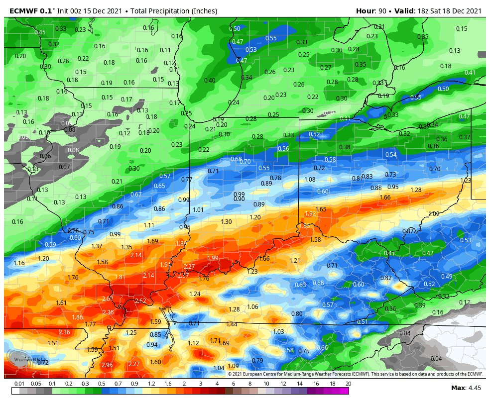
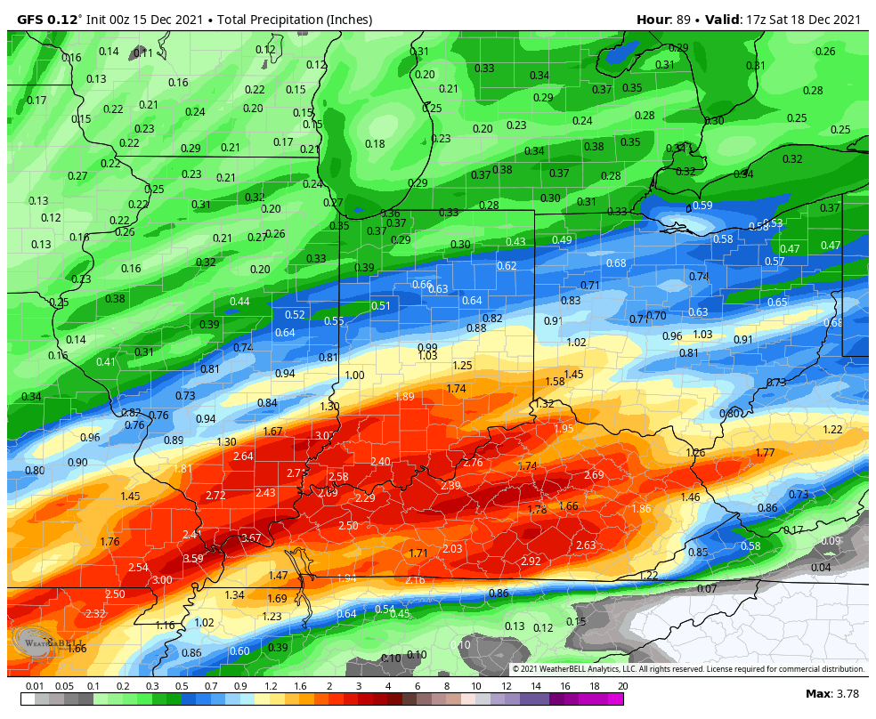
The biggest portion of those totals will come Thursday morning, and again Friday night. No severe weather is expected in Indiana, or around the Midwest during that period. Today, however, could be a big severe weather day in the northern Plains, and into Wisconsin.

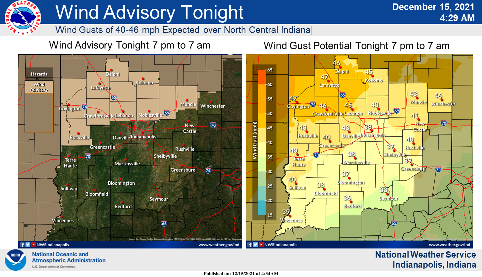
The northern part of the state is under a Wind Advisory tonight and tomorrow, with 45 mph gusts possible. Gusts will get to 40 mph throughout central Indiana.
Never miss me! Subscribe for free. My Huge Radar has real-time weather tracking, current temperatures, and severe weather watches and warnings. Get detailed Indiana conditions by clicking here. Click here to see my central Indiana 7-Day Forecast. Follow these links to get my forecasts for Lafayette, Muncie, Hendricks County, and Hamilton County. Need a second opinion? Click here for central Indiana National Weather Service forecasts. (Some charts via WeatherBELL.)
INDY SEVEN DAY FORECAST
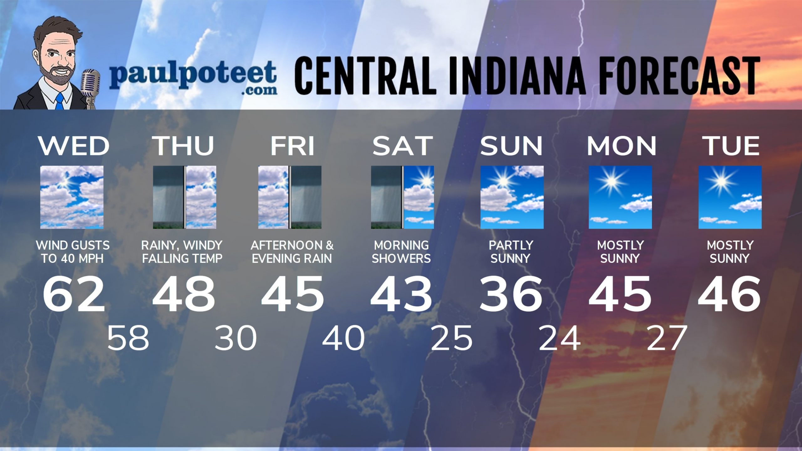
Today: Mostly cloudy. Wind gusting to 40 mph. An isolated light shower possible. High 62.
Tonight: Mostly cloudy. WIND ADVISORY north of Indy, with gusts to 45 mph. Spotty showers after midnight. Temps steady in the upper 50s to around 60.
Thursday: Rain in the morning. Some showers in the early to mid afternoon. WIND ADVISORY north of Indy, with gusts to 45 mph. Temps fall from around 60 in the morning to the upper 40s by afternoon.
Thursday Night: Partly cloudy. Low 30.
Friday: Cloudy and cooler, with a few showers in the morning. Rain in the afternoon. High 45.
Friday Night: Rainy. Low 40.
Saturday: Morning showers. Some sun in the afternoon. High 43.
Saturday Night: Partly cloudy. Low 25.
Sunday: Partly sunny. High 36.
Sunday Night: Mostly clear. Low 24.
Monday: Mostly sunny. High 45.
Monday Night: Mostly clear. Low 27.
Tuesday: Mostly sunny. High 46.
Never miss me! Subscribe for free. My Huge Radar has real-time weather tracking, current temperatures, and severe weather watches and warnings. Get detailed Indiana conditions by clicking here. Click here to see my central Indiana 7-Day Forecast. Follow these links to get my forecasts for Lafayette, Muncie, Hendricks County, and Hamilton County. Need a second opinion? Click here for central Indiana National Weather Service forecasts. (Some charts via WeatherBELL.)


