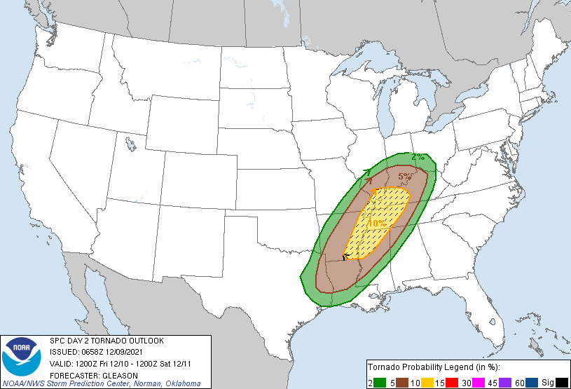
A powerful cold front is still expected to bring downpours of rain, and possibly severe weather late Friday evening into very early Saturday morning. The risk is highest in the southern half of the state. Damaging straight-line winds, large hail, and an isolated tornado are all possible.

These are computer-modeled temperatures at about sunrise Saturday.

The cooler air will be advancing from the west on these nasty, gusty west winds, which will send chilsl down into the 20s by Saturday afternoon.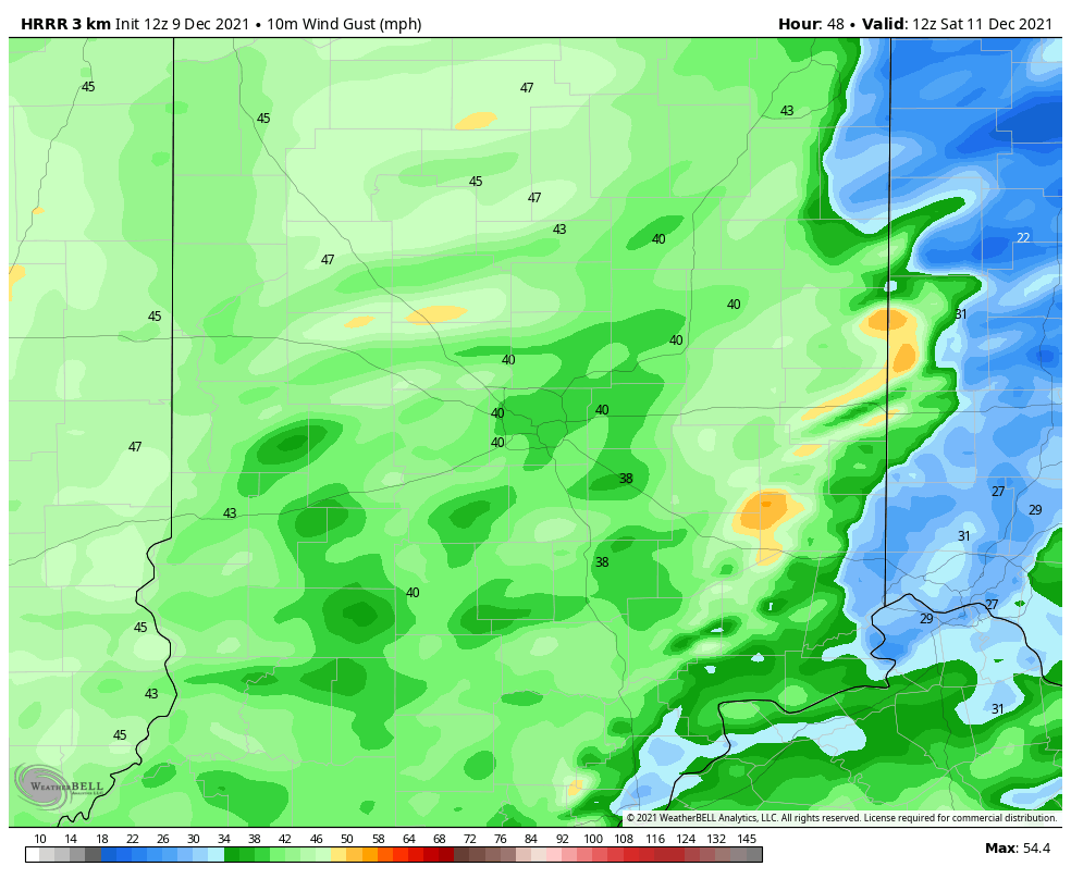
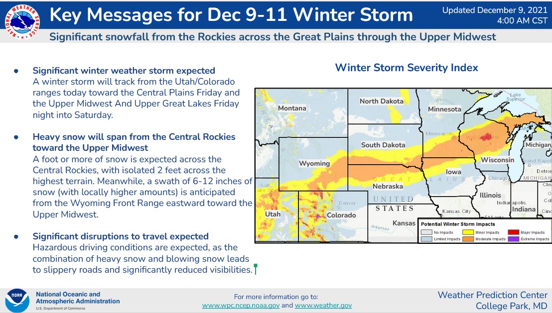
Meanwhile: up North…
Never miss me! Subscribe for free. My Huge Radar has real-time weather tracking, current temperatures, and severe weather watches and warnings. Get detailed Indiana conditions by clicking here. Click here to see my central Indiana 7-Day Forecast. Follow these links to get my forecasts for Lafayette, Muncie, Hendricks County, and Hamilton County. Need a second opinion? Click here for central Indiana National Weather Service forecasts. (Some charts via WeatherBELL.)
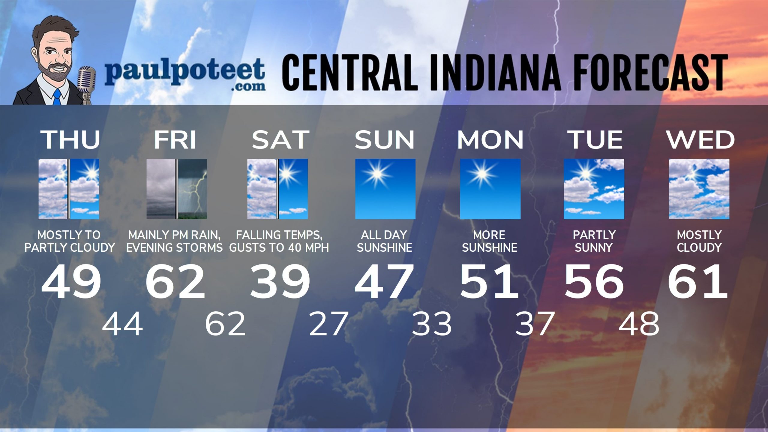
INDY SEVEN DAY FORECAST
Today: Mostly to partly cloudy. High 49.
Tonight: Partly cloudy evening. Mostly cloudy overnight. Low 44.
Friday: Cloudy. Shower chance in the morning. Rain in the afternoon. High
62.
Friday Night: Rain and storms. Low 62.
Saturday: Early morning showers, then mostly cloudy, with temps falling from around 60 at sunrise into the upper 30s by afternoon. Wind gusting to 35 mph. Chills in the 20s by afternoon.
Saturday Night: Clearing and cold. Low 27.
Sunday: Sunny. High 47.
Sunday Night: Clear. Low 33.
Monday: Sunny. High 51.
Monday Night: Partly cloudy. Low 37.
Tuesday: Partly sunny. High 56.
Tuesday Night: Mostly cloudy. Low 48.
Wednesday: Mostly cloudy. High 61.
Never miss me! Subscribe for free. My Huge Radar has real-time weather tracking, current temperatures, and severe weather watches and warnings. Get detailed Indiana conditions by clicking here. Click here to see my central Indiana 7-Day Forecast. Follow these links to get my forecasts for Lafayette, Muncie, Hendricks County, and Hamilton County. Need a second opinion? Click here for central Indiana National Weather Service forecasts. (Some charts via WeatherBELL.)


