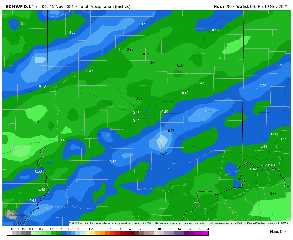
The first measurable snows of the season arrived over the weekend, and a little more rain and/or snow will fall this afternoon, but amounts will be light. Amounts will be higher with the system arriving later Wednesday.
SUNDAY SNOW TOTALS
0.9″ Castleton Area
0.9″ Anderson Area
0.5″ Fishers
0.5″ Henry County
0.5″ Indianapolis Int’l Airport
Never miss me! Subscribe for free. My Huge Radar has real-time weather tracking, current temperatures, and severe weather watches and warnings. Get detailed Indiana conditions by clicking here. Click here to see my central Indiana 7-Day Forecast. Follow these links to get my forecasts for Lafayette, Muncie, Hendricks County, and Hamilton County. Need a second opinion? Click here for central Indiana National Weather Service forecasts. (Some charts via WeatherBELL.)
INDY SEVEN DAY FORECAST
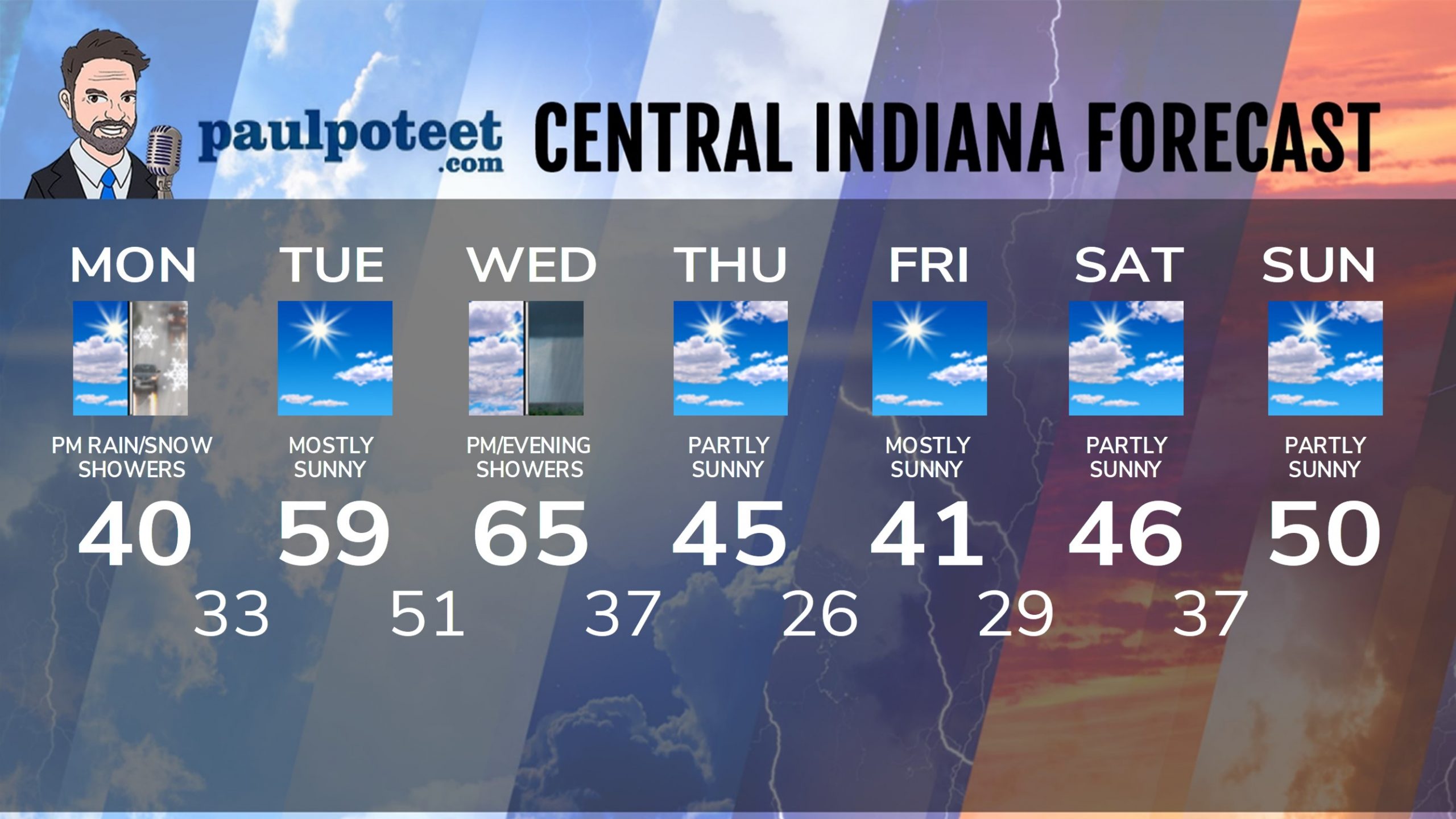
Today: Some sun in the morning, with more clouds in the afternoon. Scattered afternoon rain and/or snow showers. High 40.
Tonight: Mostly cloudy evening. Partly cloudy overnight. Low 33.
Tuesday: Mostly sunny. High 59.
Tuesday Night: Partly cloudy. Low 51.
Wednesday: Mostly cloudy. Afternoon scattered showers. High 65.
Wednesday Night: Showers. Low 37.
Thursday: Becoming partly sunny. High 45.
Thursday Night: Mostly clear. Low 26.
Friday: Mostly sunny. High 41.
Friday Night: Mostly clear. Low 29.
Saturday: Partly sunny. High 46.
Saturday Night: Partly cloudy. Low 37.
Sunday: Partly sunny. High 50.
Never miss me! Subscribe for free. My Huge Radar has real-time weather tracking, current temperatures, and severe weather watches and warnings. Get detailed Indiana conditions by clicking here. Click here to see my central Indiana 7-Day Forecast. Follow these links to get my forecasts for Lafayette, Muncie, Hendricks County, and Hamilton County. Need a second opinion? Click here for central Indiana National Weather Service forecasts. (Some charts via WeatherBELL.)


