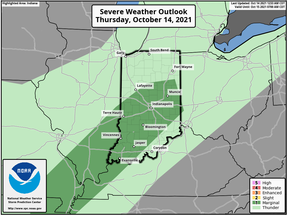
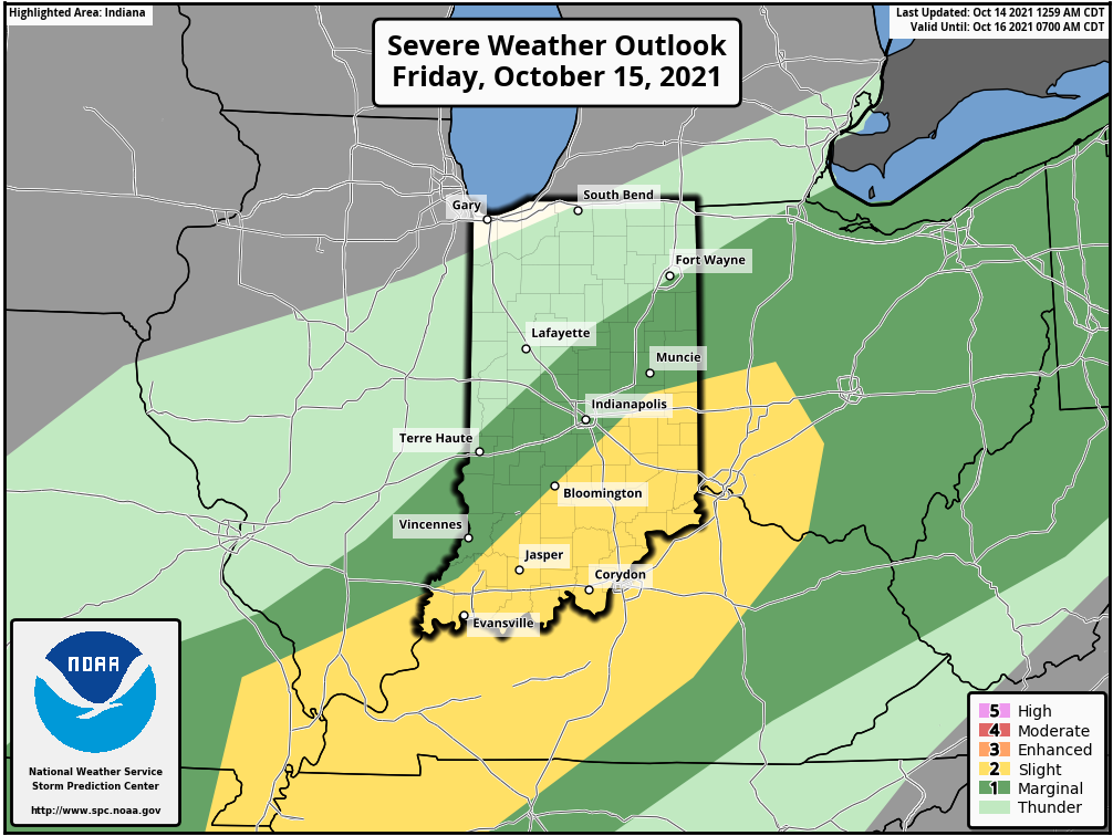
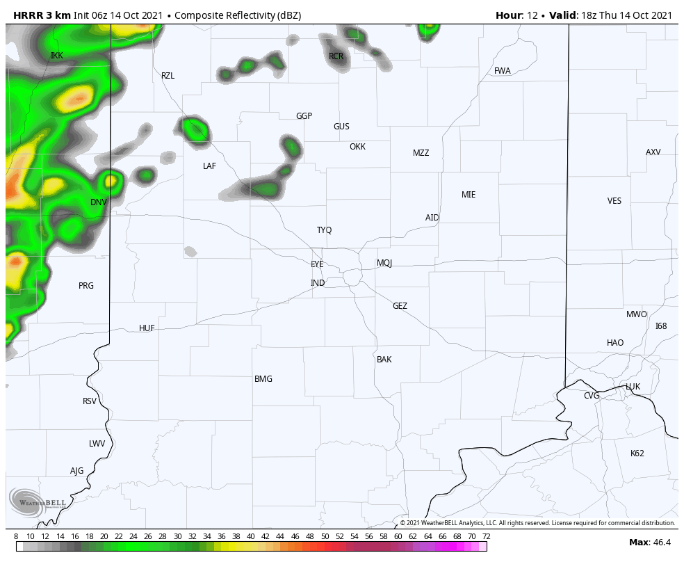
Fall is fighting with Summer, and it’s gonna win by the weekend. The battle could get bumpy this afternoon and again Friday afternoon, with the risk of some severe weather. The risk will be farther to the east and southeast than the severe weather we saw on Monday afternoon.
Shower and storms are likely this afternoon through Friday. Showers will follow Friday night, ending early Saturday morning.
Never miss me! Subscribe for free. My Huge Radar has real-time weather tracking, current temperatures, and severe weather watches and warnings. Get detailed Indiana conditions by clicking here. Click here to see my central Indiana 7-Day Forecast. Follow these links to get my forecasts for Lafayette, Muncie, Hendricks County, and Hamilton County. Need a second opinion? Click here for central Indiana National Weather Service forecasts. (Some charts via WeatherBELL.)
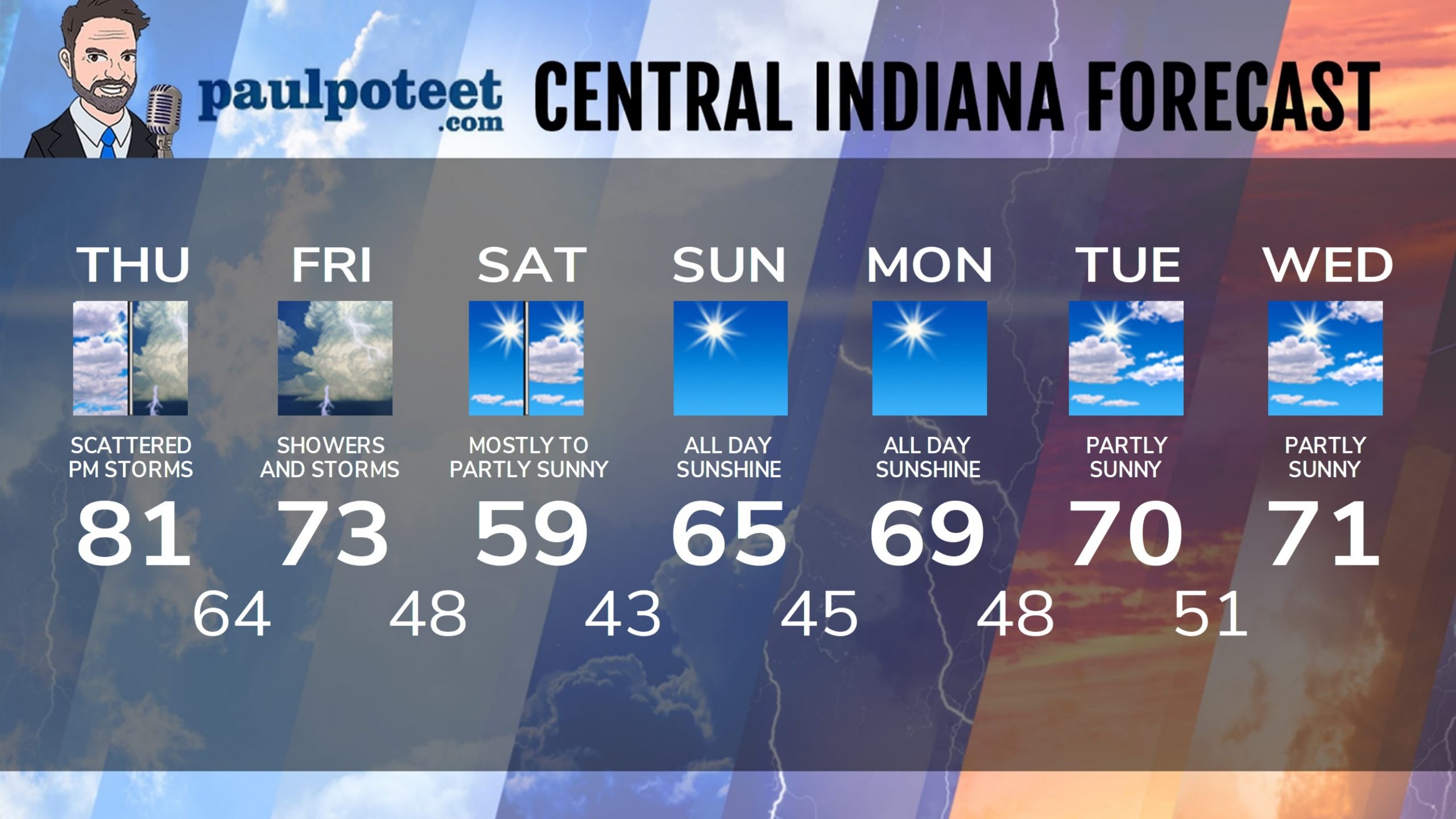
INDY SEVEN DAY FORECAST
Today: Mostly cloudy, with scattered showers and storms, mainly in the afternoon. Some storms could be severe. Wind gusting to 25 mph. High 81.
Tonight: Showers and storms. Low 64.
Friday: Periods of showers and storms. Some storms could be severe. Wind gusting to 25 mph. High 73.
Friday Night: Showers likely, with some thunder possible. Low 48.
Saturday: Mostly to partly sunny. Chilly breezes to 25 mph. High 59.
Saturday Night: Clear. Low 43.
Sunday: Sunny. High 65.
Sunday Night: Clear. Low 45.
Monday: Sunny. High 69.
Monday Night: Clear. Low 48.
Tuesday: Partly sunny. High 70.
Tuesday Night: Mostly clear. Low 51.
Wednesday: Partly sunny. High 71.
Never miss me! Subscribe for free. My Huge Radar has real-time weather tracking, current temperatures, and severe weather watches and warnings. Get detailed Indiana conditions by clicking here. Click here to see my central Indiana 7-Day Forecast. Follow these links to get my forecasts for Lafayette, Muncie, Hendricks County, and Hamilton County. Need a second opinion? Click here for central Indiana National Weather Service forecasts. (Some charts via WeatherBELL.)


