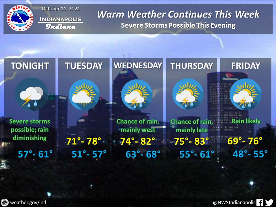
(Via @NWSIndianapolis.) A chance of showers & t-storms thru the workweek w/ high temps in the 70s to lower 80s, lows in the upper 40s to upper 60s, coolest Friday. Severe storms possible this eve, diminishing late. The greatest severe weather threat will be damaging thunderstorm winds. #INwx #nwsind https://t.co/GrR9BCqKTy
My Huge Radar has real-time weather tracking, current temperatures, and severe weather watches and warnings. Get detailed Indiana conditions by clicking here. Follow these links to get my forecasts for Lafayette, Muncie, Hendricks County, and Hamilton County. Need a second opinion? Click here for central Indiana National Weather Service forecasts.
Never miss me! Subscribe for free. My Huge Radar has real-time weather tracking, current temperatures, and severe weather watches and warnings. Get detailed Indiana conditions by clicking here. Click here to see my central Indiana 7-Day Forecast. Follow these links to get my forecasts for Lafayette, Muncie, Hendricks County, and Hamilton County. Need a second opinion? Click here for central Indiana National Weather Service forecasts. (Some charts via WeatherBELL.)


