Our biggest threat for severe weather in over a month arrives in the mid to late afternoon hours today, and lasts until around midnight. Blame this area of low pressure and attached cold front:
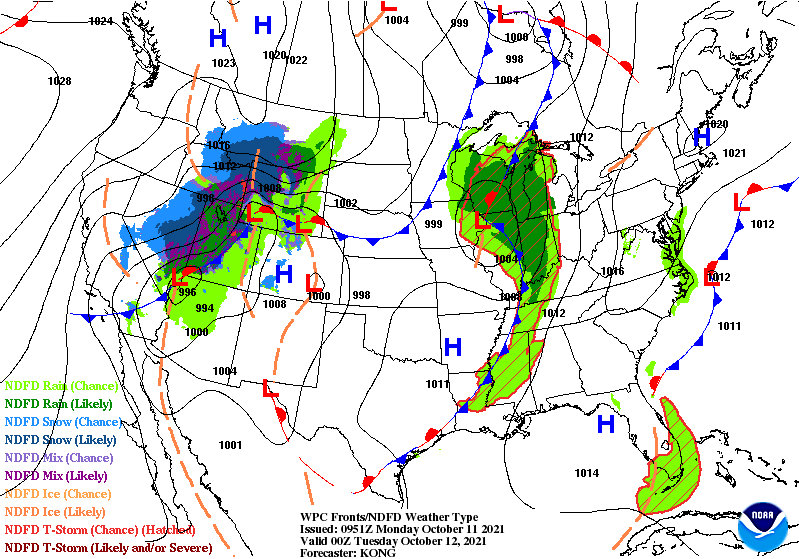
That’s going on at the surface, and meanwhile an upper level low digs in to our northwest today, providing the energy to get thunderstorms spinning. Severe weather is a possibility later this afternoon into evening.
Never miss me! Subscribe for free. My Huge Radar has real-time weather tracking, current temperatures, and severe weather watches and warnings. Get detailed Indiana conditions by clicking here. Click here to see my central Indiana 7-Day Forecast. Follow these links to get my forecasts for Lafayette, Muncie, Hendricks County, and Hamilton County. Need a second opinion? Click here for central Indiana National Weather Service forecasts. (Some charts via WeatherBELL.)
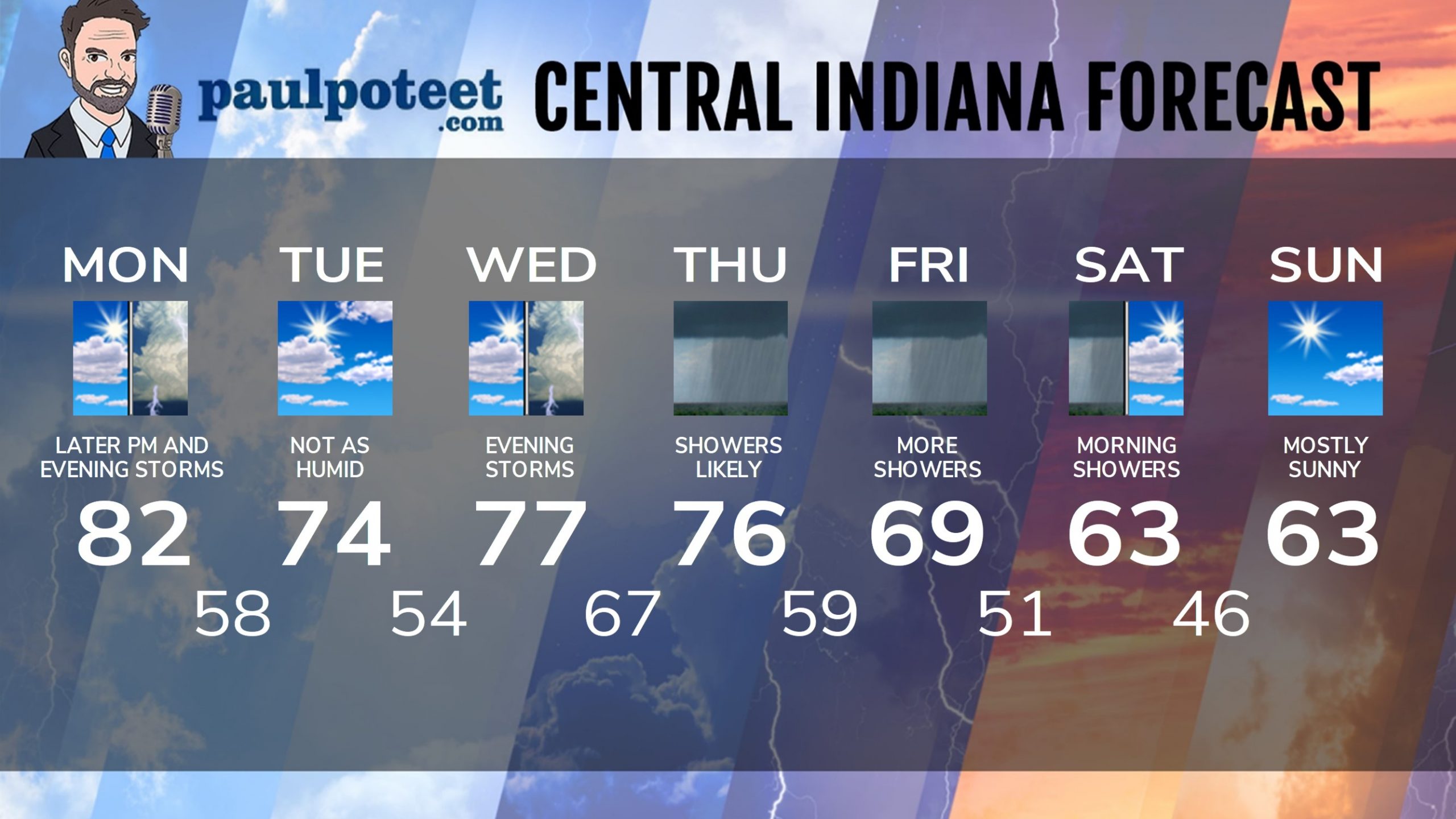
INDY SEVEN DAY FORECAST
Columbus Day: Partly to mostly cloudy. Mid to late afternoon showers and storms. Some could be severe. Wind gusting to 30 mph. High 82.
Tonight: Showers and storms. Some storms could be severe. Wind gusting to 30 mph. Showers diminish after midnight. Low 58.
Tuesday: Partly sunny. Not as hot or as humid. High 74.
Tuesday Night: Partly cloudy. Low 54.
Wednesday: Partly to mostly cloudy. High 77.
Wednesday Night: Scattered showers and storms. Low 67.
Thursday: Mostly cloudy, with periods of showers. High 76.
Thursday Night: More showers. Low 59.
Friday: More showers. High 69.
Friday Night: Shower chances. Low 51.
Saturday: Spotty morning showers, then partly sunny and cool. High 63.
Saturday Night: Mostly clear. Low 46.
Sunday: Mostly sunny. High 63.
Never miss me! Subscribe for free. My Huge Radar has real-time weather tracking, current temperatures, and severe weather watches and warnings. Get detailed Indiana conditions by clicking here. Click here to see my central Indiana 7-Day Forecast. Follow these links to get my forecasts for Lafayette, Muncie, Hendricks County, and Hamilton County. Need a second opinion? Click here for central Indiana National Weather Service forecasts. (Some charts via WeatherBELL.)


