Another one to three inches of rain is possible through Thursday morning in central Indiana.

We already had 0.48″ of rainfall Monday in Indianapolis. There was 0.25″ in Terre Haute, 0.20″ in Lafayette, 0.14″ in Muncie, and 1.30″ in Bloomington! B-town is still running about 3.5″ behind for the year, so the rain is welcome. BTW: Muncie is about 5 inches behind as of today, but most of central Indiana is near or a little above average for the year to date.
Never miss me! Subscribe for free. My Huge Radar has real-time weather tracking, current temperatures, and severe weather watches and warnings. Get detailed Indiana conditions by clicking here. Click here to see my central Indiana 7-Day Forecast. Follow these links to get my forecasts for Lafayette, Muncie, Hendricks County, and Hamilton County. Need a second opinion? Click here for central Indiana National Weather Service forecasts. (Some charts via WeatherBELL.)
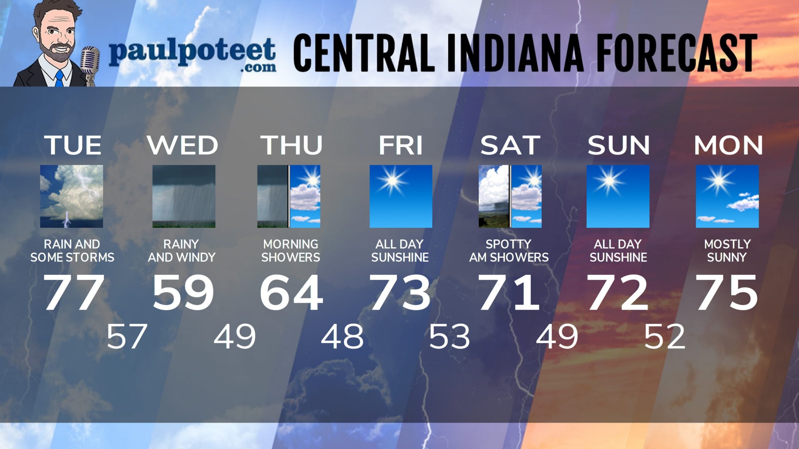
INDY SEVEN DAY FORECAST
Today: Mostly cloudy, with periods of showers and storms. Wind gusting to 20 mph. High 77.
Tonight: More showers and storms in the evening. Rain overnight. Wind gusting to 25 mph. Low 57.
Wednesday: Rainy and much cooler. Wind gusting to 30 mph. High 59.
Wednesday Night: Scattered showers. Low 49.
Thursday: Scattered morning showers, then partly sunny. High 64.
Thursday Night: Mostly clear. Low 48.
Friday: Sunny. High 73.
Friday Night: Partly cloudy. Spotty showers after midnight. Low 53.
Saturday: Spotty showers in the morning, then partly sunny. High 71.
Saturday Night: Mostly clear. Low 49.
Sunday: Sunny. High 72.
Sunday Night: Mostly clear. Low 52.
Monday: Mostly sunny. High 75.
Never miss me! Subscribe for free. My Huge Radar has real-time weather tracking, current temperatures, and severe weather watches and warnings. Get detailed Indiana conditions by clicking here. Click here to see my central Indiana 7-Day Forecast. Follow these links to get my forecasts for Lafayette, Muncie, Hendricks County, and Hamilton County. Need a second opinion? Click here for central Indiana National Weather Service forecasts. (Some charts via WeatherBELL.)


