The last weekend of Summer features above average temperatures in central Indiana. Our normal highs are in the upper 70s. It will also be a little muggy through the weekend.
RAIN SO FAR THIS MONTH
2.36″ Muncie
1.97″ Indianapolis
1.53″ Bloomington
1.27″ Terre Haute
0.65″ Lafayette
Indy and Muncie alone remain above average for the month. Our next best chance of rain (and storms) starts Monday and continues through Wednesday morning. Around a half-inch is possible.
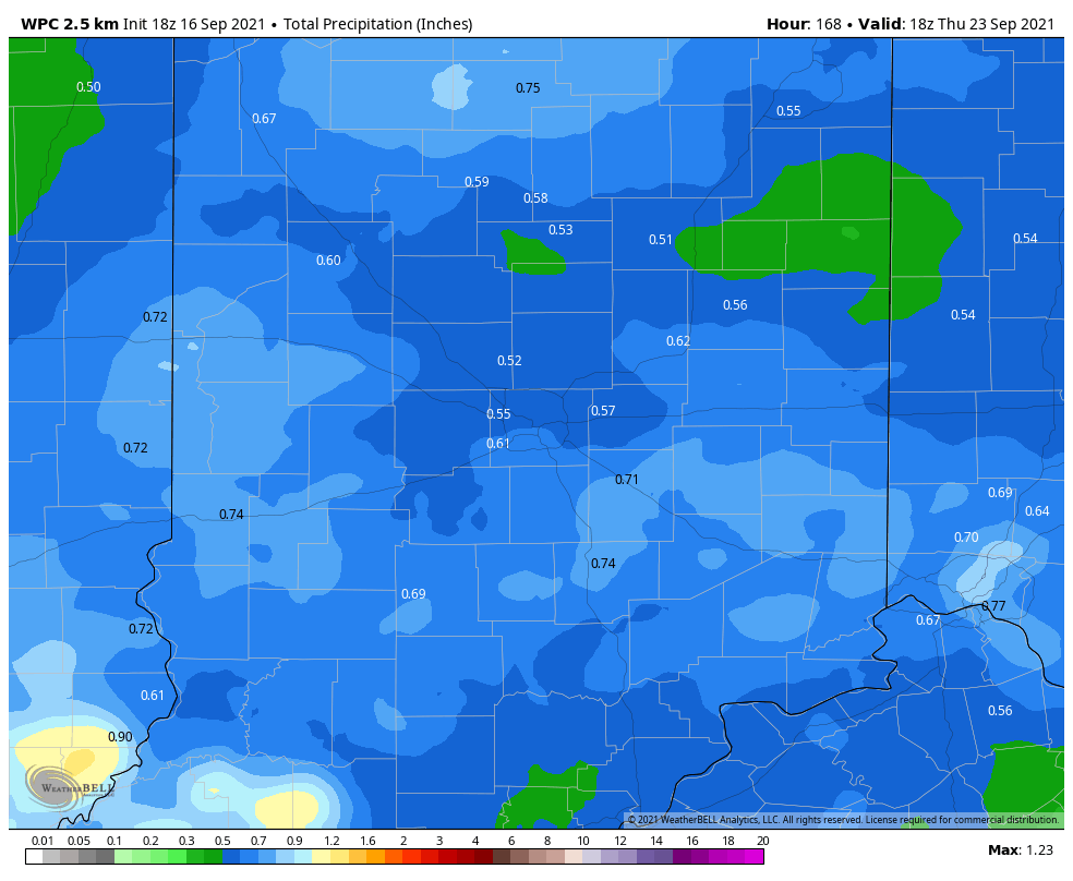
The activity will be mainly out in front of a front that will pass will knock us back to below average starting next Wednesday.

Never miss me! Subscribe for free. My Huge Radar has real-time weather tracking, current temperatures, and severe weather watches and warnings. Get detailed Indiana conditions by clicking here. Click here to see my central Indiana 7-Day Forecast. Follow these links to get my forecasts for Lafayette, Muncie, Hendricks County, and Hamilton County. Need a second opinion? Click here for central Indiana National Weather Service forecasts. (Some charts via WeatherBELL.)
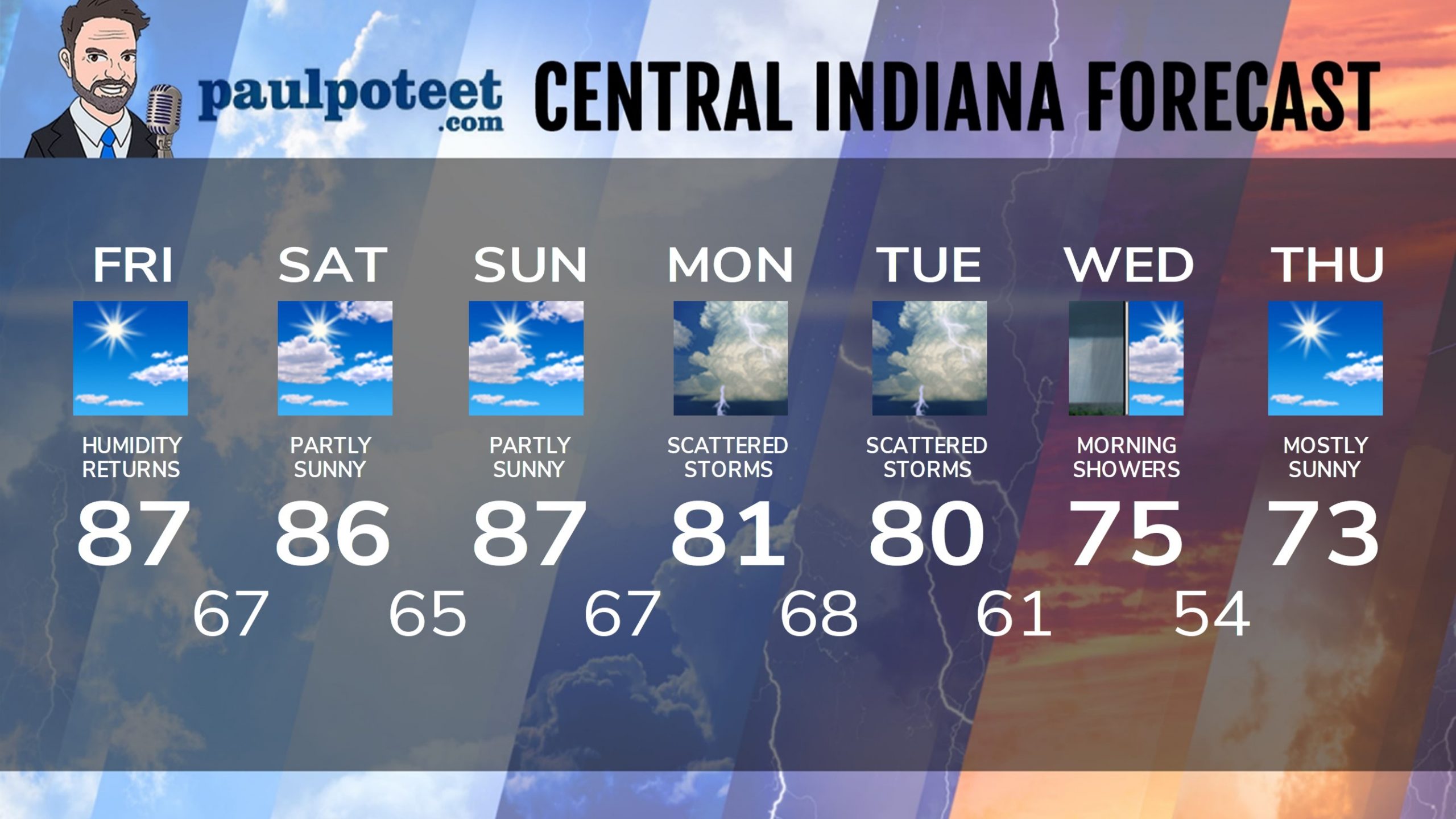
INDY SEVEN DAY FORECAST
Friday: Mostly sunny. Hotter, and more humid again. High 87.
Friday Night: Partly cloudy. Isolated shower or storm possible. Low 67.
Saturday: Partly sunny. Isolated afternoon shower or storm possible. High 86.
Saturday Night: Partly cloudy. Low 65.
Sunday: Partly sunny. High 87.
Sunday Night: Mostly clear. Low 67.
Monday: Partly to mostly cloudy, with scattered showers and storms. High 81.
Monday Night: Partly to mostly cloudy, with scattered showers and storms. Low 68.
Tuesday: Partly to mostly cloudy, with scattered showers and storms. High 80.
Tuesday Night: More showers. Low 61.
Wednesday: Morning showers, with some afternoon sunshine. High 75.
Wednesday Night: Mostly clear. Low 54.
Thursday: Mostly sunny. High 73.
Never miss me! Subscribe for free. My Huge Radar has real-time weather tracking, current temperatures, and severe weather watches and warnings. Get detailed Indiana conditions by clicking here. Click here to see my central Indiana 7-Day Forecast. Follow these links to get my forecasts for Lafayette, Muncie, Hendricks County, and Hamilton County. Need a second opinion? Click here for central Indiana National Weather Service forecasts. (Some charts via WeatherBELL.)


