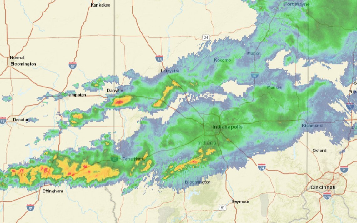
(Via @NWSIndianapolis.) Scattered showers & general t-storms stretched across central Indiana will continue to sink southward overnight. Isolated strong to maybe severe t-storm possible thru ~2 AM EDT, mainly N of about I-70. Individual storms are moving SE @ ~30 mph. #INwx #nwsind https://t.co/wmd2pHLGrC
My Huge Radar has real-time weather tracking, current temperatures, and severe weather watches and warnings. Get detailed Indiana conditions by clicking here. Follow these links to get my forecasts for Lafayette, Muncie, Hendricks County, and Hamilton County. Need a second opinion? Click here for central Indiana National Weather Service forecasts.
Never miss me! Subscribe for free. My Huge Radar has real-time weather tracking, current temperatures, and severe weather watches and warnings. Get detailed Indiana conditions by clicking here. Click here to see my central Indiana 7-Day Forecast. Follow these links to get my forecasts for Lafayette, Muncie, Hendricks County, and Hamilton County. Need a second opinion? Click here for central Indiana National Weather Service forecasts. (Some charts via WeatherBELL.)


