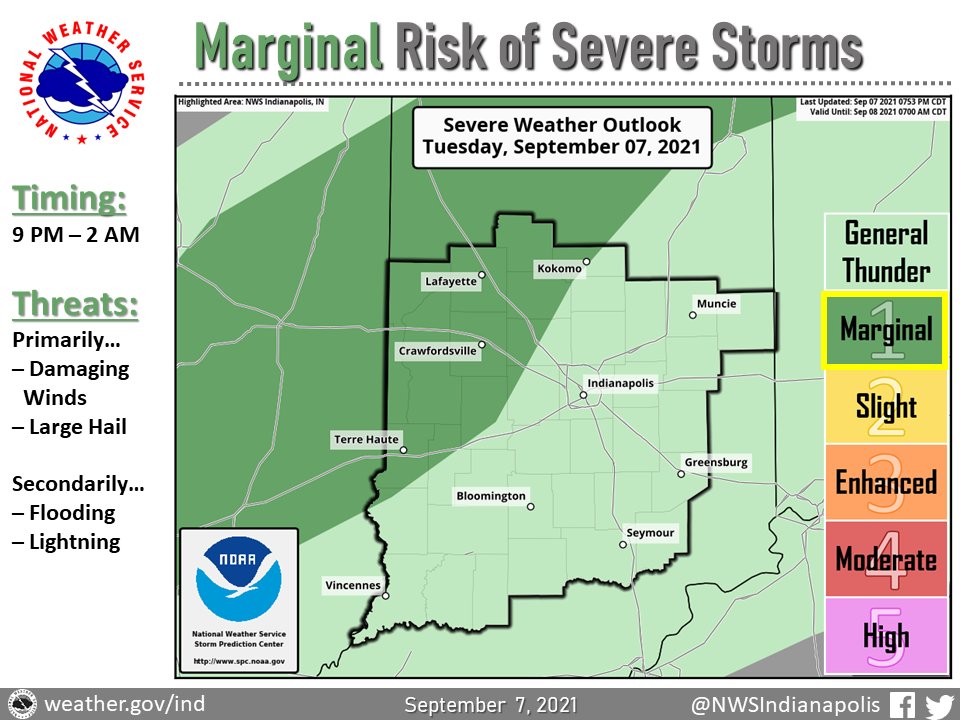
(Via @NWSIndianapolis.) T-storms to impact central/southern IN w/ some strong to isolated severe possible thru ~2 AM, mainly N of I-70. Damaging winds & hail primary concerns. As with any t-storm, heavy downpours leading to localized ponding/flooding & lightning are threats as well. #INwx #nwsind https://t.co/pHbPQX1PAv
My Huge Radar has real-time weather tracking, current temperatures, and severe weather watches and warnings. Get detailed Indiana conditions by clicking here. Follow these links to get my forecasts for Lafayette, Muncie, Hendricks County, and Hamilton County. Need a second opinion? Click here for central Indiana National Weather Service forecasts.
Never miss me! Subscribe for free. My Huge Radar has real-time weather tracking, current temperatures, and severe weather watches and warnings. Get detailed Indiana conditions by clicking here. Click here to see my central Indiana 7-Day Forecast. Follow these links to get my forecasts for Lafayette, Muncie, Hendricks County, and Hamilton County. Need a second opinion? Click here for central Indiana National Weather Service forecasts. (Some charts via WeatherBELL.)


@NWSIndianapolis Thunder in Franklin past 1/2 hr.