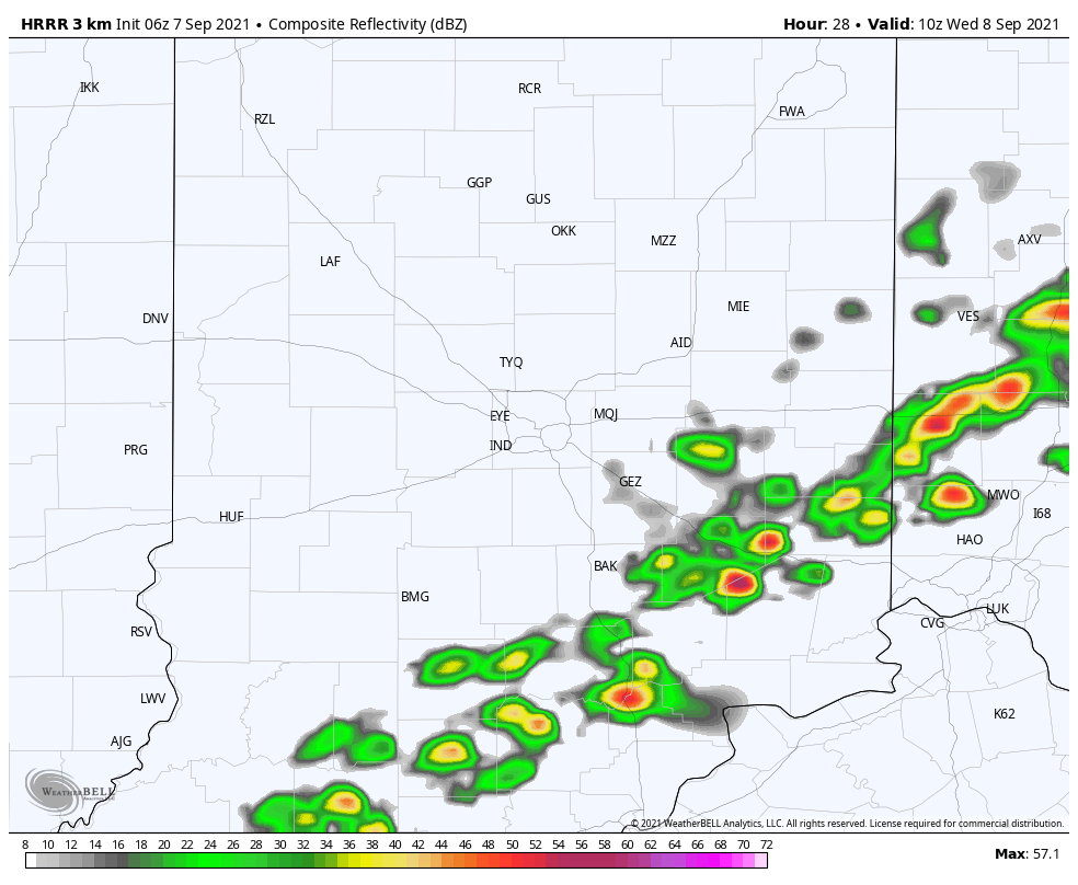
College football and pumpkin spice hype surrounds us, but summer is still going strong. Above average temps today, and a few strong to severe storms tonight. Here’s one computer-modeled look at radar by 10pm.

Annnnnnnnnnd it’s exiting by 6am Wednesday.
Saturday showers brought some beneficial rain to the state. Tote board:
1.01″ Muncie
0.92″ Indy
0.56″ Terre Haute
0.38″ Bloomington
0.32″ Lafayette
Muncie could use the rain. Yearly totals:
23.89″ Muncie
32.23″ Indy
30.91″ Terre Haute
29.01″ Bloomington
26.99″ Lafayette
Muncie and Bloomington are below average on the year, and the other stations are above average.
Never miss me! Subscribe for free. My Huge Radar has real-time weather tracking, current temperatures, and severe weather watches and warnings. Get detailed Indiana conditions by clicking here. Click here to see my central Indiana 7-Day Forecast. Follow these links to get my forecasts for Lafayette, Muncie, Hendricks County, and Hamilton County. Need a second opinion? Click here for central Indiana National Weather Service forecasts. (Some charts via WeatherBELL.)
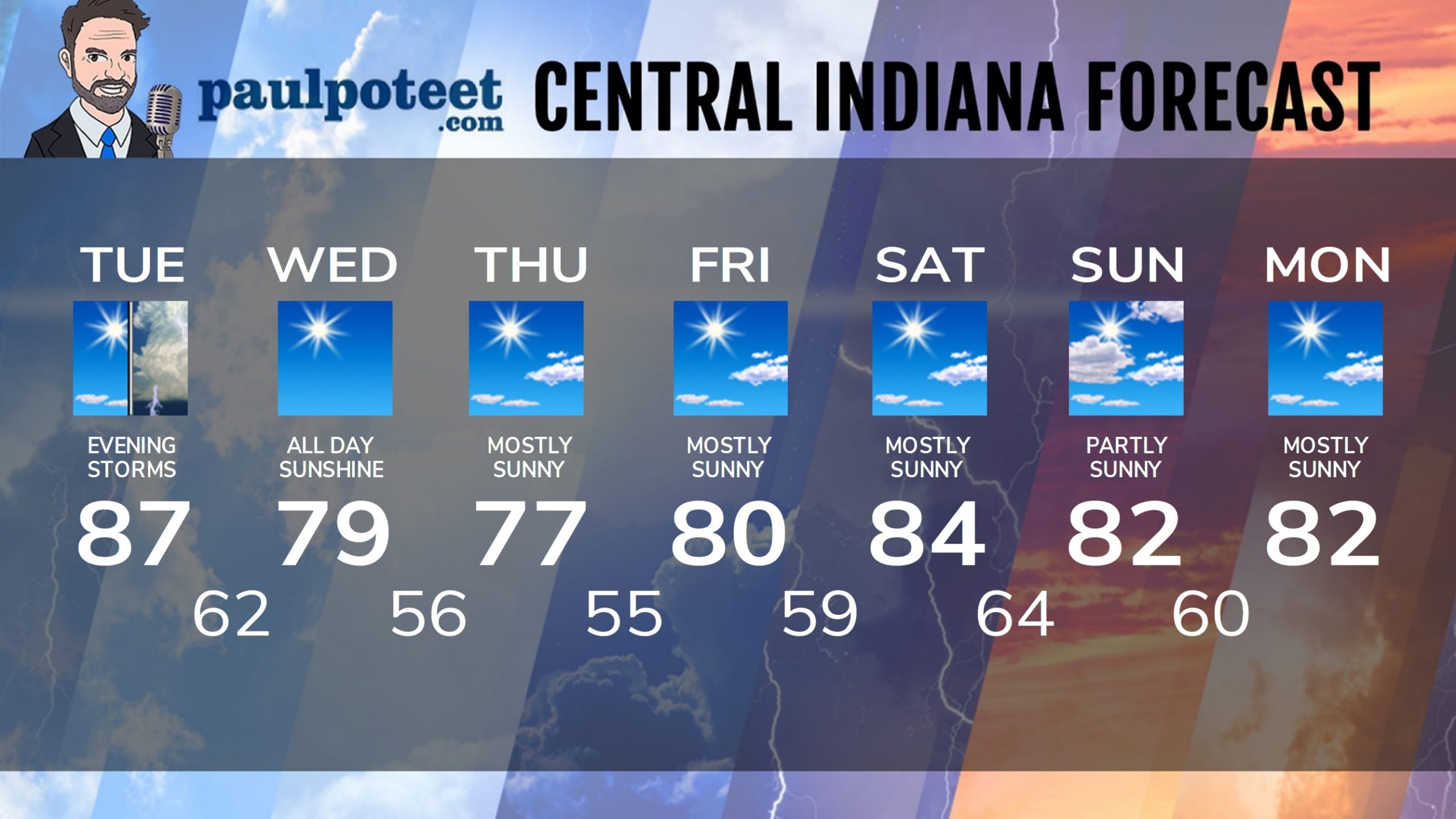
INDY SEVEN DAY FORECAST
Today: Mostly sunny. Wind gusting to 25 mph in the afternoon. High 87.
Tonight: Scattered showers and storms. Storms could be strong to severe. Muggy. Low 62.
Wednesday: Sunny. Less humid again. High 79.
Wednesday Night: Clear. Low 56.
Thursday: Mostly sunny. High 77.
Thursday Night: Mostly clear. Low 55.
Friday: Mostly sunny. High 80.
Friday Night: Mostly clear. Low 59.
Saturday: Mostly sunny. High 84.
Saturday Night: Mostly clear. Low 64.
Sunday: Partly sunny. High 82.
Sunday Night: Partly cloudy. Low 60.
Monday: Mostly sunny. High 82.
Never miss me! Subscribe for free. My Huge Radar has real-time weather tracking, current temperatures, and severe weather watches and warnings. Get detailed Indiana conditions by clicking here. Click here to see my central Indiana 7-Day Forecast. Follow these links to get my forecasts for Lafayette, Muncie, Hendricks County, and Hamilton County. Need a second opinion? Click here for central Indiana National Weather Service forecasts. (Some charts via WeatherBELL.)


