Relief is just around the corner! A stationary front will slip to the south this afternoon and evening.
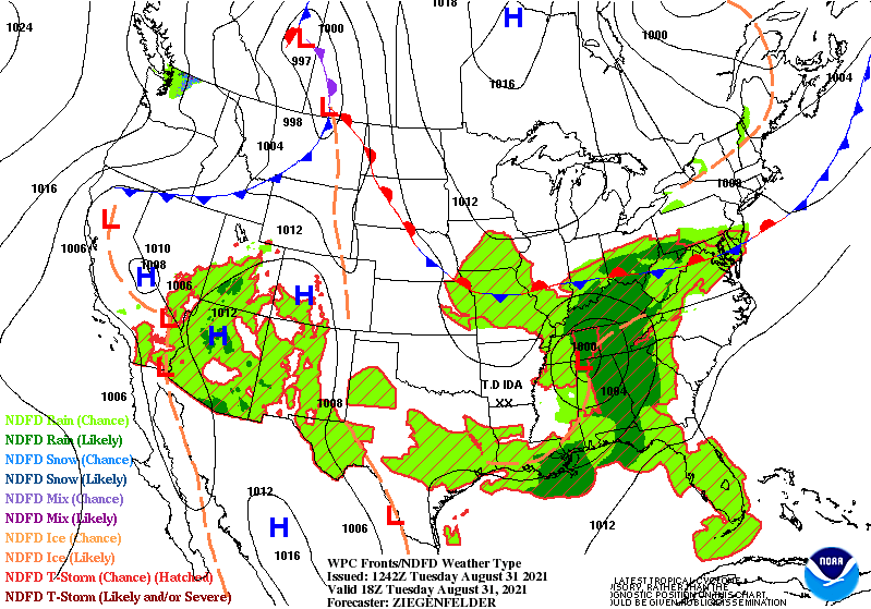
The map also shows the remnants of Ida as an area of low pressure in northwest Alabama this afternoon. The shield of showers of associated with it will stay south of central Indiana.
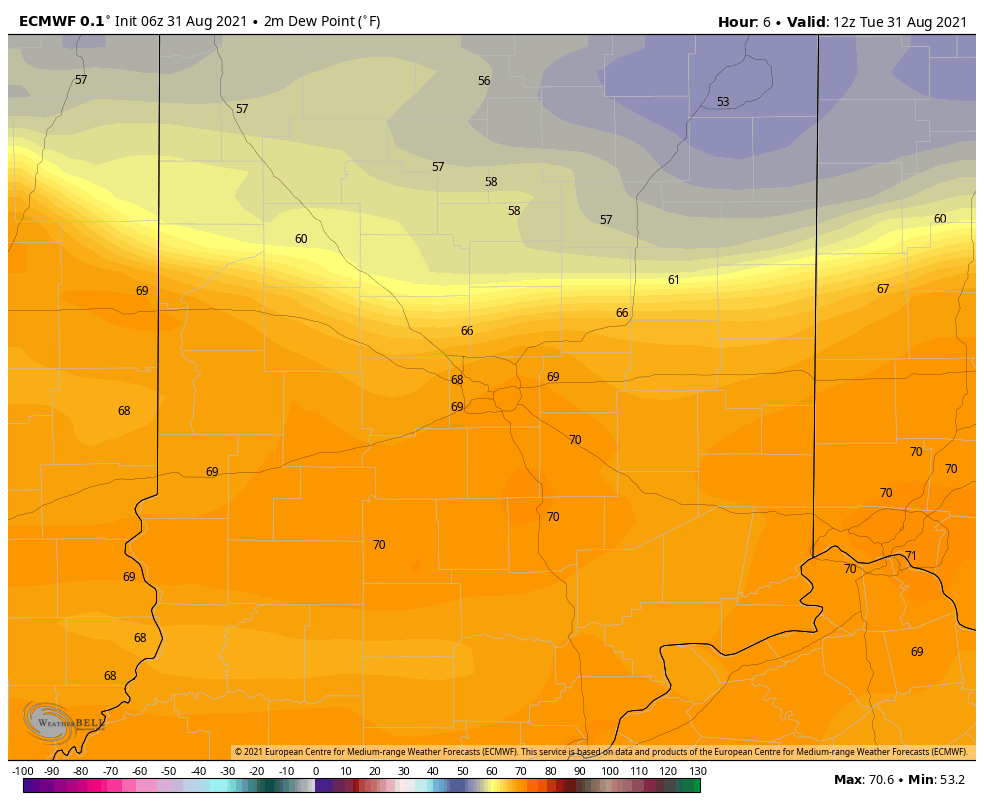
Dew points will drop into the 50s by tomorrow behind that front. Enjoy!
Never miss me! Subscribe for free. My Huge Radar has real-time weather tracking, current temperatures, and severe weather watches and warnings. Get detailed Indiana conditions by clicking here. Click here to see my central Indiana 7-Day Forecast. Follow these links to get my forecasts for Lafayette, Muncie, Hendricks County, and Hamilton County. Need a second opinion? Click here for central Indiana National Weather Service forecasts. (Some charts via WeatherBELL.)
INDY SEVEN DAY FORECAST
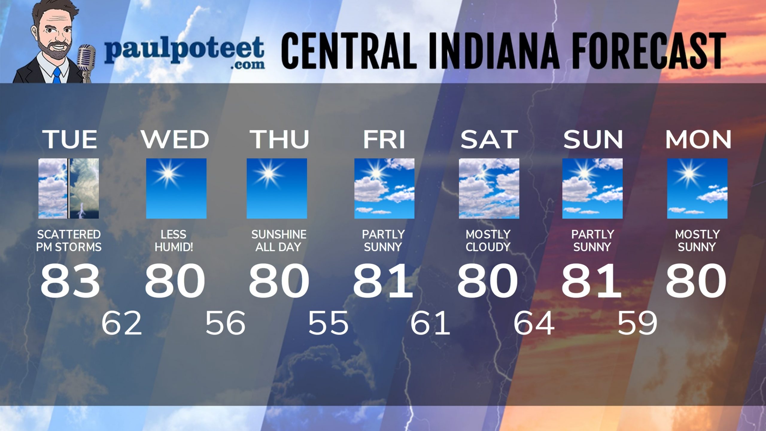
Today: Mostly cloudy, with scattered showers and storms in the afternoon. High 83.
Tonight: Scattered showers and storms end early, then partly cloudy. Low 62.
Wednesday: Sunny and less humid. High 80.
Wednesday Night: Clear. Low 56.
Thursday: Sunny. High 80.
Thursday Night: Mostly clear. Low 55.
Friday: Partly sunny. High 81.
Friday Night: Partly cloudy. Low 61.
Saturday: Mostly cloudy. High 80.
Saturday Night: Mostly cloudy. Low 64.
Sunday: Partly sunny. High 81.
Sunday Night: Partly cloudy. Low 59.
Labor Day: Mostly sunny. High 80.
Never miss me! Subscribe for free. My Huge Radar has real-time weather tracking, current temperatures, and severe weather watches and warnings. Get detailed Indiana conditions by clicking here. Click here to see my central Indiana 7-Day Forecast. Follow these links to get my forecasts for Lafayette, Muncie, Hendricks County, and Hamilton County. Need a second opinion? Click here for central Indiana National Weather Service forecasts. (Some charts via WeatherBELL.)


