The longest stretch so far of 90+ days in Indy this year started about two weeks ago. Three consecutive days. That could be topped this week. That streak included the hottest day of the years so far…94 degrees on August 12.
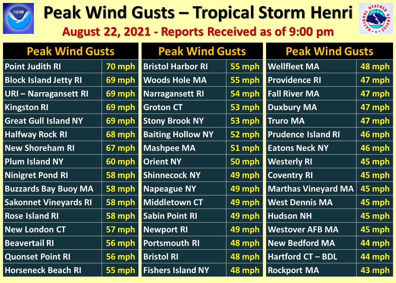
The biggest issue now with the remnants of Henri is flooding, not wind…but there were big gusts when the system made landfall yesterday as a tropical storm.
Never miss me! Subscribe for free. My Huge Radar has real-time weather tracking, current temperatures, and severe weather watches and warnings. Get detailed Indiana conditions by clicking here. Click here to see my central Indiana 7-Day Forecast. Follow these links to get my forecasts for Lafayette, Muncie, Hendricks County, and Hamilton County. Need a second opinion? Click here for central Indiana National Weather Service forecasts. (Some charts via WeatherBELL.)
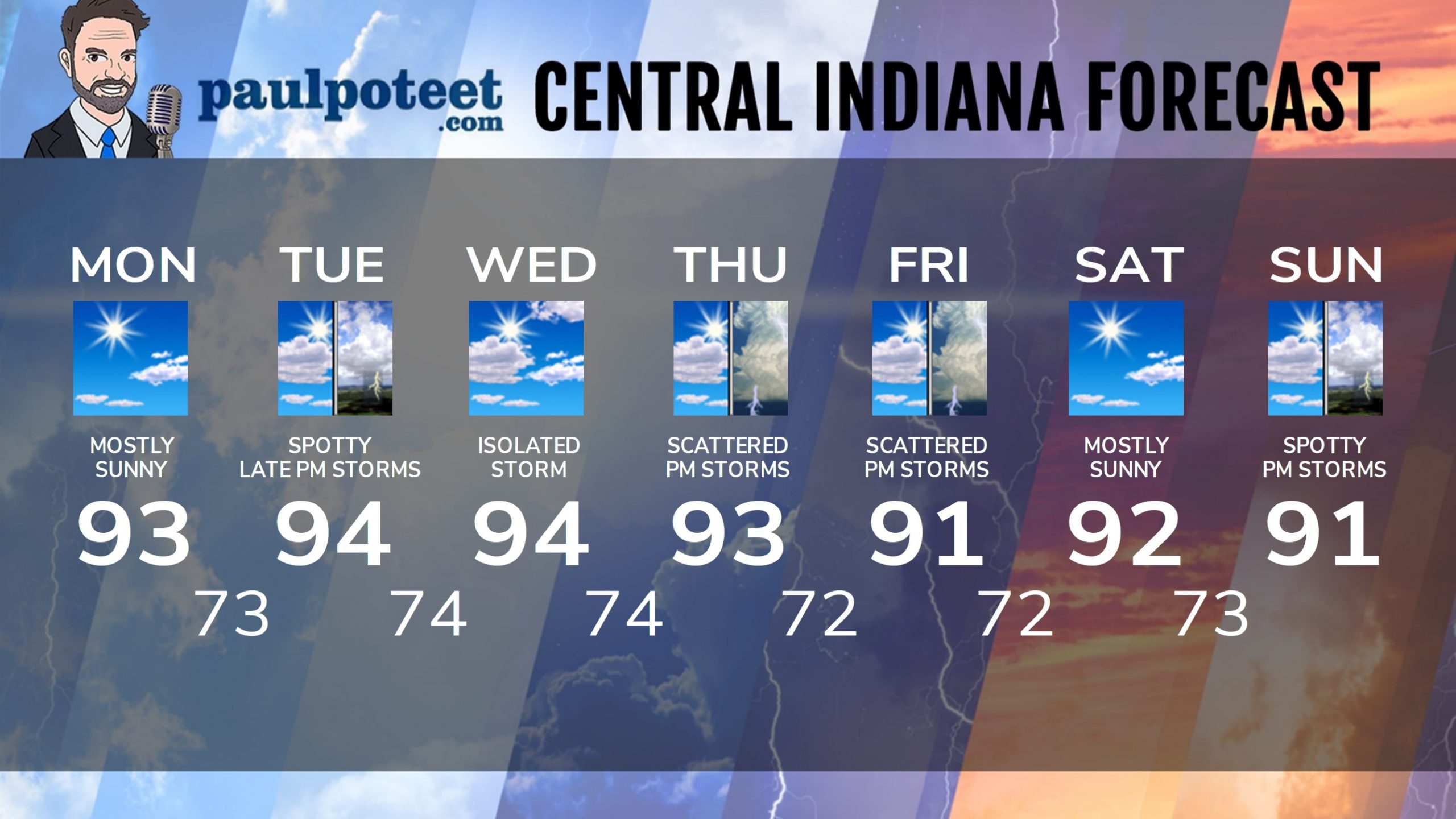
INDY SEVEN DAY FORECAST
Today: Patchy morning fog. Mostly sunny, hot and humid. (All week!) High 93.
Tonight: Mostly clear. Low 73.
Tuesday: Mostly to partly sunny. Isolated late afternoon shower or storm. High 94.
Tuesday Night: Spotty shower or storm, otherwise partly cloudy. Low 74.
Wednesday: Mostly to partly sunny. An isolated shower or storm is possible. High 94.
Wednesday Night: Partly cloudy. Low 74.
Thursday: Mostly to partly sunny, with scattered afternoon showers and storms. High 93.
Thursday Night: Scattered evening showers or storms, then partly cloudy. Low 72.
Friday: Mostly to partly sunny, with scattered afternoon showers and storms. High 91.
Friday Night: Scattered evening showers or storms, then partly cloudy. Low 72.
Saturday: Mostly sunny. High 92.
Saturday Night: Mostly clear. Low 73.
Sunday: Partly sunny, with spotty afternoon showers and storms. High 91.
Never miss me! Subscribe for free. My Huge Radar has real-time weather tracking, current temperatures, and severe weather watches and warnings. Get detailed Indiana conditions by clicking here. Click here to see my central Indiana 7-Day Forecast. Follow these links to get my forecasts for Lafayette, Muncie, Hendricks County, and Hamilton County. Need a second opinion? Click here for central Indiana National Weather Service forecasts. (Some charts via WeatherBELL.)


