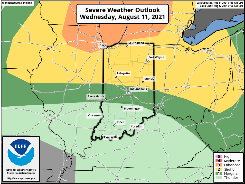
The best chance of storms today will be in the northern third of the state. There is a level 2 (out of 5) risk of severe weather, from large hail and damaging wind. Just be ready to rumble in places like Lafayette, Kokomo, and Muncie.
Never miss me! Subscribe for free. My Huge Radar has real-time weather tracking, current temperatures, and severe weather watches and warnings. Get detailed Indiana conditions by clicking here. Click here to see my central Indiana 7-Day Forecast. Follow these links to get my forecasts for Lafayette, Muncie, Hendricks County, and Hamilton County. Need a second opinion? Click here for central Indiana National Weather Service forecasts. (Some charts via WeatherBELL.)
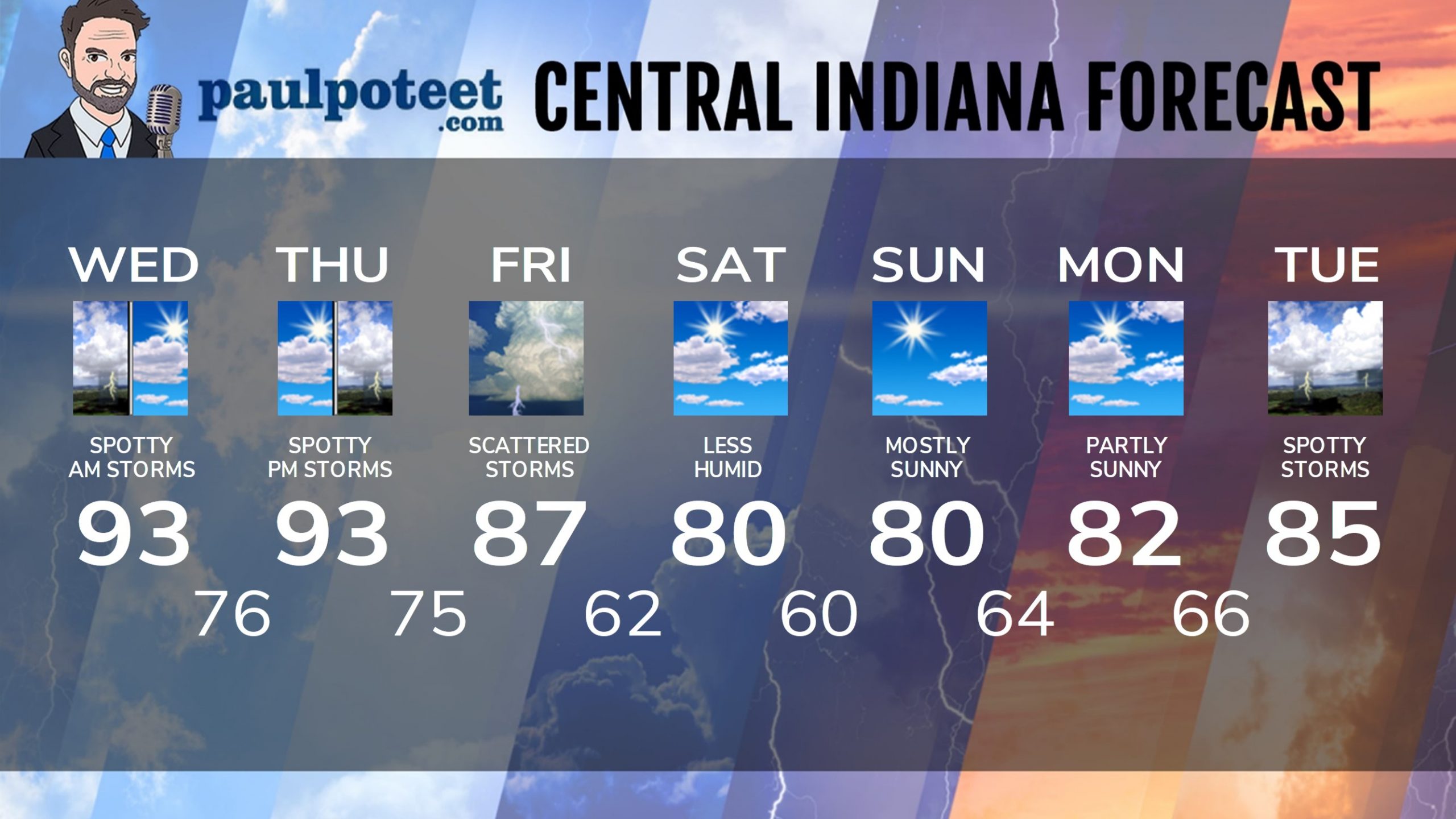
INDY SEVEN DAY FORECAST
Today: A few spotty storms in the morning. Otherwise, partly sunny, hot and humid. Triple digit heat index in the afternoon. HEAT ADVISORY 1-8 pm. High 93.
Tonight: Partly cloudy and muggy. Isolated shower or storm possible. Low 76.
Thursday: Partly sunny, hot and humid. Afternoon heat index around 100. Spotty afternoon shower or storm possible. High 93.
Thursday Night: Partly cloudy and muggy. Spotty shower or storm possible. Low 75.
Friday: Scattered showers and storms. High 87.
Friday Night: Scattered showers and storms. Low 62.
Saturday: Partly sunny, and less humid. High 80.
Saturday Night: Mostly clear. Low 60.
Sunday: Mostly sunny. High 80.
Sunday Night: Partly cloudy. Low 64.
Monday: Partly sunny. High 82.
Monday Night: Partly cloudy. Low 66.
Tuesday: Partly sunny. Spotty showers and storms. High 85.
Never miss me! Subscribe for free. My Huge Radar has real-time weather tracking, current temperatures, and severe weather watches and warnings. Get detailed Indiana conditions by clicking here. Click here to see my central Indiana 7-Day Forecast. Follow these links to get my forecasts for Lafayette, Muncie, Hendricks County, and Hamilton County. Need a second opinion? Click here for central Indiana National Weather Service forecasts. (Some charts via WeatherBELL.)


