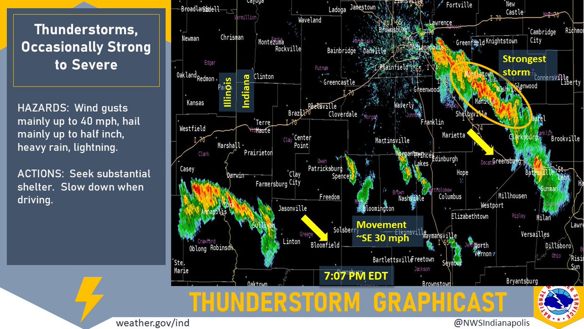
(Via @NWSIndianapolis.) At 7:07 PM EDT broken line of showers/storms from near the IL border just S of I-70 E to Bartholomew Co. Solid, stronger line E side of Indy to Dearborn Co in SE IN. Movement SE ~30 mph. Mainly winds up to 40 mph, hail to 1/2-inch. #INwx #nwsind https://t.co/hohKxuVK4L
My Huge Radar has real-time weather tracking, current temperatures, and severe weather watches and warnings. Get detailed Indiana conditions by clicking here. Follow these links to get my forecasts for Lafayette, Muncie, Hendricks County, and Hamilton County. Need a second opinion? Click here for central Indiana National Weather Service forecasts.
Never miss me! Subscribe for free. My Huge Radar has real-time weather tracking, current temperatures, and severe weather watches and warnings. Get detailed Indiana conditions by clicking here. Click here to see my central Indiana 7-Day Forecast. Follow these links to get my forecasts for Lafayette, Muncie, Hendricks County, and Hamilton County. Need a second opinion? Click here for central Indiana National Weather Service forecasts. (Some charts via WeatherBELL.)


