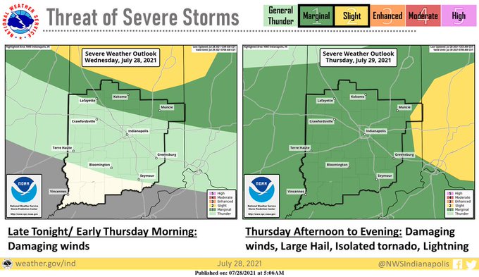
There is a threat of severe thunderstorms very late tonight and around sunrise Thursday morning, mainly north of Indy. Another round of thunderstorms could be severe throughout central Indiana Thursday afternoon and evening.
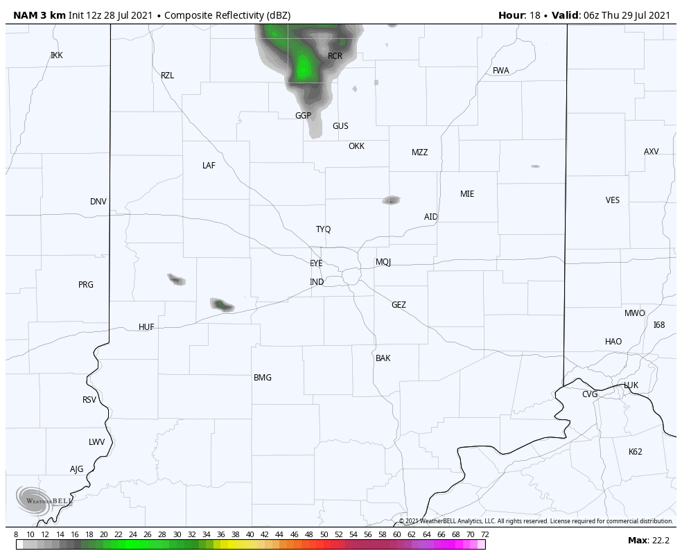
The computer-modeled radar reflects Thursday’s expected precipitation.
Never miss me! Subscribe for free. My Huge Radar has real-time weather tracking, current temperatures, and severe weather watches and warnings. Get detailed Indiana conditions by clicking here. Click here to see my central Indiana 7-Day Forecast. Follow these links to get my forecasts for Lafayette, Muncie, Hendricks County, and Hamilton County. Need a second opinion? Click here for central Indiana National Weather Service forecasts. (Some charts via WeatherBELL.)
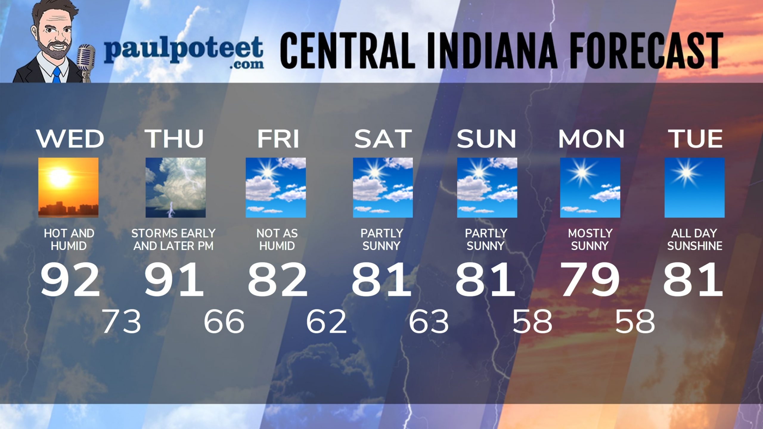
INDY SEVEN DAY FORECAST
Today: Partly to mostly sunny, hot and humid. High 92.
Tonight: Partly cloudy. Low 73.
Thursday: Partly sunny. Scattered showers and storms are possible in the
morning and likely in the afternoon. High 91.
Thursday Night: Partly cloudy. Scattered showers and storms in the evening.
Low 66.
Friday: Partly sunny and not as humid. High 82.
Friday Night: Partly cloudy. Low 62.
Saturday: Partly sunny. Isolated shower or storm possible. High 81.
Saturday Night: Partly cloudy. Low 63.
Sunday: Partly sunny. High 81.
Sunday Night: Mostly clear. Low 58.
Monday: Mostly sunny. High 79.
Monday Night: Clear. Low 58.
Tuesday: Sunny. High 81.
Never miss me! Subscribe for free. My Huge Radar has real-time weather tracking, current temperatures, and severe weather watches and warnings. Get detailed Indiana conditions by clicking here. Click here to see my central Indiana 7-Day Forecast. Follow these links to get my forecasts for Lafayette, Muncie, Hendricks County, and Hamilton County. Need a second opinion? Click here for central Indiana National Weather Service forecasts. (Some charts via WeatherBELL.)


