Today’s weather is brought to you by the letter H. Hazy, hot, humid, with a big H for high pressure on the weather map right over the state.
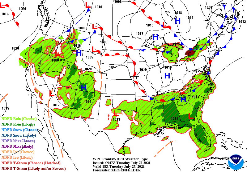
That high pressure keeps a lid on things today, with very little breeze to ease the heat and humidity.
The next weather maker is a cold front arriving Thursday.
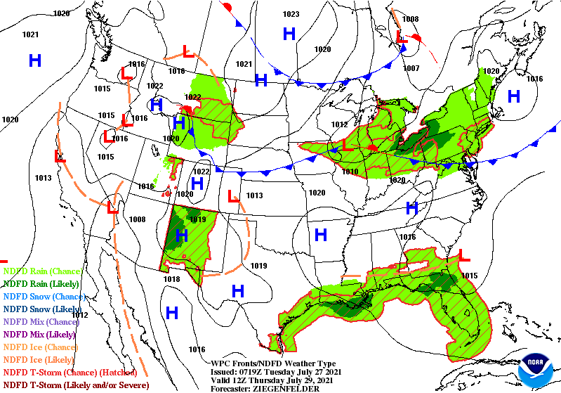
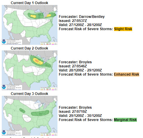
That front is stalled to the north for the moment, but will eventually sink southward. The risk of severe weather moves in tandem with the front. That risk is over all of central Indiana by Thursday. At the moment the risk level is expected to be “marginal,” which is level one of five.
Never miss me! Subscribe for free. My Huge Radar has real-time weather tracking, current temperatures, and severe weather watches and warnings. Get detailed Indiana conditions by clicking here. Click here to see my central Indiana 7-Day Forecast. Follow these links to get my forecasts for Lafayette, Muncie, Hendricks County, and Hamilton County. Need a second opinion? Click here for central Indiana National Weather Service forecasts. (Some charts via WeatherBELL.)
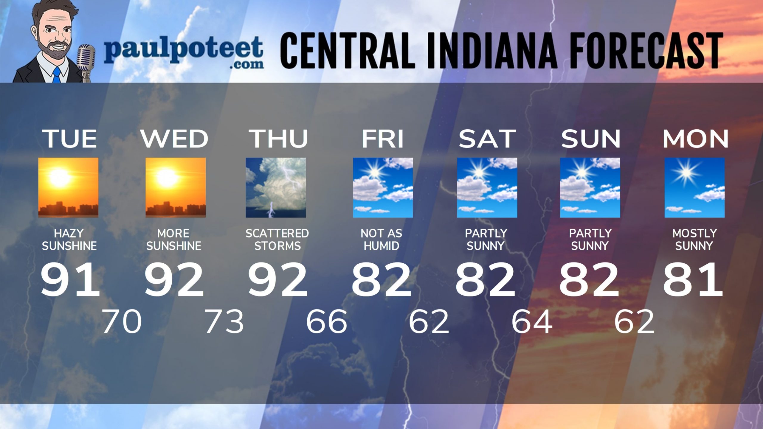
INDY SEVEN DAY FORECAST
Today: Sunny, hot and humid. Some fog in the morning and haze/smoke through the afternoon. High 91.
Tonight: Clear. Low 70.
Wednesday: Mostly sunny. High 92.
Wednesday Night: Partly cloudy. Low 73.
Thursday: Partly sunny. Scattered showers and storms, mainly in the afternoon. High 92.
Thursday Night: Partly cloudy. Scattered showers and storms. Low 66.
Friday: Partly sunny and not as humid. High 82.
Friday Night: Partly cloudy. Low 62.
Saturday: Partly sunny. Isolated shower or storm possible. High 82.
Saturday Night: Partly cloudy. Low 64.
Sunday: Partly sunny. Isolated shower or storm possible. High 82.
Sunday Night: Mostly clear. Low 62.
Monday: Mostly sunny. High 81.
Never miss me! Subscribe for free. My Huge Radar has real-time weather tracking, current temperatures, and severe weather watches and warnings. Get detailed Indiana conditions by clicking here. Click here to see my central Indiana 7-Day Forecast. Follow these links to get my forecasts for Lafayette, Muncie, Hendricks County, and Hamilton County. Need a second opinion? Click here for central Indiana National Weather Service forecasts. (Some charts via WeatherBELL.)


