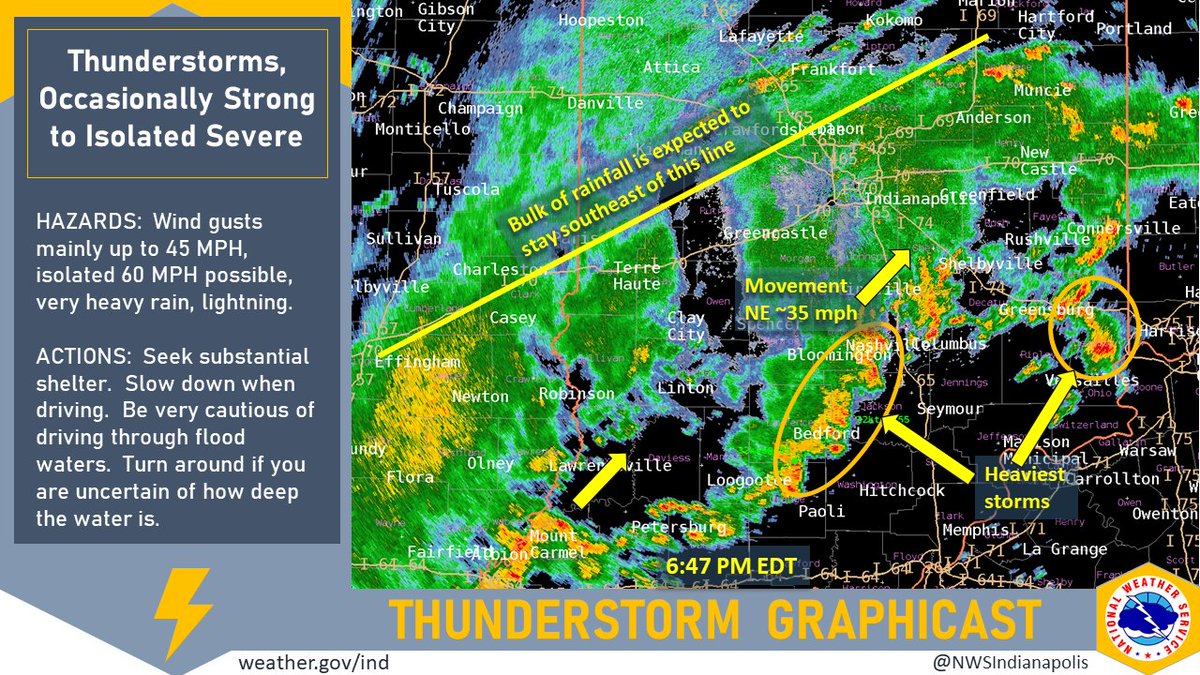
(Via @NWSIndianapolis.) At 6:47 PM EDT: Large area of moderate/heavy rain w/ embedded scattered t-storms most of central/southern IN. More rain SW moving NE towards IN ~35 mph. Most storms should be under 45 mph, isolated 50-60 possible. Beware of weather conditions around you. #INwx #nwsind https://t.co/PKDlkL38Du
My Huge Radar has real-time weather tracking, current temperatures, and severe weather watches and warnings. Get detailed Indiana conditions by clicking here. Follow these links to get my forecasts for Lafayette, Muncie, Hendricks County, and Hamilton County. Need a second opinion? Click here for central Indiana National Weather Service forecasts.
Never miss me! Subscribe for free. My Huge Radar has real-time weather tracking, current temperatures, and severe weather watches and warnings. Get detailed Indiana conditions by clicking here. Click here to see my central Indiana 7-Day Forecast. Follow these links to get my forecasts for Lafayette, Muncie, Hendricks County, and Hamilton County. Need a second opinion? Click here for central Indiana National Weather Service forecasts. (Some charts via WeatherBELL.)


