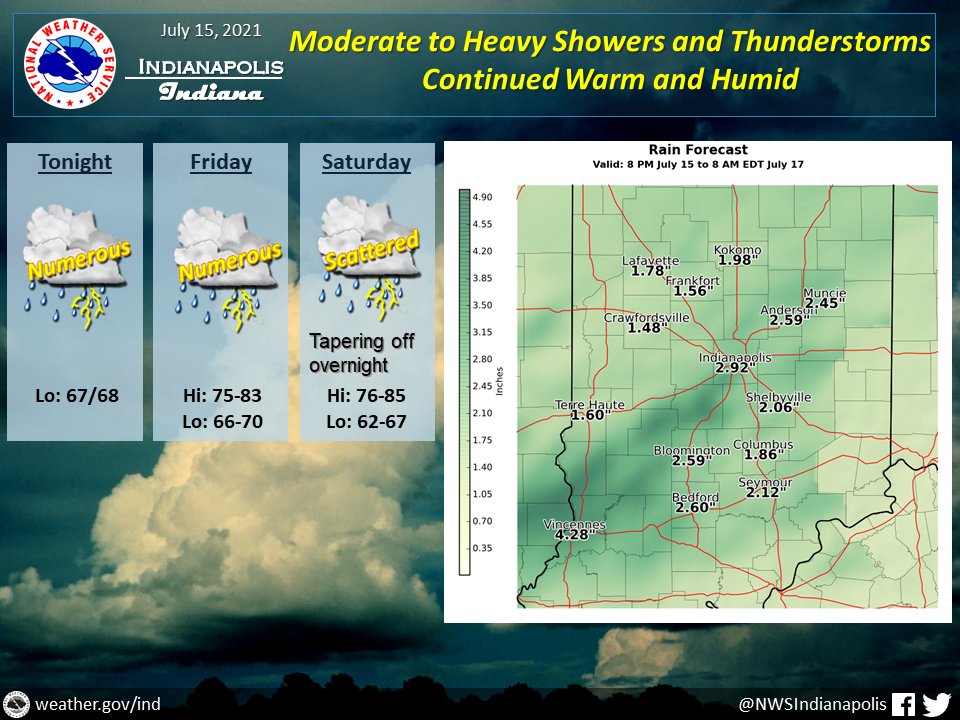
(Via @NWSIndianapolis.) Showers/t-storms will increase this eve & overnight, possibly strong/severe thru Fri night w/ moderate/heavy rain. Marginal to slight risk of excessive rain w/ flooding. Rain tapers off Sat night, returning Sunday. Thru Sat night high temps 75-85, lows 62-70. #INwx #nwsind https://t.co/6froKEYFPV
My Huge Radar has real-time weather tracking, current temperatures, and severe weather watches and warnings. Get detailed Indiana conditions by clicking here. Follow these links to get my forecasts for Lafayette, Muncie, Hendricks County, and Hamilton County. Need a second opinion? Click here for central Indiana National Weather Service forecasts.
Never miss me! Subscribe for free. My Huge Radar has real-time weather tracking, current temperatures, and severe weather watches and warnings. Get detailed Indiana conditions by clicking here. Click here to see my central Indiana 7-Day Forecast. Follow these links to get my forecasts for Lafayette, Muncie, Hendricks County, and Hamilton County. Need a second opinion? Click here for central Indiana National Weather Service forecasts. (Some charts via WeatherBELL.)


