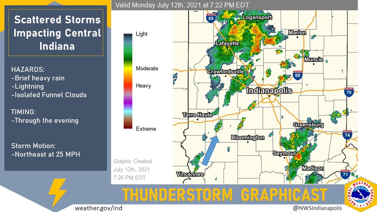
(Via @NWSIndianapolis.) Scattered thunderstorms will continue to move through central Indiana through the rest of the evening. Brief heavy rain is the primary hazard. A few funnel clouds are possible, but conditions do not favor tornado development. Storm motion is to the northeast at 20 mph. #INwx https://t.co/PiLbMKbZ9R
My Huge Radar has real-time weather tracking, current temperatures, and severe weather watches and warnings. Get detailed Indiana conditions by clicking here. Follow these links to get my forecasts for Lafayette, Muncie, Hendricks County, and Hamilton County. Need a second opinion? Click here for central Indiana National Weather Service forecasts.
Never miss me! Subscribe for free. My Huge Radar has real-time weather tracking, current temperatures, and severe weather watches and warnings. Get detailed Indiana conditions by clicking here. Click here to see my central Indiana 7-Day Forecast. Follow these links to get my forecasts for Lafayette, Muncie, Hendricks County, and Hamilton County. Need a second opinion? Click here for central Indiana National Weather Service forecasts. (Some charts via WeatherBELL.)


