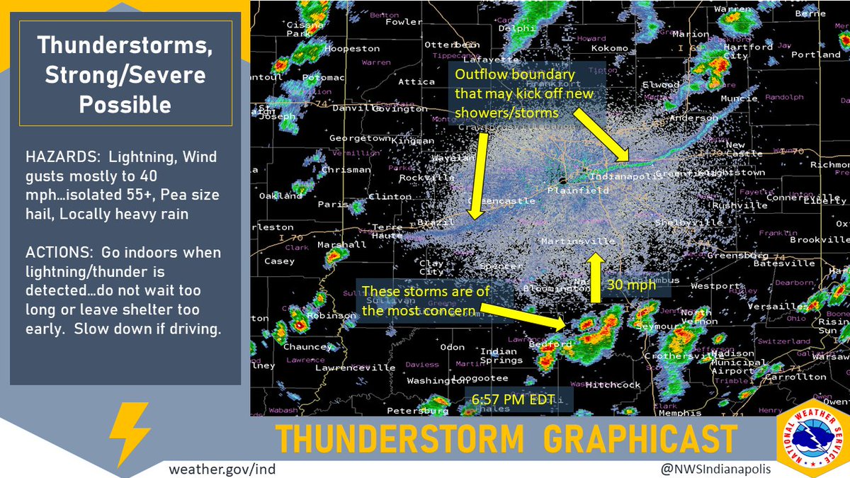
(Via @NWSIndianapolis.) At 6:57 PM EDT scattered t-storms around the region. Greatest concern in Jackson Co area in SC IN w/ potential wind gusts to 60 mph. Storms moving N at 30 mph. Elsewhere gusts mostly up to 40 mph. Considerable lightning, heavy rainfall, pea size hail possible. #INwx #nwsind https://t.co/TRTYrn9tNh
My Huge Radar has real-time weather tracking, current temperatures, and severe weather watches and warnings. Get detailed Indiana conditions by clicking here. Follow these links to get my forecasts for Lafayette, Muncie, Hendricks County, and Hamilton County. Need a second opinion? Click here for central Indiana National Weather Service forecasts.
Never miss me! Subscribe for free. My Huge Radar has real-time weather tracking, current temperatures, and severe weather watches and warnings. Get detailed Indiana conditions by clicking here. Click here to see my central Indiana 7-Day Forecast. Follow these links to get my forecasts for Lafayette, Muncie, Hendricks County, and Hamilton County. Need a second opinion? Click here for central Indiana National Weather Service forecasts. (Some charts via WeatherBELL.)


