Severe thunderstorms are expected Friday afternoon and evening. The biggest threat is storms that produce damaging wind, but there is also a risk of large hail and an isolated tornado, along with flash flooding later tonight and overnight.

This computer modeling from mid-morning Friday shows the Friday morning showers and storms moving out, and another batch of stronger showers and storms firing this evening, mainly after 6pm, with more re-development overnight into early Saturday morning. Should be quiet for awhile Saturday midday, with a chance for scattered showers and storms later in the afternoon and evening. Looks like just isolated storm threats by Sunday.
Never miss me! Subscribe for free. My Huge Radar has real-time weather tracking, current temperatures, and severe weather watches and warnings. Get detailed Indiana conditions by clicking here. Click here to see my central Indiana 7-Day Forecast. Follow these links to get my forecasts for Lafayette, Muncie, Hendricks County, and Hamilton County. Need a second opinion? Click here for central Indiana National Weather Service forecasts. (Some charts via WeatherBELL.)
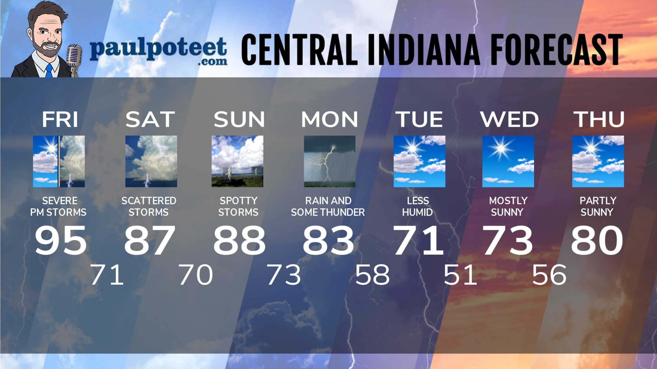
INDY SEVEN DAY FORECAST
Friday: hot and humid. Spotty shower possible in the morning. Showers and storms in the mid to late afternoon, possibly severe. Heat index around 100! High 95.
Friday Night: Showers and storms, possibly severe. Low 71.
Saturday: Mostly to partly cloudy, with scattered showers and storms early and again later in the afternoon. High 87.
Saturday Night: Partly cloudy. Scattered showers and storms. Low 70.
Sunday: Partly sunny. Spotty showers and storms, mainly in the afternoon. High 88.
Sunday Night: Partly cloudy. Spotty showers and storms. Low 73.
Monday: Showers likely, and storms possible. High 83.
Monday Night: Scattered showers and storms. Low 58.
Tuesday: Partly sunny. High 71.
Tuesday Night: Mostly clear. Low 51.
Wednesday: Mostly sunny. High 73.
Wednesday Night: Partly cloudy. Low 56.
Thursday: Partly sunny. High 80.
Never miss me! Subscribe for free. My Huge Radar has real-time weather tracking, current temperatures, and severe weather watches and warnings. Get detailed Indiana conditions by clicking here. Click here to see my central Indiana 7-Day Forecast. Follow these links to get my forecasts for Lafayette, Muncie, Hendricks County, and Hamilton County. Need a second opinion? Click here for central Indiana National Weather Service forecasts. (Some charts via WeatherBELL.)


Next Tuesday looks great!