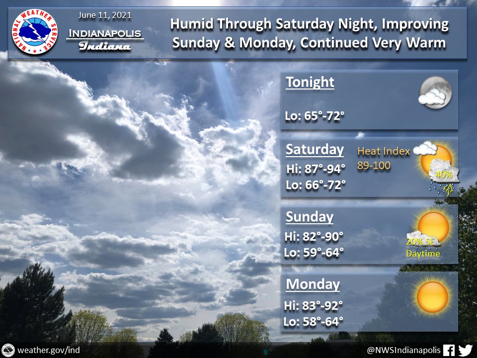
(Via @NWSIndianapolis.) Widely scattered rain showers/t-storms to die early this eve. Repeat Sat/Sat night, w/ peak heat indices ~90-100°. Drier air Sun PM & Mon. Lingering 20% chance showers SE IN Sun. Mostly clear/partly cloudy otherwise. Thru Mon night highs 82-94°, lows 58-72. #INwx #nwsind https://t.co/P5KOgMhl9u
My Huge Radar has real-time weather tracking, current temperatures, and severe weather watches and warnings. Get detailed Indiana conditions by clicking here. Follow these links to get my forecasts for Lafayette, Muncie, Hendricks County, and Hamilton County. Need a second opinion? Click here for central Indiana National Weather Service forecasts.
Never miss me! Subscribe for free. My Huge Radar has real-time weather tracking, current temperatures, and severe weather watches and warnings. Get detailed Indiana conditions by clicking here. Click here to see my central Indiana 7-Day Forecast. Follow these links to get my forecasts for Lafayette, Muncie, Hendricks County, and Hamilton County. Need a second opinion? Click here for central Indiana National Weather Service forecasts. (Some charts via WeatherBELL.)


