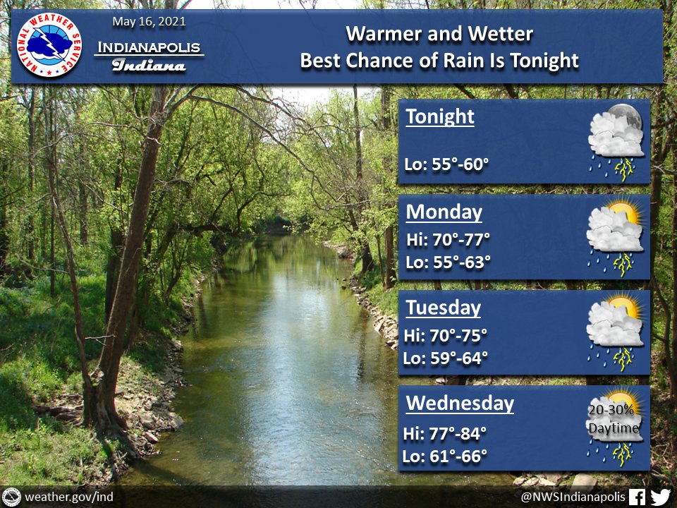
(Via @NWSIndianapolis.) Showers/t-storms return tonight. Potential for locally gusty winds from storms thru Mon eve. Rainfall amounts 1-2″ possible by Tue morn. Rain peters out Wed; dry Wed night. Temps continue to warm, with some locations reaching 80s Wed. #INwx #nwsind https://t.co/FmPQW8ibBW
My Huge Radar has real-time weather tracking, current temperatures, and severe weather watches and warnings. Get detailed Indiana conditions by clicking here. Follow these links to get my forecasts for Lafayette, Muncie, Hendricks County, and Hamilton County. Need a second opinion? Click here for central Indiana National Weather Service forecasts.
Never miss me! Subscribe for free. My Huge Radar has real-time weather tracking, current temperatures, and severe weather watches and warnings. Get detailed Indiana conditions by clicking here. Click here to see my central Indiana 7-Day Forecast. Follow these links to get my forecasts for Lafayette, Muncie, Hendricks County, and Hamilton County. Need a second opinion? Click here for central Indiana National Weather Service forecasts. (Some charts via WeatherBELL.)


