An overall pattern change kicks in this weekend, and should bring an end to borderline-frosty mornings in Central Indiana. Spring will show up, with more showers and storms in the second half of the month, and lows in the 50s and highs in the 70s. (In other words: average.)

The change will come as an upper level ridge first builds over the Plains, and then right over the Great Lakes and Midwest closer to Memorial Day.
Never miss me! Subscribe for free. My Huge Radar has real-time weather tracking, current temperatures, and severe weather watches and warnings. Get detailed Indiana conditions by clicking here. Click here to see my central Indiana 7-Day Forecast. Follow these links to get my forecasts for Lafayette, Muncie, Hendricks County, and Hamilton County. Need a second opinion? Click here for central Indiana National Weather Service forecasts. (Some charts via WeatherBELL.)
INDY SEVEN DAY FORECAST
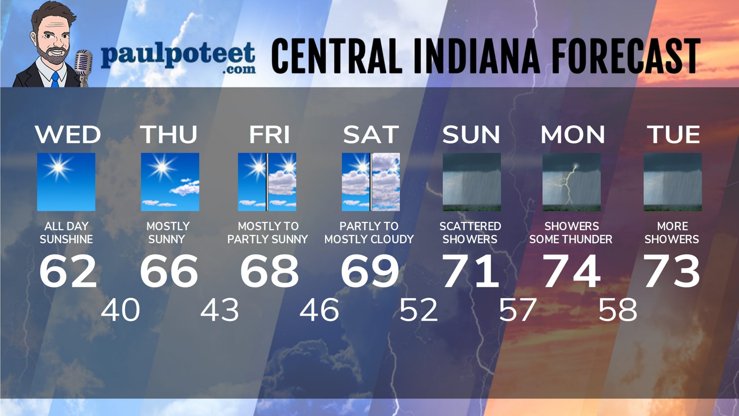
Today: Patchy early morning frost, then sunny. High 62.
Tonight: Clear. Low 40.
Thursday: Mostly sunny. High 66.
Thursday Night: Mostly clear. Low 43.
Friday: Mostly to partly sunny. High 68.
Friday Night: Partly cloudy. Low 46.
Saturday: Partly to mostly cloudy. High 69.
Saturday Night: Mostly cloudy. Stray showers after midnight. Low 52.
Sunday: Mostly cloudy, with scattered showers. High 71.
Sunday Night: Scattered showers. Low 57.
Monday: Scattered showers and some thunder possible. High 74.
Sunday Night: Scattered showers. Low 58.
Monday: Scattered showers and some thunder possible. High 73.
Never miss me! Subscribe for free. My Huge Radar has real-time weather tracking, current temperatures, and severe weather watches and warnings. Get detailed Indiana conditions by clicking here. Click here to see my central Indiana 7-Day Forecast. Follow these links to get my forecasts for Lafayette, Muncie, Hendricks County, and Hamilton County. Need a second opinion? Click here for central Indiana National Weather Service forecasts. (Some charts via WeatherBELL.)


